CM6 4AR maps, stats, and open data
CM6 4AR is located in the Great Dunmow South & Barnston electoral ward, within the local authority district of Uttlesford and the English Parliamentary constituency of Saffron Walden. The Sub Integrated Care Board (ICB) Location is NHS Hertfordshire and West Essex ICB - 07H and the police force is Essex. This postcode has been in use since October 2018.
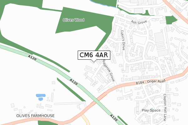
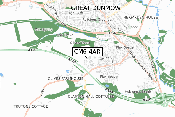
CM6 4AR maps


Licence: Open Government Licence (requires attribution)
Attribution: Contains OS data © Crown copyright and database right 2025
Source: Open Postcode Geo
Licence: Open Government Licence (requires attribution)
Attribution: Contains OS data © Crown copyright and database right 2025; Contains Royal Mail data © Royal Mail copyright and database right 2025; Source: Office for National Statistics licensed under the Open Government Licence v.3.0
CM6 4AR geodata
| Easting | 562710 |
| Northing | 221094 |
| Latitude | 51.864709 |
| Longitude | 0.361714 |
Where is CM6 4AR?
| Country | England |
| Postcode District | CM6 |
Politics
| Ward | Great Dunmow South & Barnston |
|---|---|
| Constituency | Saffron Walden |
Transport
Nearest bus stops to CM6 4AR
| Station Road (Chelmsford Road) | Great Dunmow | 559m |
| Gatehouse Villas (Chelmsford Road) | Great Dunmow | 568m |
| Station Road (High Street) | Great Dunmow | 593m |
| Gatehouse Villas (Chelmsford Road) | Great Dunmow | 682m |
| The Avenue (Braintree Road) | Great Dunmow | 695m |
Broadband
Broadband access in CM6 4AR (2020 data)
| Percentage of properties with Next Generation Access | 100.0% |
| Percentage of properties with Superfast Broadband | 100.0% |
| Percentage of properties with Ultrafast Broadband | 100.0% |
| Percentage of properties with Full Fibre Broadband | 100.0% |
Superfast Broadband is between 30Mbps and 300Mbps
Ultrafast Broadband is > 300Mbps
Broadband limitations in CM6 4AR (2020 data)
| Percentage of properties unable to receive 2Mbps | 0.0% |
| Percentage of properties unable to receive 5Mbps | 0.0% |
| Percentage of properties unable to receive 10Mbps | 0.0% |
| Percentage of properties unable to receive 30Mbps | 0.0% |
Deprivation
28% of English postcodes are less deprived than CM6 4AR:Food Standards Agency
Three nearest food hygiene ratings to CM6 4AR (metres)


➜ Get more ratings from the Food Standards Agency
Nearest post box to CM6 4AR
| Last Collection | |||
|---|---|---|---|
| Location | Mon-Fri | Sat | Distance |
| Easton Lodge | 16:00 | 09:45 | 485m |
| Stortford Road | 17:30 | 12:00 | 720m |
| North Street | 17:30 | 11:45 | 1,366m |
CM6 4AR ITL and CM6 4AR LAU
The below table lists the International Territorial Level (ITL) codes (formerly Nomenclature of Territorial Units for Statistics (NUTS) codes) and Local Administrative Units (LAU) codes for CM6 4AR:
| ITL 1 Code | Name |
|---|---|
| TLH | East |
| ITL 2 Code | Name |
| TLH3 | Essex |
| ITL 3 Code | Name |
| TLH35 | West Essex |
| LAU 1 Code | Name |
| E07000077 | Uttlesford |
CM6 4AR census areas
The below table lists the Census Output Area (OA), Lower Layer Super Output Area (LSOA), and Middle Layer Super Output Area (MSOA) for CM6 4AR:
| Code | Name | |
|---|---|---|
| OA | E00112123 | |
| LSOA | E01022068 | Uttlesford 007C |
| MSOA | E02004597 | Uttlesford 007 |
Nearest postcodes to CM6 4AR
| CM6 1YX | Heywood Lane | 151m |
| CM6 1XQ | Lukins Drive | 185m |
| CM6 1YW | Oliveswood Road | 214m |
| CM6 1EX | Ongar Road | 260m |
| CM6 1QY | Ash Grove | 322m |
| CM6 1XW | Nursery Rise | 327m |
| CM6 1JB | Ongar Road | 369m |
| CM6 1EU | Ongar Road Trading Estate | 379m |
| CM6 1XJ | Flitch Industrial Estate | 392m |
| CM6 1DB | David Wright Close | 399m |