CM24 8XY maps, stats, and open data
CM24 8XY is located in the Stansted North electoral ward, within the local authority district of Uttlesford and the English Parliamentary constituency of Saffron Walden. The Sub Integrated Care Board (ICB) Location is NHS Hertfordshire and West Essex ICB - 07H and the police force is Essex. This postcode has been in use since October 2019.
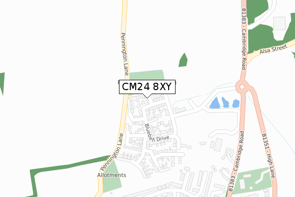
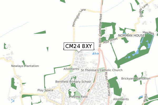
CM24 8XY maps


Licence: Open Government Licence (requires attribution)
Attribution: Contains OS data © Crown copyright and database right 2025
Source: Open Postcode Geo
Licence: Open Government Licence (requires attribution)
Attribution: Contains OS data © Crown copyright and database right 2025; Contains Royal Mail data © Royal Mail copyright and database right 2025; Source: Office for National Statistics licensed under the Open Government Licence v.3.0
CM24 8XY geodata
| Easting | 551071 |
| Northing | 226137 |
| Latitude | 51.913287 |
| Longitude | 0.195021 |
Where is CM24 8XY?
| Country | England |
| Postcode District | CM24 |
Politics
| Ward | Stansted North |
|---|---|
| Constituency | Saffron Walden |
House Prices
Sales of detached houses in CM24 8XY
6, BEECH CLOSE, STANSTED, CM24 8XY 2020 20 JUL £609,950 |
5, BEECH CLOSE, STANSTED, CM24 8XY 2020 13 JUL £545,950 |
4, BEECH CLOSE, STANSTED, CM24 8XY 2020 24 MAR £509,950 |
7, BEECH CLOSE, STANSTED, CM24 8XY 2020 19 MAR £550,000 |
2, BEECH CLOSE, STANSTED, CM24 8XY 2020 21 FEB £550,000 |
3, BEECH CLOSE, STANSTED, CM24 8XY 2020 21 FEB £444,950 |
➜ Stansted Mountfitchet house prices
Licence: Contains HM Land Registry data © Crown copyright and database right 2025. This data is licensed under the Open Government Licence v3.0.
Transport
Nearest bus stops to CM24 8XY
| Alsa Street (Cambridge Road) | Stansted Mountfitchet | 346m |
| Alsa Street (Cambridge Road) | Stansted Mountfitchet | 353m |
| Croasdaile Road | Stansted Mountfitchet | 606m |
| The Three Colts (Cambridge Road) | Stansted Mountfitchet | 621m |
| Croasdaile Road | Stansted Mountfitchet | 631m |
Nearest railway stations to CM24 8XY
| Stansted Mountfitchet Station | 1.4km |
| Elsenham Station | 2.4km |
| Stansted Airport Station | 5.3km |
Deprivation
0.3% of English postcodes are less deprived than CM24 8XY:Food Standards Agency
Three nearest food hygiene ratings to CM24 8XY (metres)


➜ Get more ratings from the Food Standards Agency
Nearest post box to CM24 8XY
| Last Collection | |||
|---|---|---|---|
| Location | Mon-Fri | Sat | Distance |
| Wood End Green | 16:30 | 09:00 | 762m |
| Stansted Old Post Office | 17:30 | 11:00 | 1,149m |
| 7 Chapel Hill | 17:30 | 11:30 | 1,270m |
CM24 8XY ITL and CM24 8XY LAU
The below table lists the International Territorial Level (ITL) codes (formerly Nomenclature of Territorial Units for Statistics (NUTS) codes) and Local Administrative Units (LAU) codes for CM24 8XY:
| ITL 1 Code | Name |
|---|---|
| TLH | East |
| ITL 2 Code | Name |
| TLH3 | Essex |
| ITL 3 Code | Name |
| TLH35 | West Essex |
| LAU 1 Code | Name |
| E07000077 | Uttlesford |
CM24 8XY census areas
The below table lists the Census Output Area (OA), Lower Layer Super Output Area (LSOA), and Middle Layer Super Output Area (MSOA) for CM24 8XY:
| Code | Name | |
|---|---|---|
| OA | E00112212 | |
| LSOA | E01022084 | Uttlesford 005D |
| MSOA | E02004595 | Uttlesford 005 |
Nearest postcodes to CM24 8XY
| CM24 8ED | Poulteney Road | 324m |
| CM24 8EA | Rainsford Road | 336m |
| CM24 8DX | Rainsford Road | 361m |
| CM24 8EH | Alderbury Road | 367m |
| CM24 8EW | The Rookery | 378m |
| CM24 8EB | Mary Mcarthur Place | 388m |
| CM24 8EN | White Bear | 398m |
| CM24 8DW | Croasdaile Road | 403m |
| CM24 8DU | Rainsford Road | 428m |
| CM24 8EJ | Queens Close | 487m |