CM23 5FL maps, stats, and open data
CM23 5FL is located in the Bishop's Stortford Parsonage electoral ward, within the local authority district of East Hertfordshire and the English Parliamentary constituency of Hertford and Stortford. The Sub Integrated Care Board (ICB) Location is NHS Hertfordshire and West Essex ICB - 06K and the police force is Hertfordshire. This postcode has been in use since January 2019.
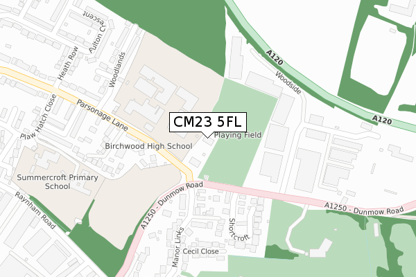
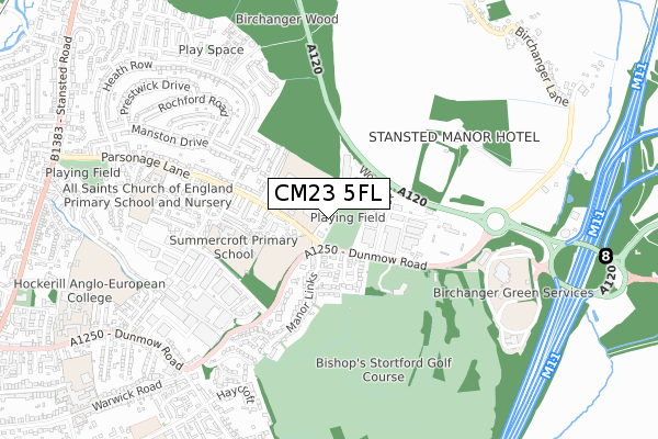
CM23 5FL maps


Licence: Open Government Licence (requires attribution)
Attribution: Contains OS data © Crown copyright and database right 2025
Source: Open Postcode Geo
Licence: Open Government Licence (requires attribution)
Attribution: Contains OS data © Crown copyright and database right 2025; Contains Royal Mail data © Royal Mail copyright and database right 2025; Source: Office for National Statistics licensed under the Open Government Licence v.3.0
CM23 5FL geodata
| Easting | 550546 |
| Northing | 221703 |
| Latitude | 51.873592 |
| Longitude | 0.185460 |
Where is CM23 5FL?
| Country | England |
| Postcode District | CM23 |
Politics
| Ward | Bishop's Stortford Parsonage |
|---|---|
| Constituency | Hertford And Stortford |
Transport
Nearest bus stops to CM23 5FL
| Shortcroft (Dunmow Road) | Parsonage Estate | 131m |
| Birchwood High School (Dunmow Road) | Parsonage Estate | 150m |
| Birchwood High School (Parsonage Lane) | Parsonage Estate | 155m |
| Shortcroft (Dunmow Road) | Parsonage Estate | 190m |
| Raynham Road (Dunmow Road) | Hockerill | 367m |
Nearest railway stations to CM23 5FL
| Bishops Stortford Station | 1.6km |
| Stansted Mountfitchet Station | 3.3km |
Deprivation
1.4% of English postcodes are less deprived than CM23 5FL:Food Standards Agency
Three nearest food hygiene ratings to CM23 5FL (metres)


➜ Get more ratings from the Food Standards Agency
Nearest post box to CM23 5FL
| Last Collection | |||
|---|---|---|---|
| Location | Mon-Fri | Sat | Distance |
| Heath Row | 17:15 | 11:00 | 378m |
| Welcome Break M11 | 16:00 | 11:30 | 719m |
| Haymeads Lane | 17:30 | 12:00 | 811m |
CM23 5FL ITL and CM23 5FL LAU
The below table lists the International Territorial Level (ITL) codes (formerly Nomenclature of Territorial Units for Statistics (NUTS) codes) and Local Administrative Units (LAU) codes for CM23 5FL:
| ITL 1 Code | Name |
|---|---|
| TLH | East |
| ITL 2 Code | Name |
| TLH2 | Bedfordshire and Hertfordshire |
| ITL 3 Code | Name |
| TLH23 | Hertfordshire CC |
| LAU 1 Code | Name |
| E07000242 | East Hertfordshire |
CM23 5FL census areas
The below table lists the Census Output Area (OA), Lower Layer Super Output Area (LSOA), and Middle Layer Super Output Area (MSOA) for CM23 5FL:
| Code | Name | |
|---|---|---|
| OA | E00119061 | |
| LSOA | E01023440 | East Hertfordshire 005C |
| MSOA | E02004882 | East Hertfordshire 005 |
Nearest postcodes to CM23 5FL
| CM23 5QX | Dunmow Road | 142m |
| CM23 5BQ | Parsonage Lane | 191m |
| CM23 5FA | Birchwood Mews | 206m |
| CM23 5RB | Mayes Close | 210m |
| CM23 5QY | Shortcroft | 216m |
| CM23 5AZ | Friars Wood | 255m |
| CM23 5RD | Cecil Close | 284m |
| CM23 5BD | Parsonage Lane | 301m |
| CM23 5BT | The Copse | 302m |
| CM23 5BS | Woodlands | 306m |