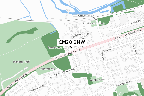
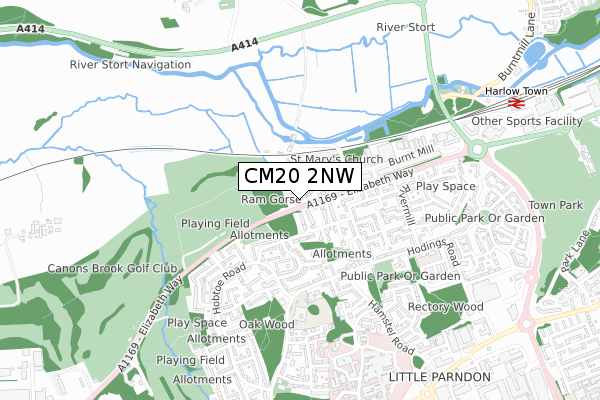
CM20 2NW is located in the Little Parndon and Hare Street electoral ward, within the local authority district of Harlow and the English Parliamentary constituency of Harlow. The Sub Integrated Care Board (ICB) Location is NHS Hertfordshire and West Essex ICB - 07H and the police force is Essex. This postcode has been in use since June 2018.


GetTheData
Source: OS Open Zoomstack (Ordnance Survey)
Licence: Open Government Licence (requires attribution)
Attribution: Contains OS data © Crown copyright and database right 2025
Source: Open Postcode Geo
Licence: Open Government Licence (requires attribution)
Attribution: Contains OS data © Crown copyright and database right 2025; Contains Royal Mail data © Royal Mail copyright and database right 2025; Source: Office for National Statistics licensed under the Open Government Licence v.3.0
| Easting | 543720 |
| Northing | 210839 |
| Latitude | 51.777776 |
| Longitude | 0.081872 |
GetTheData
Source: Open Postcode Geo
Licence: Open Government Licence
| Country | England |
| Postcode District | CM20 |
➜ See where CM20 is on a map ➜ Where is Harlow? | |
GetTheData
Source: Land Registry Price Paid Data
Licence: Open Government Licence
| Ward | Little Parndon And Hare Street |
| Constituency | Harlow |
GetTheData
Source: ONS Postcode Database
Licence: Open Government Licence
2022 22 APR £430,000 |
2, TAYLOR CLOSE, HARLOW, CM20 2NW 2019 26 SEP £515,000 |
13, TAYLOR CLOSE, HARLOW, CM20 2NW 2018 21 SEP £519,995 |
2018 28 JUN £399,995 |
GetTheData
Source: HM Land Registry Price Paid Data
Licence: Contains HM Land Registry data © Crown copyright and database right 2025. This data is licensed under the Open Government Licence v3.0.
| Hobtoe Road | Little Parndon | 301m |
| Ram Gorse (Hodings Road) | Little Parndon | 346m |
| Ram Gorse (Hodings Road) | Little Parndon | 362m |
| Hobtoe Road | Little Parndon | 385m |
| Canons Gate (Hobtoe Road) | Little Parndon | 401m |
| Harlow Town Station | 1km |
| Roydon Station | 3.2km |
| Harlow Mill Station | 3.8km |
GetTheData
Source: NaPTAN
Licence: Open Government Licence
| Percentage of properties with Next Generation Access | 100.0% |
| Percentage of properties with Superfast Broadband | 100.0% |
| Percentage of properties with Ultrafast Broadband | 100.0% |
| Percentage of properties with Full Fibre Broadband | 100.0% |
Superfast Broadband is between 30Mbps and 300Mbps
Ultrafast Broadband is > 300Mbps
| Percentage of properties unable to receive 2Mbps | 0.0% |
| Percentage of properties unable to receive 5Mbps | 0.0% |
| Percentage of properties unable to receive 10Mbps | 0.0% |
| Percentage of properties unable to receive 30Mbps | 0.0% |
GetTheData
Source: Ofcom
Licence: Ofcom Terms of Use (requires attribution)
GetTheData
Source: ONS Postcode Database
Licence: Open Government Licence


➜ Get more ratings from the Food Standards Agency
GetTheData
Source: Food Standards Agency
Licence: FSA terms & conditions
| Last Collection | |||
|---|---|---|---|
| Location | Mon-Fri | Sat | Distance |
| Harlow Town Station | 17:15 | 12:15 | 95m |
| Rectory Wood | 17:15 | 12:00 | 364m |
| Colt Hatch | 17:15 | 12:00 | 367m |
GetTheData
Source: Dracos
Licence: Creative Commons Attribution-ShareAlike
The below table lists the International Territorial Level (ITL) codes (formerly Nomenclature of Territorial Units for Statistics (NUTS) codes) and Local Administrative Units (LAU) codes for CM20 2NW:
| ITL 1 Code | Name |
|---|---|
| TLH | East |
| ITL 2 Code | Name |
| TLH3 | Essex |
| ITL 3 Code | Name |
| TLH35 | West Essex |
| LAU 1 Code | Name |
| E07000073 | Harlow |
GetTheData
Source: ONS Postcode Directory
Licence: Open Government Licence
The below table lists the Census Output Area (OA), Lower Layer Super Output Area (LSOA), and Middle Layer Super Output Area (MSOA) for CM20 2NW:
| Code | Name | |
|---|---|---|
| OA | E00110944 | |
| LSOA | E01021839 | Harlow 004A |
| MSOA | E02004547 | Harlow 004 |
GetTheData
Source: ONS Postcode Directory
Licence: Open Government Licence
| CM20 1RS | Herons Wood | 87m |
| CM20 1RT | Herons Wood | 141m |
| CM20 1RR | Herons Wood | 161m |
| CM20 1RU | Herons Wood | 184m |
| CM20 1RP | Herons Wood | 196m |
| CM20 1PZ | Ram Gorse | 247m |
| CM20 1QB | Ram Gorse | 261m |
| CM20 2HP | Parndon Mill Lane | 261m |
| CM20 1PL | The Hornbeams | 283m |
| CM20 1PJ | The Hornbeams | 286m |
GetTheData
Source: Open Postcode Geo; Land Registry Price Paid Data
Licence: Open Government Licence