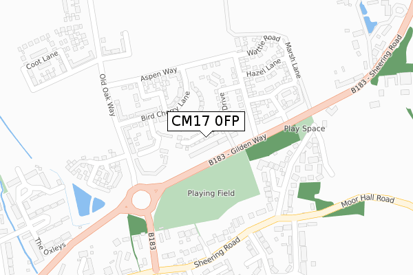
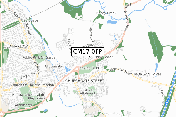
CM17 0FP is located in the Old Harlow electoral ward, within the local authority district of Harlow and the English Parliamentary constituency of Harlow. The Sub Integrated Care Board (ICB) Location is NHS Hertfordshire and West Essex ICB - 07H and the police force is Essex. This postcode has been in use since November 2018.


GetTheData
Source: OS Open Zoomstack (Ordnance Survey)
Licence: Open Government Licence (requires attribution)
Attribution: Contains OS data © Crown copyright and database right 2025
Source: Open Postcode Geo
Licence: Open Government Licence (requires attribution)
Attribution: Contains OS data © Crown copyright and database right 2025; Contains Royal Mail data © Royal Mail copyright and database right 2025; Source: Office for National Statistics licensed under the Open Government Licence v.3.0
| Easting | 548432 |
| Northing | 211959 |
| Latitude | 51.786611 |
| Longitude | 0.150601 |
GetTheData
Source: Open Postcode Geo
Licence: Open Government Licence
| Country | England |
| Postcode District | CM17 |
➜ See where CM17 is on a map ➜ Where is Harlow? | |
GetTheData
Source: Land Registry Price Paid Data
Licence: Open Government Licence
| Ward | Old Harlow |
| Constituency | Harlow |
GetTheData
Source: ONS Postcode Database
Licence: Open Government Licence
82, PLUMTREE DRIVE, HARLOW, CM17 0FP 2020 28 SEP £400,000 |
72, PLUMTREE DRIVE, HARLOW, CM17 0FP 2019 20 DEC £400,000 |
70, PLUMTREE DRIVE, HARLOW, CM17 0FP 2019 28 JUN £400,000 |
54, PLUMTREE DRIVE, HARLOW, CM17 0FP 2019 29 MAR £370,000 |
2, PLUMTREE DRIVE, HARLOW, CM17 0FP 2018 30 NOV £415,000 |
GetTheData
Source: HM Land Registry Price Paid Data
Licence: Contains HM Land Registry data © Crown copyright and database right 2025. This data is licensed under the Open Government Licence v3.0.
| Fitzwilliams Court (Sheering Road) | Old Harlow | 254m |
| Pitten House (Gilden Way Spur) | Old Harlow | 269m |
| Pitten House (Gilden Way Spur) | Old Harlow | 277m |
| Windmill Fields (Sheering Road) | Old Harlow | 283m |
| Windmill Fields (Sheering Road) | Old Harlow | 285m |
| Harlow Mill Station | 1.3km |
| Sawbridgeworth Station | 3.2km |
| Harlow Town Station | 3.9km |
GetTheData
Source: NaPTAN
Licence: Open Government Licence
| Percentage of properties with Next Generation Access | 100.0% |
| Percentage of properties with Superfast Broadband | 100.0% |
| Percentage of properties with Ultrafast Broadband | 100.0% |
| Percentage of properties with Full Fibre Broadband | 100.0% |
Superfast Broadband is between 30Mbps and 300Mbps
Ultrafast Broadband is > 300Mbps
| Median download speed | 360.0Mbps |
| Average download speed | 360.0Mbps |
| Maximum download speed | 360.00Mbps |
| Median upload speed | 360.0Mbps |
| Average upload speed | 360.0Mbps |
| Maximum upload speed | 360.00Mbps |
| Percentage of properties unable to receive 2Mbps | 0.0% |
| Percentage of properties unable to receive 5Mbps | 0.0% |
| Percentage of properties unable to receive 10Mbps | 0.0% |
| Percentage of properties unable to receive 30Mbps | 0.0% |
GetTheData
Source: Ofcom
Licence: Ofcom Terms of Use (requires attribution)
GetTheData
Source: ONS Postcode Database
Licence: Open Government Licence


➜ Get more ratings from the Food Standards Agency
GetTheData
Source: Food Standards Agency
Licence: FSA terms & conditions
| Last Collection | |||
|---|---|---|---|
| Location | Mon-Fri | Sat | Distance |
| The Hoo | 17:15 | 12:15 | 1,125m |
| London Road P.o. | 17:30 | 12:30 | 1,321m |
| Tesco | 17:30 | 12:30 | 1,747m |
GetTheData
Source: Dracos
Licence: Creative Commons Attribution-ShareAlike
The below table lists the International Territorial Level (ITL) codes (formerly Nomenclature of Territorial Units for Statistics (NUTS) codes) and Local Administrative Units (LAU) codes for CM17 0FP:
| ITL 1 Code | Name |
|---|---|
| TLH | East |
| ITL 2 Code | Name |
| TLH3 | Essex |
| ITL 3 Code | Name |
| TLH35 | West Essex |
| LAU 1 Code | Name |
| E07000073 | Harlow |
GetTheData
Source: ONS Postcode Directory
Licence: Open Government Licence
The below table lists the Census Output Area (OA), Lower Layer Super Output Area (LSOA), and Middle Layer Super Output Area (MSOA) for CM17 0FP:
| Code | Name | |
|---|---|---|
| OA | E00111021 | |
| LSOA | E01021857 | Harlow 001D |
| MSOA | E02004544 | Harlow 001 |
GetTheData
Source: ONS Postcode Directory
Licence: Open Government Licence
| CM17 0JA | Gilden Way | 81m |
| CM17 0LH | Mayfield Close | 183m |
| CM17 0JW | Sheering Road | 212m |
| CM17 0JN | Sheering Road | 254m |
| CM17 0LL | High House Estate | 279m |
| CM17 0JZ | Wetherly Close | 279m |
| CM17 0LE | Roden Close | 281m |
| CM17 0LG | Windmill Fields | 296m |
| CM17 0JF | Drakes Meadow | 333m |
| CM17 0LU | Cobbins Way | 355m |
GetTheData
Source: Open Postcode Geo; Land Registry Price Paid Data
Licence: Open Government Licence