CM13 3FU maps, stats, and open data
- Home
- Postcode
- CM
- CM13
- CM13 3
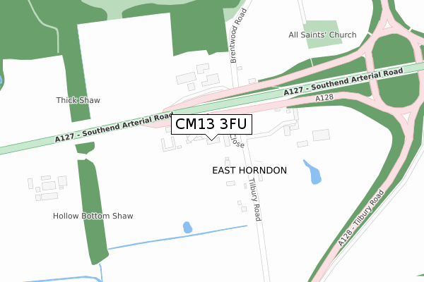
CM13 3FU is located in the Herongate, Ingrave and West Horndon electoral ward, within the local authority district of Brentwood and the English Parliamentary constituency of Brentwood and Ongar. The Sub Integrated Care Board (ICB) Location is NHS Mid and South Essex ICB - 99E and the police force is Essex. This postcode has been in use since July 2019.
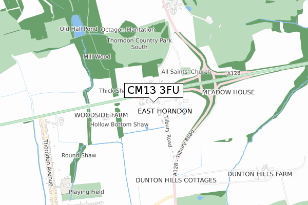
CM13 3FU maps


Source: OS Open Zoomstack (Ordnance Survey)
Licence: Open Government Licence (requires attribution)
Attribution: Contains OS data © Crown copyright and database right 2025
Source: Open Postcode GeoLicence: Open Government Licence (requires attribution)
Attribution: Contains OS data © Crown copyright and database right 2025; Contains Royal Mail data © Royal Mail copyright and database right 2025; Source: Office for National Statistics licensed under the Open Government Licence v.3.0
CM13 3FU geodata
| Easting | 563307 |
| Northing | 189273 |
| Latitude | 51.578666 |
| Longitude | 0.355470 |
Where is CM13 3FU?
| Country | England |
| Postcode District | CM13 |
Politics
| Ward | Herongate, Ingrave And West Horndon |
|---|
| Constituency | Brentwood And Ongar |
|---|
Transport
Nearest bus stops to CM13 3FU
| Halfway House (Tilbury Road) | East Horndon | 447m |
| Halfway House (Tilbury Road) | East Horndon | 473m |
| Dunton Hills Farm (Tilbury Road) | West Horndon | 596m |
| Dunton Hills Farm (Tilbury Road) | West Horndon | 671m |
| Thorndon Country Park (Brentwood Road) | Herongate | 749m |
Nearest railway stations to CM13 3FU
| West Horndon Station | 1.6km |
| Laindon Station | 4.9km |
| Brentwood Station | 5.5km |
Broadband
Broadband access in CM13 3FU (2020 data)
| Percentage of properties with Next Generation Access | 100.0% |
| Percentage of properties with Superfast Broadband | 100.0% |
| Percentage of properties with Ultrafast Broadband | 100.0% |
| Percentage of properties with Full Fibre Broadband | 100.0% |
Superfast Broadband is between 30Mbps and 300Mbps
Ultrafast Broadband is > 300Mbps
Broadband limitations in CM13 3FU (2020 data)
| Percentage of properties unable to receive 2Mbps | 0.0% |
| Percentage of properties unable to receive 5Mbps | 0.0% |
| Percentage of properties unable to receive 10Mbps | 0.0% |
| Percentage of properties unable to receive 30Mbps | 0.0% |
Deprivation
17% of English postcodes are less deprived than
CM13 3FU:
Food Standards Agency
Three nearest food hygiene ratings to CM13 3FU (metres)
The Halfway House
Halfway House Public House
139m
Travelodge At Halfway House
Starbucks
➜ Get more ratings from the Food Standards Agency
Nearest post box to CM13 3FU
| | Last Collection | |
|---|
| Location | Mon-Fri | Sat | Distance |
|---|
| West Horndon P.o. | 16:45 | 11:00 | 1,278m |
| Billericay Road | 17:00 | 09:15 | 1,815m |
| Childerditch Lane | 16:00 | 08:00 | 1,973m |
CM13 3FU ITL and CM13 3FU LAU
The below table lists the International Territorial Level (ITL) codes (formerly Nomenclature of Territorial Units for Statistics (NUTS) codes) and Local Administrative Units (LAU) codes for CM13 3FU:
| ITL 1 Code | Name |
|---|
| TLH | East |
| ITL 2 Code | Name |
|---|
| TLH3 | Essex |
| ITL 3 Code | Name |
|---|
| TLH36 | Heart of Essex |
| LAU 1 Code | Name |
|---|
| E07000068 | Brentwood |
CM13 3FU census areas
The below table lists the Census Output Area (OA), Lower Layer Super Output Area (LSOA), and Middle Layer Super Output Area (MSOA) for CM13 3FU:
| Code | Name |
|---|
| OA | E00108962 | |
|---|
| LSOA | E01021446 | Brentwood 009B |
|---|
| MSOA | E02004472 | Brentwood 009 |
|---|
Nearest postcodes to CM13 3FU


