CM1 6DS maps, stats, and open data
CM1 6DS is located in the Springfield North electoral ward, within the local authority district of Chelmsford and the English Parliamentary constituency of Chelmsford. The Sub Integrated Care Board (ICB) Location is NHS Mid and South Essex ICB - 06Q and the police force is Essex. This postcode has been in use since March 2019.
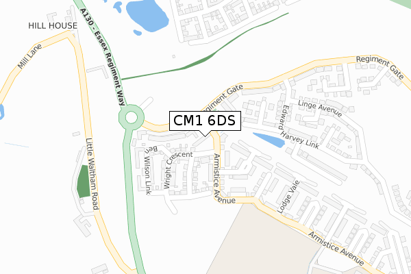
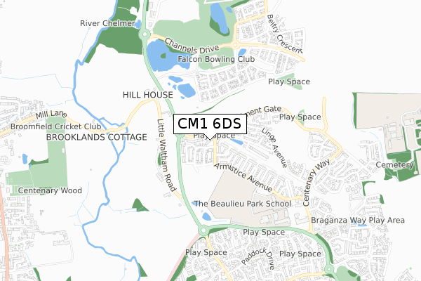
CM1 6DS maps


Licence: Open Government Licence (requires attribution)
Attribution: Contains OS data © Crown copyright and database right 2025
Source: Open Postcode Geo
Licence: Open Government Licence (requires attribution)
Attribution: Contains OS data © Crown copyright and database right 2025; Contains Royal Mail data © Royal Mail copyright and database right 2025; Source: Office for National Statistics licensed under the Open Government Licence v.3.0
CM1 6DS geodata
| Easting | 572034 |
| Northing | 210232 |
| Latitude | 51.764347 |
| Longitude | 0.491603 |
Where is CM1 6DS?
| Country | England |
| Postcode District | CM1 |
Politics
| Ward | Springfield North |
|---|---|
| Constituency | Chelmsford |
Transport
Nearest bus stops to CM1 6DS
| Blacksmith Close (Pump Lane) | North Springfield | 705m |
| Saddle Rise (Paddock Drive) | North Springfield | 722m |
| Croft Court (Paddock Drive) | North Springfield | 762m |
| Harness Close (Paddock Drive) | North Springfield | 850m |
| Mountbatten Way (Pump Lane) | North Springfield | 863m |
Nearest railway stations to CM1 6DS
| Chelmsford Station | 3.5km |
Broadband
Broadband access in CM1 6DS (2020 data)
| Percentage of properties with Next Generation Access | 100.0% |
| Percentage of properties with Superfast Broadband | 100.0% |
| Percentage of properties with Ultrafast Broadband | 100.0% |
| Percentage of properties with Full Fibre Broadband | 100.0% |
Superfast Broadband is between 30Mbps and 300Mbps
Ultrafast Broadband is > 300Mbps
Broadband speed in CM1 6DS (2019 data)
Download
Ofcom does not currently provide download speed data for CM1 6DS. This is because there are less than four broadband connections in this postcode.
Upload
Ofcom does not currently provide upload speed data for CM1 6DS. This is because there are less than four broadband connections in this postcode.
Broadband limitations in CM1 6DS (2020 data)
| Percentage of properties unable to receive 2Mbps | 0.0% |
| Percentage of properties unable to receive 5Mbps | 0.0% |
| Percentage of properties unable to receive 10Mbps | 0.0% |
| Percentage of properties unable to receive 30Mbps | 0.0% |
Deprivation
6.6% of English postcodes are less deprived than CM1 6DS:Food Standards Agency
Three nearest food hygiene ratings to CM1 6DS (metres)


➜ Get more ratings from the Food Standards Agency
Nearest post box to CM1 6DS
| Last Collection | |||
|---|---|---|---|
| Location | Mon-Fri | Sat | Distance |
| Church Green | 17:15 | 13:00 | 788m |
| Mill Lane | 17:10 | 13:00 | 1,069m |
| Goulton Road | 17:10 | 13:00 | 1,667m |
CM1 6DS ITL and CM1 6DS LAU
The below table lists the International Territorial Level (ITL) codes (formerly Nomenclature of Territorial Units for Statistics (NUTS) codes) and Local Administrative Units (LAU) codes for CM1 6DS:
| ITL 1 Code | Name |
|---|---|
| TLH | East |
| ITL 2 Code | Name |
| TLH3 | Essex |
| ITL 3 Code | Name |
| TLH36 | Heart of Essex |
| LAU 1 Code | Name |
| E07000070 | Chelmsford |
CM1 6DS census areas
The below table lists the Census Output Area (OA), Lower Layer Super Output Area (LSOA), and Middle Layer Super Output Area (MSOA) for CM1 6DS:
| Code | Name | |
|---|---|---|
| OA | E00109826 | |
| LSOA | E01021616 | Chelmsford 004A |
| MSOA | E02004488 | Chelmsford 004 |
Nearest postcodes to CM1 6DS
| CM1 7TQ | Mill Lane | 462m |
| CM3 3FR | Jigger Gardens | 574m |
| CM1 6SZ | Anvil Way | 601m |
| CM3 3FP | Brassie Wood | 604m |
| CM1 6SY | Blacksmith Close | 618m |
| CM1 6SX | Saddle Rise | 629m |
| CM1 6FQ | Wavell Close | 637m |
| CM3 3PY | Belsteads Farm Lane | 650m |
| CM1 6UG | Barn Green | 679m |
| CM1 6SU | Tythe Close | 708m |