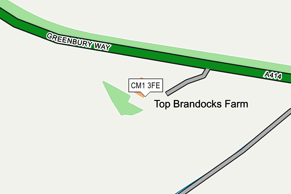
CM1 3FE is located in the Writtle electoral ward, within the local authority district of Chelmsford and the English Parliamentary constituency of Saffron Walden. The Sub Integrated Care Board (ICB) Location is NHS Mid and South Essex ICB - 06Q and the police force is Essex. This postcode has been in use since June 2017.


GetTheData
Source: OS OpenMap – Local (Ordnance Survey)
Source: OS VectorMap District (Ordnance Survey)
Licence: Open Government Licence (requires attribution)
| Easting | 566889 |
| Northing | 205476 |
| Latitude | 51.723177 |
| Longitude | 0.414839 |
GetTheData
Source: Open Postcode Geo
Licence: Open Government Licence
| Country | England |
| Postcode District | CM1 |
➜ See where CM1 is on a map | |
GetTheData
Source: Land Registry Price Paid Data
Licence: Open Government Licence
| Ward | Writtle |
| Constituency | Saffron Walden |
GetTheData
Source: ONS Postcode Database
Licence: Open Government Licence
| Lodge Road | Oxney Green | 425m |
| The Ryle (Lodge Road) | Writtle | 545m |
| Chequers Road | Oxney Green | 664m |
| Ongar Road | Oxney Green | 675m |
| Ongar Road | Oxney Green | 692m |
| Chelmsford Station | 4km |
GetTheData
Source: NaPTAN
Licence: Open Government Licence
GetTheData
Source: ONS Postcode Database
Licence: Open Government Licence


➜ Get more ratings from the Food Standards Agency
GetTheData
Source: Food Standards Agency
Licence: FSA terms & conditions
| Last Collection | |||
|---|---|---|---|
| Location | Mon-Fri | Sat | Distance |
| Long Brandocks | 16:50 | 08:45 | 741m |
| Lodge Road | 16:45 | 09:00 | 1,028m |
| Writtle P.o. | 17:30 | 12:00 | 1,217m |
GetTheData
Source: Dracos
Licence: Creative Commons Attribution-ShareAlike
The below table lists the International Territorial Level (ITL) codes (formerly Nomenclature of Territorial Units for Statistics (NUTS) codes) and Local Administrative Units (LAU) codes for CM1 3FE:
| ITL 1 Code | Name |
|---|---|
| TLH | East |
| ITL 2 Code | Name |
| TLH3 | Essex |
| ITL 3 Code | Name |
| TLH36 | Heart of Essex |
| LAU 1 Code | Name |
| E07000070 | Chelmsford |
GetTheData
Source: ONS Postcode Directory
Licence: Open Government Licence
The below table lists the Census Output Area (OA), Lower Layer Super Output Area (LSOA), and Middle Layer Super Output Area (MSOA) for CM1 3FE:
| Code | Name | |
|---|---|---|
| OA | E00109898 | |
| LSOA | E01021634 | Chelmsford 011D |
| MSOA | E02004495 | Chelmsford 011 |
GetTheData
Source: ONS Postcode Directory
Licence: Open Government Licence
| CM1 3PW | Highwood Road | 420m |
| CM1 3NJ | The Shrubberies | 448m |
| CM1 3JB | Lodge Road | 462m |
| CM1 3PR | Causeway Cottages | 484m |
| CM1 3JU | Oxney Mead | 493m |
| CM1 3JT | Rollestons | 494m |
| CM1 3JN | Long Brandocks | 523m |
| CM1 3JW | Long Brandocks | 534m |
| CM1 3JL | Long Brandocks | 534m |
| CM1 3NQ | Chequers Road | 555m |
GetTheData
Source: Open Postcode Geo; Land Registry Price Paid Data
Licence: Open Government Licence