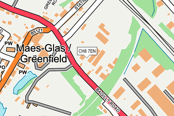
CH8 7EN is located in the Holywell Central electoral ward, within the unitary authority of Flintshire and the Welsh Parliamentary constituency of Delyn. The Local Health Board is Betsi Cadwaladr University and the police force is North Wales. This postcode has been in use since April 2017.


GetTheData
Source: OS OpenMap – Local (Ordnance Survey)
Source: OS VectorMap District (Ordnance Survey)
Licence: Open Government Licence (requires attribution)
| Easting | 319107 |
| Northing | 376137 |
| Latitude | 53.276036 |
| Longitude | -3.214575 |
GetTheData
Source: Open Postcode Geo
Licence: Open Government Licence
| Country | Wales |
| Postcode District | CH8 |
➜ See where CH8 is on a map ➜ Where is Holywell? | |
GetTheData
Source: Land Registry Price Paid Data
Licence: Open Government Licence
| Ward | Holywell Central |
| Constituency | Delyn |
GetTheData
Source: ONS Postcode Database
Licence: Open Government Licence
| Nant-y-coed (Abbots Walk) | Pen-y-maes | 156m |
| Abbots Walk Entrance (Abbots Walk) | Pen-y-maes | 159m |
| Nant-y-coed (Abbots Walk) | Pen-y-maes | 163m |
| Pen-y-maes Gardens (Pen-y-maes Road) | Pen-y-maes | 195m |
| Wat`s Dyke Avenue | Holywell | 328m |
GetTheData
Source: NaPTAN
Licence: Open Government Licence
GetTheData
Source: ONS Postcode Database
Licence: Open Government Licence


➜ Get more ratings from the Food Standards Agency
GetTheData
Source: Food Standards Agency
Licence: FSA terms & conditions
| Last Collection | |||
|---|---|---|---|
| Location | Mon-Fri | Sat | Distance |
| Pantasaph | 09:00 | 08:30 | 540m |
| Holywell Post Office | 17:30 | 11:30 | 541m |
| High Street Box | 17:30 | 11:30 | 601m |
GetTheData
Source: Dracos
Licence: Creative Commons Attribution-ShareAlike
The below table lists the International Territorial Level (ITL) codes (formerly Nomenclature of Territorial Units for Statistics (NUTS) codes) and Local Administrative Units (LAU) codes for CH8 7EN:
| ITL 1 Code | Name |
|---|---|
| TLL | Wales |
| ITL 2 Code | Name |
| TLL2 | East Wales |
| ITL 3 Code | Name |
| TLL23 | Flintshire and Wrexham |
| LAU 1 Code | Name |
| W06000005 | Flintshire |
GetTheData
Source: ONS Postcode Directory
Licence: Open Government Licence
The below table lists the Census Output Area (OA), Lower Layer Super Output Area (LSOA), and Middle Layer Super Output Area (MSOA) for CH8 7EN:
| Code | Name | |
|---|---|---|
| OA | W00001629 | |
| LSOA | W01000304 | Flintshire 003E |
| MSOA | W02000060 | Flintshire 003 |
GetTheData
Source: ONS Postcode Directory
Licence: Open Government Licence
| CH8 7BP | Nant Y Coed | 91m |
| CH8 7AG | Strand Lane | 145m |
| CH8 7AY | Nant Y Coed | 161m |
| CH8 7BY | Abbots Walk | 197m |
| CH8 7BZ | Abbots Walk | 204m |
| CH8 7AF | Strand Park | 215m |
| CH8 7AD | Maes Yr Odyn | 220m |
| CH8 7BA | Nant Y Coed | 221m |
| CH8 7AW | Strand Walk | 246m |
| CH8 7BJ | Prince Of Wales Avenue | 252m |
GetTheData
Source: Open Postcode Geo; Land Registry Price Paid Data
Licence: Open Government Licence