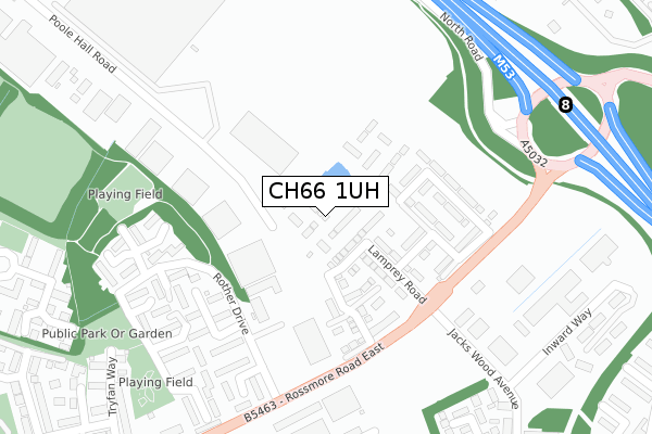
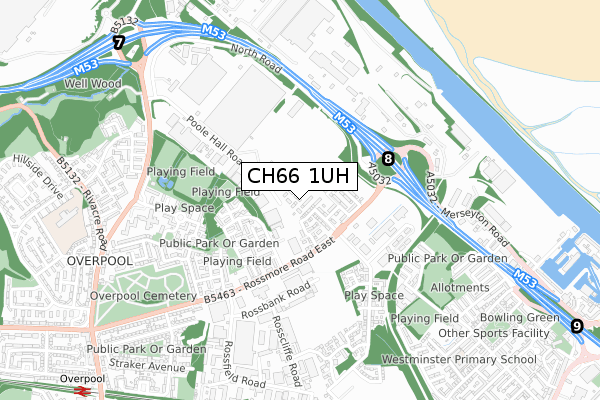
CH66 1UH is located in the Westminster electoral ward, within the unitary authority of Cheshire West and Chester and the English Parliamentary constituency of Ellesmere Port and Neston. The Sub Integrated Care Board (ICB) Location is NHS Cheshire and Merseyside ICB - 27D and the police force is Cheshire. This postcode has been in use since September 2019.


GetTheData
Source: OS Open Zoomstack (Ordnance Survey)
Licence: Open Government Licence (requires attribution)
Attribution: Contains OS data © Crown copyright and database right 2025
Source: Open Postcode Geo
Licence: Open Government Licence (requires attribution)
Attribution: Contains OS data © Crown copyright and database right 2025; Contains Royal Mail data © Royal Mail copyright and database right 2025; Source: Office for National Statistics licensed under the Open Government Licence v.3.0
| Easting | 339349 |
| Northing | 377539 |
| Latitude | 53.291342 |
| Longitude | -2.911331 |
GetTheData
Source: Open Postcode Geo
Licence: Open Government Licence
| Country | England |
| Postcode District | CH66 |
➜ See where CH66 is on a map ➜ Where is Ellesmere Port? | |
GetTheData
Source: Land Registry Price Paid Data
Licence: Open Government Licence
| Ward | Westminster |
| Constituency | Ellesmere Port And Neston |
GetTheData
Source: ONS Postcode Database
Licence: Open Government Licence
2023 3 OCT £240,000 |
20, PONDSIDE DRIVE, ELLESMERE PORT, CH66 1UH 2020 21 AUG £224,995 |
2020 21 AUG £209,995 |
23, PONDSIDE DRIVE, ELLESMERE PORT, CH66 1UH 2020 14 AUG £209,995 |
21, PONDSIDE DRIVE, ELLESMERE PORT, CH66 1UH 2020 7 AUG £239,995 |
18, PONDSIDE DRIVE, ELLESMERE PORT, CH66 1UH 2020 17 JUL £224,995 |
15, PONDSIDE DRIVE, ELLESMERE PORT, CH66 1UH 2019 13 DEC £207,995 |
11, PONDSIDE DRIVE, ELLESMERE PORT, CH66 1UH 2019 6 DEC £207,995 |
9, PONDSIDE DRIVE, ELLESMERE PORT, CH66 1UH 2019 29 NOV £234,995 |
7, PONDSIDE DRIVE, ELLESMERE PORT, CH66 1UH 2019 18 NOV £213,995 |
GetTheData
Source: HM Land Registry Price Paid Data
Licence: Contains HM Land Registry data © Crown copyright and database right 2025. This data is licensed under the Open Government Licence v3.0.
| Motorway Junction (Rossmore Road East) | Ellesmere Port | 253m |
| Motorway Junction (Rossmore Road East) | Ellesmere Port | 269m |
| Lookers Gb (Rossmore Road East) | Overpool | 332m |
| Lookers Gb (Rossmore Road East) | Overpool | 337m |
| Naylor Place (Naylor Road) | Overpool | 483m |
| Overpool Station | 1.2km |
| Ellesmere Port Station | 1.4km |
| Little Sutton Station | 2.2km |
GetTheData
Source: NaPTAN
Licence: Open Government Licence
GetTheData
Source: ONS Postcode Database
Licence: Open Government Licence


➜ Get more ratings from the Food Standards Agency
GetTheData
Source: Food Standards Agency
Licence: FSA terms & conditions
| Last Collection | |||
|---|---|---|---|
| Location | Mon-Fri | Sat | Distance |
| Poolhall Road | 17:28 | 12:56 | 278m |
| Ellesmere Port Delivery Office | 18:00 | 12:45 | 542m |
| Gowey Court | 17:45 | 12:53 | 846m |
GetTheData
Source: Dracos
Licence: Creative Commons Attribution-ShareAlike
The below table lists the International Territorial Level (ITL) codes (formerly Nomenclature of Territorial Units for Statistics (NUTS) codes) and Local Administrative Units (LAU) codes for CH66 1UH:
| ITL 1 Code | Name |
|---|---|
| TLD | North West (England) |
| ITL 2 Code | Name |
| TLD6 | Cheshire |
| ITL 3 Code | Name |
| TLD63 | Cheshire West and Chester |
| LAU 1 Code | Name |
| E06000050 | Cheshire West and Chester |
GetTheData
Source: ONS Postcode Directory
Licence: Open Government Licence
The below table lists the Census Output Area (OA), Lower Layer Super Output Area (LSOA), and Middle Layer Super Output Area (MSOA) for CH66 1UH:
| Code | Name | |
|---|---|---|
| OA | E00168840 | |
| LSOA | E01018563 | Cheshire West and Chester 007D |
| MSOA | E02003845 | Cheshire West and Chester 007 |
GetTheData
Source: ONS Postcode Directory
Licence: Open Government Licence
| CH65 3DP | Rother Drive | 142m |
| CH65 3DL | Swale Road | 245m |
| CH66 1SP | Leven Walk | 282m |
| CH65 3DN | Ure Court | 304m |
| CH65 3DJ | Tees Court | 307m |
| CH65 3DW | Aire Close | 313m |
| CH65 3DQ | Wharfe Lane | 316m |
| CH66 1SR | Dove Close | 323m |
| CH66 1ST | Poole Hall Industrial Estate | 361m |
| CH65 3AH | Slackswood Close | 392m |
GetTheData
Source: Open Postcode Geo; Land Registry Price Paid Data
Licence: Open Government Licence