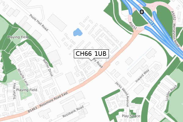
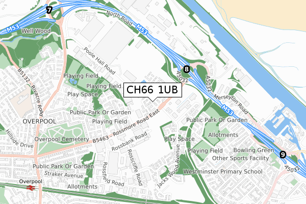
CH66 1UB is located in the Westminster electoral ward, within the unitary authority of Cheshire West and Chester and the English Parliamentary constituency of Ellesmere Port and Neston. The Sub Integrated Care Board (ICB) Location is NHS Cheshire and Merseyside ICB - 27D and the police force is Cheshire. This postcode has been in use since May 2018.


GetTheData
Source: OS Open Zoomstack (Ordnance Survey)
Licence: Open Government Licence (requires attribution)
Attribution: Contains OS data © Crown copyright and database right 2025
Source: Open Postcode Geo
Licence: Open Government Licence (requires attribution)
Attribution: Contains OS data © Crown copyright and database right 2025; Contains Royal Mail data © Royal Mail copyright and database right 2025; Source: Office for National Statistics licensed under the Open Government Licence v.3.0
| Easting | 339452 |
| Northing | 377435 |
| Latitude | 53.290419 |
| Longitude | -2.909766 |
GetTheData
Source: Open Postcode Geo
Licence: Open Government Licence
| Country | England |
| Postcode District | CH66 |
➜ See where CH66 is on a map ➜ Where is Ellesmere Port? | |
GetTheData
Source: Land Registry Price Paid Data
Licence: Open Government Licence
| Ward | Westminster |
| Constituency | Ellesmere Port And Neston |
GetTheData
Source: ONS Postcode Database
Licence: Open Government Licence
2024 28 MAR £305,000 |
2022 20 JUL £225,000 |
2018 28 SEP £184,950 |
39, LAMPREY ROAD, ELLESMERE PORT, CH66 1UB 2018 28 SEP £184,950 |
33, LAMPREY ROAD, ELLESMERE PORT, CH66 1UB 2018 6 JUL £194,950 |
2018 6 JUL £196,950 |
31, LAMPREY ROAD, ELLESMERE PORT, CH66 1UB 2018 29 JUN £209,950 |
32, LAMPREY ROAD, ELLESMERE PORT, CH66 1UB 2018 11 JUN £225,995 |
2018 16 MAY £229,995 |
GetTheData
Source: HM Land Registry Price Paid Data
Licence: Contains HM Land Registry data © Crown copyright and database right 2025. This data is licensed under the Open Government Licence v3.0.
| Motorway Junction (Rossmore Road East) | Ellesmere Port | 164m |
| Motorway Junction (Rossmore Road East) | Ellesmere Port | 174m |
| Lookers Gb (Rossmore Road East) | Overpool | 301m |
| Lookers Gb (Rossmore Road East) | Overpool | 315m |
| Naylor Place (Naylor Road) | Overpool | 585m |
| Overpool Station | 1.2km |
| Ellesmere Port Station | 1.3km |
| Little Sutton Station | 2.3km |
GetTheData
Source: NaPTAN
Licence: Open Government Licence
| Percentage of properties with Next Generation Access | 100.0% |
| Percentage of properties with Superfast Broadband | 100.0% |
| Percentage of properties with Ultrafast Broadband | 95.7% |
| Percentage of properties with Full Fibre Broadband | 95.7% |
Superfast Broadband is between 30Mbps and 300Mbps
Ultrafast Broadband is > 300Mbps
| Percentage of properties unable to receive 2Mbps | 0.0% |
| Percentage of properties unable to receive 5Mbps | 0.0% |
| Percentage of properties unable to receive 10Mbps | 0.0% |
| Percentage of properties unable to receive 30Mbps | 0.0% |
GetTheData
Source: Ofcom
Licence: Ofcom Terms of Use (requires attribution)
GetTheData
Source: ONS Postcode Database
Licence: Open Government Licence


➜ Get more ratings from the Food Standards Agency
GetTheData
Source: Food Standards Agency
Licence: FSA terms & conditions
| Last Collection | |||
|---|---|---|---|
| Location | Mon-Fri | Sat | Distance |
| Poolhall Road | 17:28 | 12:56 | 240m |
| Ellesmere Port Delivery Office | 18:00 | 12:45 | 470m |
| Livingstone Road | 17:37 | 12:34 | 767m |
GetTheData
Source: Dracos
Licence: Creative Commons Attribution-ShareAlike
The below table lists the International Territorial Level (ITL) codes (formerly Nomenclature of Territorial Units for Statistics (NUTS) codes) and Local Administrative Units (LAU) codes for CH66 1UB:
| ITL 1 Code | Name |
|---|---|
| TLD | North West (England) |
| ITL 2 Code | Name |
| TLD6 | Cheshire |
| ITL 3 Code | Name |
| TLD63 | Cheshire West and Chester |
| LAU 1 Code | Name |
| E06000050 | Cheshire West and Chester |
GetTheData
Source: ONS Postcode Directory
Licence: Open Government Licence
The below table lists the Census Output Area (OA), Lower Layer Super Output Area (LSOA), and Middle Layer Super Output Area (MSOA) for CH66 1UB:
| Code | Name | |
|---|---|---|
| OA | E00168840 | |
| LSOA | E01018563 | Cheshire West and Chester 007D |
| MSOA | E02003845 | Cheshire West and Chester 007 |
GetTheData
Source: ONS Postcode Directory
Licence: Open Government Licence
| CH65 3DP | Rother Drive | 199m |
| CH65 3AH | Slackswood Close | 250m |
| CH65 3DL | Swale Road | 301m |
| CH65 3DJ | Tees Court | 302m |
| CH65 3EY | Inward Way | 315m |
| CH65 3AG | Standingwood Road | 319m |
| CH65 3DQ | Wharfe Lane | 336m |
| CH65 3DW | Aire Close | 350m |
| CH65 3AR | Hallwood Walk | 355m |
| CH65 3AP | Redhillswood Close | 361m |
GetTheData
Source: Open Postcode Geo; Land Registry Price Paid Data
Licence: Open Government Licence