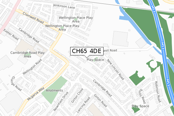
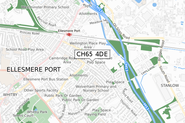
CH65 4DE is located in the Central & Grange electoral ward, within the unitary authority of Cheshire West and Chester and the English Parliamentary constituency of Ellesmere Port and Neston. The Sub Integrated Care Board (ICB) Location is NHS Cheshire and Merseyside ICB - 27D and the police force is Cheshire. This postcode has been in use since February 2018.


GetTheData
Source: OS Open Zoomstack (Ordnance Survey)
Licence: Open Government Licence (requires attribution)
Attribution: Contains OS data © Crown copyright and database right 2025
Source: Open Postcode Geo
Licence: Open Government Licence (requires attribution)
Attribution: Contains OS data © Crown copyright and database right 2025; Contains Royal Mail data © Royal Mail copyright and database right 2025; Source: Office for National Statistics licensed under the Open Government Licence v.3.0
| Easting | 340653 |
| Northing | 376137 |
| Latitude | 53.278889 |
| Longitude | -2.891509 |
GetTheData
Source: Open Postcode Geo
Licence: Open Government Licence
| Country | England |
| Postcode District | CH65 |
➜ See where CH65 is on a map ➜ Where is Ellesmere Port? | |
GetTheData
Source: Land Registry Price Paid Data
Licence: Open Government Licence
| Ward | Central & Grange |
| Constituency | Ellesmere Port And Neston |
GetTheData
Source: ONS Postcode Database
Licence: Open Government Licence
2024 23 AUG £275,000 |
2022 21 JAN £248,000 |
32, CHURCHILL LANE, ELLESMERE PORT, CH65 4DE 2019 17 SEP £131,995 |
2019 28 JUN £182,000 |
2019 28 JUN £188,000 |
23, CHURCHILL LANE, ELLESMERE PORT, CH65 4DE 2019 29 MAR £196,995 |
27, CHURCHILL LANE, ELLESMERE PORT, CH65 4DE 2019 26 MAR £204,995 |
25, CHURCHILL LANE, ELLESMERE PORT, CH65 4DE 2019 25 MAR £204,995 |
19, CHURCHILL LANE, ELLESMERE PORT, CH65 4DE 2018 13 AUG £212,995 |
21, CHURCHILL LANE, ELLESMERE PORT, CH65 4DE 2018 10 AUG £194,995 |
GetTheData
Source: HM Land Registry Price Paid Data
Licence: Contains HM Land Registry data © Crown copyright and database right 2025. This data is licensed under the Open Government Licence v3.0.
| Newnham Drive (Cambridge Road) | Wolverham | 72m |
| Newnham Drive (Cambridge Road) | Wolverham | 91m |
| Cambridge Road Primary (Wellington Road) | Ellesmere Port | 251m |
| Marchwell Road (Cambridge Road) | Wolverham | 373m |
| Phoenix Social Club (Cromwell Road) | Ellesmere Port | 421m |
| Ellesmere Port Station | 0.5km |
| Overpool Station | 2.2km |
| Stanlow & Thornton Station | 3.3km |
GetTheData
Source: NaPTAN
Licence: Open Government Licence
| Percentage of properties with Next Generation Access | 100.0% |
| Percentage of properties with Superfast Broadband | 100.0% |
| Percentage of properties with Ultrafast Broadband | 100.0% |
| Percentage of properties with Full Fibre Broadband | 100.0% |
Superfast Broadband is between 30Mbps and 300Mbps
Ultrafast Broadband is > 300Mbps
| Percentage of properties unable to receive 2Mbps | 0.0% |
| Percentage of properties unable to receive 5Mbps | 0.0% |
| Percentage of properties unable to receive 10Mbps | 0.0% |
| Percentage of properties unable to receive 30Mbps | 0.0% |
GetTheData
Source: Ofcom
Licence: Ofcom Terms of Use (requires attribution)
GetTheData
Source: ONS Postcode Database
Licence: Open Government Licence


➜ Get more ratings from the Food Standards Agency
GetTheData
Source: Food Standards Agency
Licence: FSA terms & conditions
| Last Collection | |||
|---|---|---|---|
| Location | Mon-Fri | Sat | Distance |
| Newham Drive | 18:15 | 12:00 | 135m |
| Wellington Road | 18:15 | 12:21 | 442m |
| Cromwell Road | 18:15 | 12:23 | 489m |
GetTheData
Source: Dracos
Licence: Creative Commons Attribution-ShareAlike
The below table lists the International Territorial Level (ITL) codes (formerly Nomenclature of Territorial Units for Statistics (NUTS) codes) and Local Administrative Units (LAU) codes for CH65 4DE:
| ITL 1 Code | Name |
|---|---|
| TLD | North West (England) |
| ITL 2 Code | Name |
| TLD6 | Cheshire |
| ITL 3 Code | Name |
| TLD63 | Cheshire West and Chester |
| LAU 1 Code | Name |
| E06000050 | Cheshire West and Chester |
GetTheData
Source: ONS Postcode Directory
Licence: Open Government Licence
The below table lists the Census Output Area (OA), Lower Layer Super Output Area (LSOA), and Middle Layer Super Output Area (MSOA) for CH65 4DE:
| Code | Name | |
|---|---|---|
| OA | E00093450 | |
| LSOA | E01018520 | Cheshire West and Chester 007B |
| MSOA | E02003845 | Cheshire West and Chester 007 |
GetTheData
Source: ONS Postcode Directory
Licence: Open Government Licence
| CH65 0BS | Cambridge Road | 96m |
| CH65 0BT | Cambridge Road | 109m |
| CH65 0EF | Arthur Avenue | 159m |
| CH65 5BW | Cambridge Road | 161m |
| CH65 5BL | Cambridge Road | 176m |
| CH65 0EG | Arthur Avenue | 184m |
| CH65 5BE | Girton Road | 188m |
| CH65 4AB | Wellington Road North | 217m |
| CH65 4AA | Cromwell Road | 227m |
| CH65 5AN | Newnham Drive | 228m |
GetTheData
Source: Open Postcode Geo; Land Registry Price Paid Data
Licence: Open Government Licence