Property/Postcode Data Search:
CH43 0AD maps, stats, and open data
CH43 0AD is located in the Prenton electoral ward, within the metropolitan district of Wirral and the English Parliamentary constituency of Birkenhead. The Sub Integrated Care Board (ICB) Location is NHS Cheshire and Merseyside ICB - 12F and the police force is Merseyside. This postcode has been in use since April 2020.
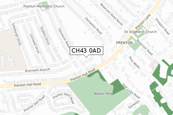
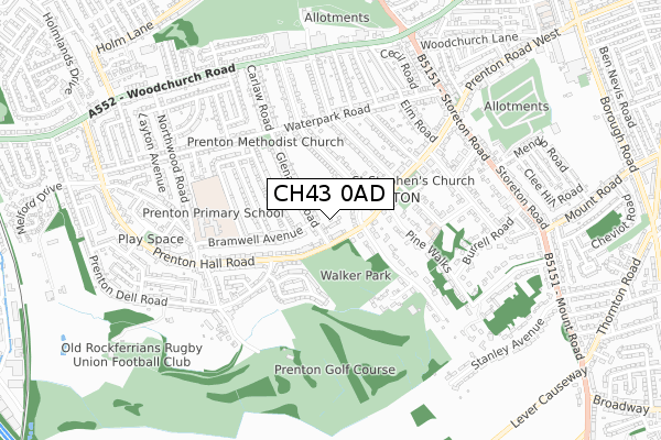
CH43 0AD maps


Source: OS Open Zoomstack (Ordnance Survey)
Licence: Open Government Licence (requires attribution)
Attribution: Contains OS data © Crown copyright and database right 2025
Source: Open Postcode Geo
Licence: Open Government Licence (requires attribution)
Attribution: Contains OS data © Crown copyright and database right 2025; Contains Royal Mail data © Royal Mail copyright and database right 2025; Source: Office for National Statistics licensed under the Open Government Licence v.3.0
Licence: Open Government Licence (requires attribution)
Attribution: Contains OS data © Crown copyright and database right 2025
Source: Open Postcode Geo
Licence: Open Government Licence (requires attribution)
Attribution: Contains OS data © Crown copyright and database right 2025; Contains Royal Mail data © Royal Mail copyright and database right 2025; Source: Office for National Statistics licensed under the Open Government Licence v.3.0
CH43 0AD geodata
| Easting | 330496 |
| Northing | 386212 |
| Latitude | 53.368199 |
| Longitude | -3.046024 |
Where is CH43 0AD?
| Country | England |
| Postcode District | CH43 |
Politics
| Ward | Prenton |
|---|---|
| Constituency | Birkenhead |
House Prices
Sales of detached houses in CH43 0AD
2025 16 MAY £440,000 |
2023 1 DEC £440,000 |
2023 29 SEP £405,000 |
2022 25 NOV £435,000 |
26, GLENAVON PARK, PRENTON, WIRRAL, CH43 0AD 2022 8 FEB £390,000 |
5, GLENAVON PARK, PRENTON, CH43 0AD 2021 29 OCT £395,000 |
1, GLENAVON PARK, PRENTON, CH43 0AD 2021 30 JUL £395,000 |
28, GLENAVON PARK, PRENTON, CH43 0AD 2021 21 JUL £395,950 |
2021 30 JUN £399,950 |
2021 9 APR £410,000 |
Source: HM Land Registry Price Paid Data
Licence: Contains HM Land Registry data © Crown copyright and database right 2025. This data is licensed under the Open Government Licence v3.0.
Licence: Contains HM Land Registry data © Crown copyright and database right 2025. This data is licensed under the Open Government Licence v3.0.
Transport
Nearest bus stops to CH43 0AD
| Osmaston Road (Prenton Hall Road) | Prenton | 122m |
| Golf Links Road (Prenton Hall Road) | Prenton | 132m |
| Prenton Dell Road (Prenton Hall Road) | Prenton | 285m |
| Reservoir Road North (Prenton Lane) | Prenton | 307m |
| Prenton Dell Road (Prenton Hall Road) | Prenton | 328m |
Nearest railway stations to CH43 0AD
| Rock Ferry Station | 2.4km |
| Green Lane Station | 2.6km |
| Birkenhead Central Station | 2.8km |
Deprivation
1.7% of English postcodes are less deprived than CH43 0AD:Food Standards Agency
Three nearest food hygiene ratings to CH43 0AD (metres)
Prenton Methodist Church

Glenavon Road
254m
Norway Lodge Nursing Home

Norway Lodge Nursing Home
348m
Prenton Golf Club

Golf Links Road
384m
➜ Get more ratings from the Food Standards Agency
Nearest post box to CH43 0AD
| Last Collection | |||
|---|---|---|---|
| Location | Mon-Fri | Sat | Distance |
| Beresford Road | 17:00 | 12:00 | 1,284m |
| Alton Road | 17:30 | 12:00 | 1,799m |
| Pine Walks | 17:30 | 12:00 | 1,926m |
CH43 0AD ITL and CH43 0AD LAU
The below table lists the International Territorial Level (ITL) codes (formerly Nomenclature of Territorial Units for Statistics (NUTS) codes) and Local Administrative Units (LAU) codes for CH43 0AD:
| ITL 1 Code | Name |
|---|---|
| TLD | North West (England) |
| ITL 2 Code | Name |
| TLD7 | Merseyside |
| ITL 3 Code | Name |
| TLD74 | Wirral |
| LAU 1 Code | Name |
| E08000015 | Wirral |
CH43 0AD census areas
The below table lists the Census Output Area (OA), Lower Layer Super Output Area (LSOA), and Middle Layer Super Output Area (MSOA) for CH43 0AD:
| Code | Name | |
|---|---|---|
| OA | E00036735 | |
| LSOA | E01007254 | Wirral 030D |
| MSOA | E02001496 | Wirral 030 |
Nearest postcodes to CH43 0AD
| CH43 0RD | Glenavon Road | 72m |
| CH42 8LP | Osmaston Road | 102m |
| CH43 0RF | Glenavon Road | 111m |
| CH43 3EW | Prenton Hall Road | 153m |
| CH43 0RA | Prenton Hall Road | 181m |
| CH42 8LR | Osmaston Road | 186m |
| CH42 8LL | Osmaston Road | 227m |
| CH43 0RH | Bramwell Avenue | 232m |
| CH42 8LU | Reservoir Road North | 236m |
| CH42 8QD | Prenton Lane | 236m |