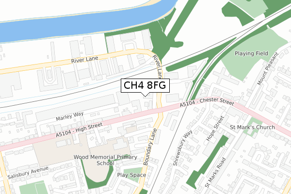
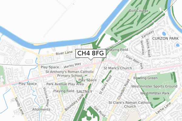
CH4 8FG is located in the Saltney Ferry electoral ward, within the unitary authority of Flintshire and the Welsh Parliamentary constituency of Alyn and Deeside. The Local Health Board is Betsi Cadwaladr University and the police force is North Wales. This postcode has been in use since January 2019.


GetTheData
Source: OS Open Zoomstack (Ordnance Survey)
Licence: Open Government Licence (requires attribution)
Attribution: Contains OS data © Crown copyright and database right 2025
Source: Open Postcode Geo
Licence: Open Government Licence (requires attribution)
Attribution: Contains OS data © Crown copyright and database right 2025; Contains Royal Mail data © Royal Mail copyright and database right 2025; Source: Office for National Statistics licensed under the Open Government Licence v.3.0
| Easting | 338563 |
| Northing | 365147 |
| Latitude | 53.179876 |
| Longitude | -2.920728 |
GetTheData
Source: Open Postcode Geo
Licence: Open Government Licence
| Country | Wales |
| Postcode District | CH4 |
➜ See where CH4 is on a map ➜ Where is Chester? | |
GetTheData
Source: Land Registry Price Paid Data
Licence: Open Government Licence
| Ward | Saltney Ferry |
| Constituency | Alyn And Deeside |
GetTheData
Source: ONS Postcode Database
Licence: Open Government Licence
| Anchor Hotel (High Street) | Saltney | 57m |
| Anchor Hotel (High Street) | Saltney | 84m |
| Police Station (High Street) | Saltney | 259m |
| Brewery Arms Ph (Chester Street) | Lache | 262m |
| Police Station (High Street) | Saltney | 285m |
| Chester Station | 3.3km |
| Bache Station | 3.8km |
GetTheData
Source: NaPTAN
Licence: Open Government Licence
| Percentage of properties with Next Generation Access | 100.0% |
| Percentage of properties with Superfast Broadband | 100.0% |
| Percentage of properties with Ultrafast Broadband | 0.0% |
| Percentage of properties with Full Fibre Broadband | 0.0% |
Superfast Broadband is between 30Mbps and 300Mbps
Ultrafast Broadband is > 300Mbps
| Percentage of properties unable to receive 2Mbps | 0.0% |
| Percentage of properties unable to receive 5Mbps | 0.0% |
| Percentage of properties unable to receive 10Mbps | 0.0% |
| Percentage of properties unable to receive 30Mbps | 0.0% |
GetTheData
Source: Ofcom
Licence: Ofcom Terms of Use (requires attribution)
GetTheData
Source: ONS Postcode Database
Licence: Open Government Licence


➜ Get more ratings from the Food Standards Agency
GetTheData
Source: Food Standards Agency
Licence: FSA terms & conditions
| Last Collection | |||
|---|---|---|---|
| Location | Mon-Fri | Sat | Distance |
| Saltney Post Office. | 16:45 | 12:15 | 331m |
| Cliveden Road. | 16:30 | 12:15 | 618m |
| Park Avenue. | 16:45 | 12:30 | 632m |
GetTheData
Source: Dracos
Licence: Creative Commons Attribution-ShareAlike
The below table lists the International Territorial Level (ITL) codes (formerly Nomenclature of Territorial Units for Statistics (NUTS) codes) and Local Administrative Units (LAU) codes for CH4 8FG:
| ITL 1 Code | Name |
|---|---|
| TLL | Wales |
| ITL 2 Code | Name |
| TLL2 | East Wales |
| ITL 3 Code | Name |
| TLL23 | Flintshire and Wrexham |
| LAU 1 Code | Name |
| W06000005 | Flintshire |
GetTheData
Source: ONS Postcode Directory
Licence: Open Government Licence
The below table lists the Census Output Area (OA), Lower Layer Super Output Area (LSOA), and Middle Layer Super Output Area (MSOA) for CH4 8FG:
| Code | Name | |
|---|---|---|
| OA | W00001769 | |
| LSOA | W01000329 | Flintshire 015D |
| MSOA | W02000072 | Flintshire 015 |
GetTheData
Source: ONS Postcode Directory
Licence: Open Government Licence
| CH4 8GA | River Lane | 42m |
| CH4 8SE | High Street | 79m |
| CH4 8NH | 195m | |
| CH4 8QZ | Chainmakers Row | 207m |
| CH4 8DA | Telford Way | 229m |
| CH4 8BP | Curzon Street | 235m |
| CH4 8QF | Rhodfar Bont | 236m |
| CH4 8BR | Donnington Way | 240m |
| CH4 8SF | High Street | 249m |
| CH4 8BY | Shrewsbury Way | 250m |
GetTheData
Source: Open Postcode Geo; Land Registry Price Paid Data
Licence: Open Government Licence