Property/Postcode Data Search:
CH4 0TW maps, stats, and open data
CH4 0TW is located in the Pen-y-ffordd electoral ward, within the unitary authority of Flintshire and the Welsh Parliamentary constituency of Alyn and Deeside. The Local Health Board is Betsi Cadwaladr University and the police force is North Wales. This postcode has been in use since September 2019.
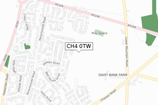
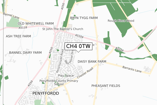
CH4 0TW maps


Source: OS Open Zoomstack (Ordnance Survey)
Licence: Open Government Licence (requires attribution)
Attribution: Contains OS data © Crown copyright and database right 2025
Source: Open Postcode Geo
Licence: Open Government Licence (requires attribution)
Attribution: Contains OS data © Crown copyright and database right 2025; Contains Royal Mail data © Royal Mail copyright and database right 2025; Source: Office for National Statistics licensed under the Open Government Licence v.3.0
Licence: Open Government Licence (requires attribution)
Attribution: Contains OS data © Crown copyright and database right 2025
Source: Open Postcode Geo
Licence: Open Government Licence (requires attribution)
Attribution: Contains OS data © Crown copyright and database right 2025; Contains Royal Mail data © Royal Mail copyright and database right 2025; Source: Office for National Statistics licensed under the Open Government Licence v.3.0
CH4 0TW geodata
| Easting | 330809 |
| Northing | 362452 |
| Latitude | 53.154702 |
| Longitude | -3.036145 |
Where is CH4 0TW?
| Country | Wales |
| Postcode District | CH4 |
Politics
| Ward | Pen-y-ffordd |
|---|---|
| Constituency | Alyn And Deeside |
House Prices
Sales of detached houses in CH4 0TW
36, FFORDD GLYNNE, PENYMYNYDD, CHESTER, CH4 0TW 2024 4 OCT £395,000 |
37, FFORDD GLYNNE, PENYMYNYDD, CHESTER, CH4 0TW 2024 29 JUL £385,000 |
79, FFORDD GLYNNE, PENYMYNYDD, CHESTER, CH4 0TW 2024 21 JUN £380,995 |
2024 7 JUN £344,995 |
60, FFORDD GLYNNE, PENYMYNYDD, CHESTER, CH4 0TW 2024 17 MAY £338,000 |
77, FFORDD GLYNNE, PENYMYNYDD, CHESTER, CH4 0TW 2024 3 MAY £316,000 |
18, FFORDD GLYNNE, PENYMYNYDD, CHESTER, CH4 0TW 2024 2 APR £395,000 |
75, FFORDD GLYNNE, PENYMYNYDD, CHESTER, CH4 0TW 2023 27 OCT £337,995 |
42, FFORDD GLYNNE, PENYMYNYDD, CHESTER, CH4 0TW 2023 14 APR £435,995 |
73, FFORDD GLYNNE, PENYMYNYDD, CHESTER, CH4 0TW 2023 31 MAR £353,995 |
Source: HM Land Registry Price Paid Data
Licence: Contains HM Land Registry data © Crown copyright and database right 2025. This data is licensed under the Open Government Licence v3.0.
Licence: Contains HM Land Registry data © Crown copyright and database right 2025. This data is licensed under the Open Government Licence v3.0.
Transport
Nearest bus stops to CH4 0TW
| Bank Farm (Chester Road) | Penymynydd | 319m |
| Bank Farm (Chester Road) | Penymynydd | 327m |
| St John The Baptist`s Church (A5104) | Penymynydd | 417m |
| St John The Baptist's Church (A5104) | Penymynydd | 450m |
| Old Horse And Jockey (A550) | Penymynydd | 495m |
Nearest railway stations to CH4 0TW
| Buckley Station | 1.6km |
| Penyffordd Station | 1.8km |
| Hawarden Station | 3.4km |
Deprivation
5.6% of Welsh postcodes are less deprived than CH4 0TW:Food Standards Agency
Three nearest food hygiene ratings to CH4 0TW (metres)
Stepping Stones Day Nursery

Stepping Stones Day Nursery
349m
Jemoley's & Penyffordd Post Office

Jemoleys & Penyffordd Post Office
824m
Mrs G Waring

Mrs G Waring
862m
➜ Get more ratings from the Food Standards Agency
Nearest post box to CH4 0TW
| Last Collection | |||
|---|---|---|---|
| Location | Mon-Fri | Sat | Distance |
| Well House Drive, Penymynydd. | 16:45 | 07:30 | 339m |
| Penymynydd. | 16:45 | 09:00 | 462m |
| Penyffordd Post Office. | 17:00 | 11:40 | 821m |
CH4 0TW ITL and CH4 0TW LAU
The below table lists the International Territorial Level (ITL) codes (formerly Nomenclature of Territorial Units for Statistics (NUTS) codes) and Local Administrative Units (LAU) codes for CH4 0TW:
| ITL 1 Code | Name |
|---|---|
| TLL | Wales |
| ITL 2 Code | Name |
| TLL2 | East Wales |
| ITL 3 Code | Name |
| TLL23 | Flintshire and Wrexham |
| LAU 1 Code | Name |
| W06000005 | Flintshire |
CH4 0TW census areas
The below table lists the Census Output Area (OA), Lower Layer Super Output Area (LSOA), and Middle Layer Super Output Area (MSOA) for CH4 0TW:
| Code | Name | |
|---|---|---|
| OA | W00001758 | |
| LSOA | W01000327 | Flintshire 018C |
| MSOA | W02000075 | Flintshire 018 |
Nearest postcodes to CH4 0TW
| CH4 0YT | St Johns Close | 106m |
| CH4 0YU | Pleasant View | 114m |
| CH4 0GN | Lion Court | 143m |
| CH4 0YX | Hulleys Close | 152m |
| CH4 0YY | Gorse Close | 181m |
| CH4 0GL | Green Meadow Rise | 200m |
| CH4 0LB | Well House Drive | 218m |
| CH4 0ES | Old Hope Road | 218m |
| CH4 0NG | Williams Close | 241m |
| CH4 0GP | Treetop Close | 246m |