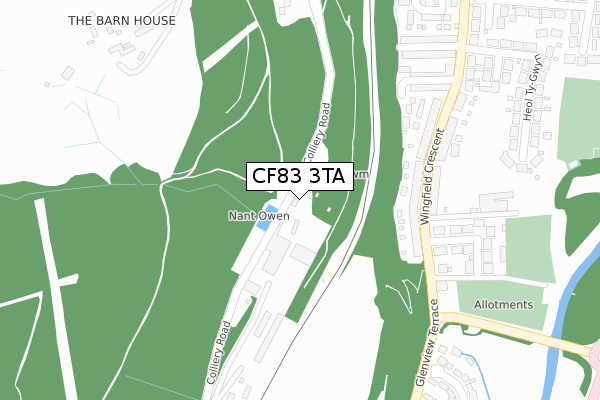
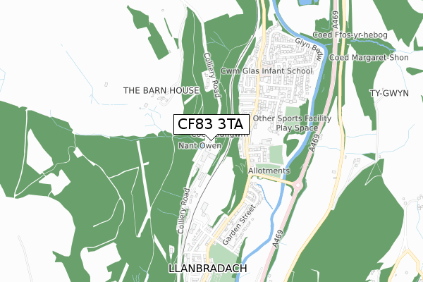
CF83 3TA is located in the Llanbradach electoral ward, within the unitary authority of Caerphilly and the Welsh Parliamentary constituency of Caerphilly. The Local Health Board is Aneurin Bevan University and the police force is Gwent. This postcode has been in use since September 2018.


GetTheData
Source: OS Open Zoomstack (Ordnance Survey)
Licence: Open Government Licence (requires attribution)
Attribution: Contains OS data © Crown copyright and database right 2025
Source: Open Postcode Geo
Licence: Open Government Licence (requires attribution)
Attribution: Contains OS data © Crown copyright and database right 2025; Contains Royal Mail data © Royal Mail copyright and database right 2025; Source: Office for National Statistics licensed under the Open Government Licence v.3.0
| Easting | 314891 |
| Northing | 191063 |
| Latitude | 51.611942 |
| Longitude | -3.230534 |
GetTheData
Source: Open Postcode Geo
Licence: Open Government Licence
| Country | Wales |
| Postcode District | CF83 |
➜ See where CF83 is on a map ➜ Where is Llanbradach? | |
GetTheData
Source: Land Registry Price Paid Data
Licence: Open Government Licence
| Ward | Llanbradach |
| Constituency | Caerphilly |
GetTheData
Source: ONS Postcode Database
Licence: Open Government Licence
| Wingfield Hotel (Wingfield Crescent) | Llanbradach | 217m |
| Wingfield Hotel (Wingfield Crescent) | Llanbradach | 233m |
| Heol Ty Gwyn (Caerphilly Road) | Llanbradach | 345m |
| Victoria Street (Caerphilly Road) | Llanbradach | 360m |
| Ffrwd Terrace (Glenview Terrace) | Llanbradach | 495m |
| Llanbradach Station | 1km |
| Energlyn & Churchill Park Station | 3.2km |
| Ystrad Mynach Station | 3.3km |
GetTheData
Source: NaPTAN
Licence: Open Government Licence
| Percentage of properties with Next Generation Access | 100.0% |
| Percentage of properties with Superfast Broadband | 100.0% |
| Percentage of properties with Ultrafast Broadband | 0.0% |
| Percentage of properties with Full Fibre Broadband | 0.0% |
Superfast Broadband is between 30Mbps and 300Mbps
Ultrafast Broadband is > 300Mbps
| Percentage of properties unable to receive 2Mbps | 0.0% |
| Percentage of properties unable to receive 5Mbps | 0.0% |
| Percentage of properties unable to receive 10Mbps | 0.0% |
| Percentage of properties unable to receive 30Mbps | 0.0% |
GetTheData
Source: Ofcom
Licence: Ofcom Terms of Use (requires attribution)
GetTheData
Source: ONS Postcode Database
Licence: Open Government Licence


➜ Get more ratings from the Food Standards Agency
GetTheData
Source: Food Standards Agency
Licence: FSA terms & conditions
| Last Collection | |||
|---|---|---|---|
| Location | Mon-Fri | Sat | Distance |
| Bedwas Road | 17:00 | 12:00 | 3,510m |
| Mill Road | 16:30 | 12:00 | 3,600m |
| Maesycymmer Post Office | 17:00 | 11:15 | 3,669m |
GetTheData
Source: Dracos
Licence: Creative Commons Attribution-ShareAlike
The below table lists the International Territorial Level (ITL) codes (formerly Nomenclature of Territorial Units for Statistics (NUTS) codes) and Local Administrative Units (LAU) codes for CF83 3TA:
| ITL 1 Code | Name |
|---|---|
| TLL | Wales |
| ITL 2 Code | Name |
| TLL1 | West Wales and The Valleys |
| ITL 3 Code | Name |
| TLL16 | Gwent Valleys |
| LAU 1 Code | Name |
| W06000018 | Caerphilly |
GetTheData
Source: ONS Postcode Directory
Licence: Open Government Licence
The below table lists the Census Output Area (OA), Lower Layer Super Output Area (LSOA), and Middle Layer Super Output Area (MSOA) for CF83 3TA:
| Code | Name | |
|---|---|---|
| OA | W00007164 | |
| LSOA | W01001367 | Caerphilly 019B |
| MSOA | W02000308 | Caerphilly 019 |
GetTheData
Source: ONS Postcode Directory
Licence: Open Government Licence
| CF83 3NU | Wingfield Crescent | 201m |
| CF83 3NW | Plasturtwyn Terrace | 246m |
| CF83 3NX | Oakfield Street | 283m |
| CF83 3NZ | Lon Yr Afon | 298m |
| CF83 3NY | Victoria Street | 326m |
| CF83 3RW | 336m | |
| CF83 3PB | Heol Ty Gwyn | 382m |
| CF83 3NA | Garden Close | 416m |
| CF83 3QR | Graddfa Villas | 420m |
| CF83 3NS | Glen View Terrace | 448m |
GetTheData
Source: Open Postcode Geo; Land Registry Price Paid Data
Licence: Open Government Licence