Property/Postcode Data Search:
CF62 4QR maps, stats, and open data
CF62 4QR is located in the Llantwit Major electoral ward, within the unitary authority of Vale of Glamorgan and the Welsh Parliamentary constituency of Vale of Glamorgan. The Local Health Board is Cardiff and Vale University and the police force is South Wales. This postcode has been in use since December 2017.
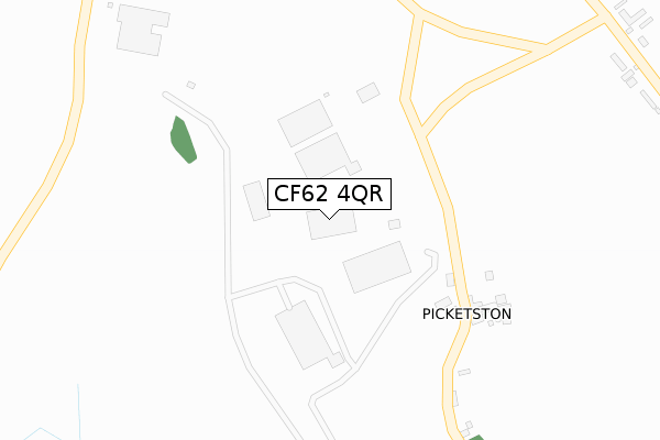
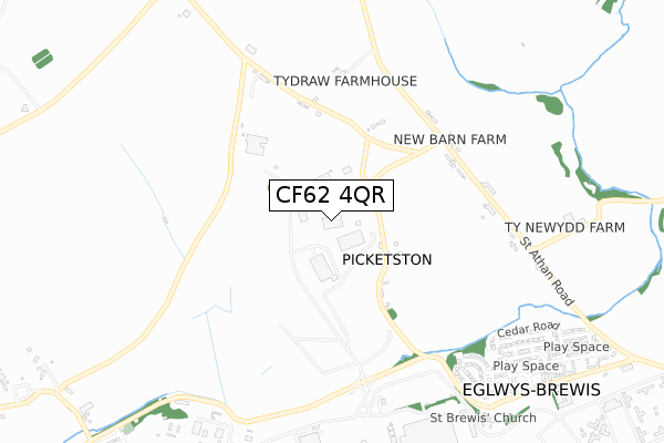
CF62 4QR maps


Source: OS Open Zoomstack (Ordnance Survey)
Licence: Open Government Licence (requires attribution)
Attribution: Contains OS data © Crown copyright and database right 2025
Source: Open Postcode Geo
Licence: Open Government Licence (requires attribution)
Attribution: Contains OS data © Crown copyright and database right 2025; Contains Royal Mail data © Royal Mail copyright and database right 2025; Source: Office for National Statistics licensed under the Open Government Licence v.3.0
Licence: Open Government Licence (requires attribution)
Attribution: Contains OS data © Crown copyright and database right 2025
Source: Open Postcode Geo
Licence: Open Government Licence (requires attribution)
Attribution: Contains OS data © Crown copyright and database right 2025; Contains Royal Mail data © Royal Mail copyright and database right 2025; Source: Office for National Statistics licensed under the Open Government Licence v.3.0
CF62 4QR geodata
| Easting | 299975 |
| Northing | 169963 |
| Latitude | 51.419825 |
| Longitude | -3.439888 |
Where is CF62 4QR?
| Country | Wales |
| Postcode District | CF62 |
Politics
| Ward | Llantwit Major |
|---|---|
| Constituency | Vale Of Glamorgan |
Transport
Nearest bus stops to CF62 4QR
| New Barn Farm (St Mary Church Road) | Eglwys-brewis | 472m |
| New Barn Farm (St Mary Church Road) | Eglwys-brewis | 486m |
| Picketstone Close (Eglwys Brewis Road) | Eglwys-brewis | 855m |
| Picketstone Close (Eglwys Brewis Road) | Eglwys-brewis | 861m |
| Pinewood Square (Main Road) | Eglwys-brewis | 1,074m |
Nearest railway stations to CF62 4QR
| Llantwit Major Station | 3.1km |
Deprivation
22% of Welsh postcodes are less deprived than CF62 4QR:Food Standards Agency
Three nearest food hygiene ratings to CF62 4QR (metres)
South Wales Air Museum SWAM Cafe (Hangar 872)

South Wales Aviation Museum Picketston Site Bro Tathan North
186m
Picketston Meats

Forge Cottage
323m
Rachael's Rainbows
16 Chestnut Avenue
789m
➜ Get more ratings from the Food Standards Agency
Nearest post box to CF62 4QR
| Last Collection | |||
|---|---|---|---|
| Location | Mon-Fri | Sat | Distance |
| Boverton Post Office | 16:45 | 11:45 | 2,300m |
| Llanblethain Hill | 16:15 | 11:15 | 2,638m |
| Caer Worgan | 16:15 | 11:15 | 3,098m |
CF62 4QR ITL and CF62 4QR LAU
The below table lists the International Territorial Level (ITL) codes (formerly Nomenclature of Territorial Units for Statistics (NUTS) codes) and Local Administrative Units (LAU) codes for CF62 4QR:
| ITL 1 Code | Name |
|---|---|
| TLL | Wales |
| ITL 2 Code | Name |
| TLL2 | East Wales |
| ITL 3 Code | Name |
| TLL22 | Cardiff and Vale of Glamorgan |
| LAU 1 Code | Name |
| W06000014 | Vale of Glamorgan |
CF62 4QR census areas
The below table lists the Census Output Area (OA), Lower Layer Super Output Area (LSOA), and Middle Layer Super Output Area (MSOA) for CF62 4QR:
| Code | Name | |
|---|---|---|
| OA | W00005843 | |
| LSOA | W01001108 | The Vale of Glamorgan 014A |
| MSOA | W02000250 | The Vale of Glamorgan 014 |
Nearest postcodes to CF62 4QR
| CF62 4QP | 321m | |
| CF62 4QL | Newbarn Holdings | 477m |
| CF62 4DN | Picketston Close | 857m |
| CF62 4JP | Chestnut Avenue | 876m |
| CF62 4JS | Elm Grove | 908m |
| CF62 4JT | Cedar Road | 920m |
| CF62 4JQ | Lime Grove | 938m |
| CF62 4JR | Pinewood Square | 965m |
| CF62 4JN | Oak Grove | 983m |
| CF62 4JZ | Walnut Grove | 1077m |