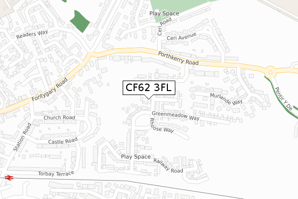
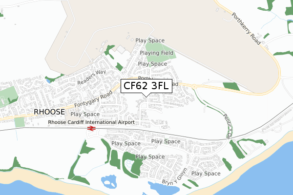
CF62 3FL maps, stats, and open data
CF62 3FL is located in the Rhoose electoral ward, within the unitary authority of Vale of Glamorgan and the Welsh Parliamentary constituency of Vale of Glamorgan. The Local Health Board is Cardiff and Vale University and the police force is South Wales. This postcode has been in use since January 2018.
CF62 3FL maps


Licence: Open Government Licence (requires attribution)
Attribution: Contains OS data © Crown copyright and database right 2025
Source: Open Postcode Geo
Licence: Open Government Licence (requires attribution)
Attribution: Contains OS data © Crown copyright and database right 2025; Contains Royal Mail data © Royal Mail copyright and database right 2025; Source: Office for National Statistics licensed under the Open Government Licence v.3.0
CF62 3FL geodata
| Easting | 306641 |
| Northing | 166470 |
| Latitude | 51.389564 |
| Longitude | -3.343130 |
Where is CF62 3FL?
| Country | Wales |
| Postcode District | CF62 |
Politics
| Ward | Rhoose |
|---|---|
| Constituency | Vale Of Glamorgan |
House Prices
Sales of detached houses in CF62 3FL
4, ST PETERS CRESCENT, RHOOSE, BARRY, CF62 3FL 2021 29 OCT £283,000 |
3, ST PETERS CRESCENT, RHOOSE, BARRY, CF62 3FL 2021 29 OCT £369,995 |
16, ST PETERS CRESCENT, RHOOSE, BARRY, CF62 3FL 2021 1 OCT £307,000 |
14, ST PETERS CRESCENT, RHOOSE, BARRY, CF62 3FL 2021 1 OCT £299,245 |
15, ST PETERS CRESCENT, RHOOSE, BARRY, CF62 3FL 2021 1 OCT £284,995 |
5, ST PETERS CRESCENT, RHOOSE, BARRY, CF62 3FL 2021 24 SEP £309,000 |
17, ST PETERS CRESCENT, RHOOSE, BARRY, CF62 3FL 2021 24 SEP £306,845 |
18, ST PETERS CRESCENT, RHOOSE, BARRY, CF62 3FL 2021 10 SEP £280,000 |
2, ST PETERS CRESCENT, RHOOSE, BARRY, CF62 3FL 2021 3 SEP £278,000 |
19, ST PETERS CRESCENT, RHOOSE, BARRY, CF62 3FL 2021 13 AUG £295,000 |
Licence: Contains HM Land Registry data © Crown copyright and database right 2025. This data is licensed under the Open Government Licence v3.0.
Transport
Nearest bus stops to CF62 3FL
| Ceri Avenue (Porthkerry Road) | Rhoose | 194m |
| Romilly Road (Fontygary Road) | Rhoose | 213m |
| Ceri Avenue (Porthkerry Road) | Rhoose | 251m |
| Station Road (Fontygary Road) | Rhoose | 334m |
| Shops (Fontygary Road) | Rhoose | 468m |
Nearest railway stations to CF62 3FL
| Rhoose Station | 0.5km |
| Barry Station | 4.1km |
| Barry Island Station | 4.9km |
Broadband
Broadband access in CF62 3FL (2020 data)
| Percentage of properties with Next Generation Access | 100.0% |
| Percentage of properties with Superfast Broadband | 100.0% |
| Percentage of properties with Ultrafast Broadband | 50.0% |
| Percentage of properties with Full Fibre Broadband | 50.0% |
Superfast Broadband is between 30Mbps and 300Mbps
Ultrafast Broadband is > 300Mbps
Broadband limitations in CF62 3FL (2020 data)
| Percentage of properties unable to receive 2Mbps | 0.0% |
| Percentage of properties unable to receive 5Mbps | 0.0% |
| Percentage of properties unable to receive 10Mbps | 0.0% |
| Percentage of properties unable to receive 30Mbps | 0.0% |
Deprivation
18.6% of Welsh postcodes are less deprived than CF62 3FL:Food Standards Agency
Three nearest food hygiene ratings to CF62 3FL (metres)


➜ Get more ratings from the Food Standards Agency
Nearest post box to CF62 3FL
| Last Collection | |||
|---|---|---|---|
| Location | Mon-Fri | Sat | Distance |
| Torbay Terrace | 17:00 | 07:15 | 274m |
| Fontygary Cross | 16:00 | 09:00 | 401m |
| Bulwarks | 16:00 | 08:00 | 1,558m |
CF62 3FL ITL and CF62 3FL LAU
The below table lists the International Territorial Level (ITL) codes (formerly Nomenclature of Territorial Units for Statistics (NUTS) codes) and Local Administrative Units (LAU) codes for CF62 3FL:
| ITL 1 Code | Name |
|---|---|
| TLL | Wales |
| ITL 2 Code | Name |
| TLL2 | East Wales |
| ITL 3 Code | Name |
| TLL22 | Cardiff and Vale of Glamorgan |
| LAU 1 Code | Name |
| W06000014 | Vale of Glamorgan |
CF62 3FL census areas
The below table lists the Census Output Area (OA), Lower Layer Super Output Area (LSOA), and Middle Layer Super Output Area (MSOA) for CF62 3FL:
| Code | Name | |
|---|---|---|
| OA | W00009834 | |
| LSOA | W01001118 | The Vale of Glamorgan 014C |
| MSOA | W02000250 | The Vale of Glamorgan 014 |
Nearest postcodes to CF62 3FL
| CF62 3HD | Porthkerry Road | 155m |
| CF62 3EW | Castle Road | 186m |
| CF62 3AU | Romilly Road | 190m |
| CF62 3EP | Rhoose Road | 212m |
| CF62 3ES | Romilly Road | 214m |
| CF62 3FQ | Meadowcroft | 247m |
| CF62 3HA | Torbay Terrace | 254m |
| CF62 3EX | Church Road | 264m |
| CF62 3DQ | Jackson Close | 265m |
| CF62 3HE | Porthkerry Road | 266m |