Property/Postcode Data Search:
CF44 9AZ maps, stats, and open data
CF44 9AZ is located in the Hirwaun, Penderyn and Rhigos electoral ward, within the unitary authority of Rhondda Cynon Taf and the Welsh Parliamentary constituency of Cynon Valley. The Local Health Board is Cwm Taf Morgannwg University and the police force is South Wales. This postcode has been in use since November 2019.
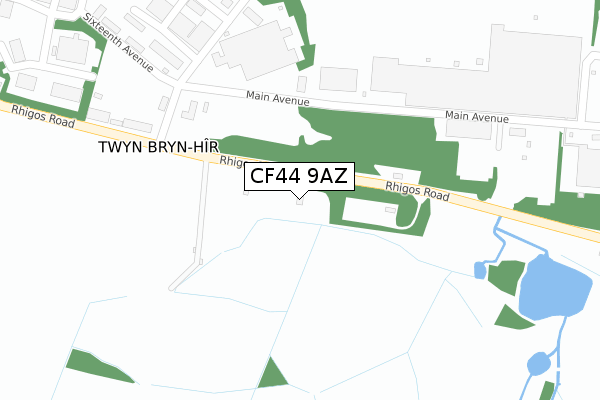
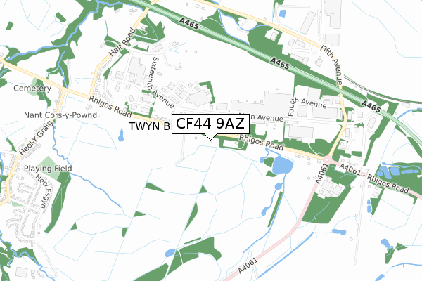
CF44 9AZ maps


Source: OS Open Zoomstack (Ordnance Survey)
Licence: Open Government Licence (requires attribution)
Attribution: Contains OS data © Crown copyright and database right 2025
Source: Open Postcode Geo
Licence: Open Government Licence (requires attribution)
Attribution: Contains OS data © Crown copyright and database right 2025; Contains Royal Mail data © Royal Mail copyright and database right 2025; Source: Office for National Statistics licensed under the Open Government Licence v.3.0
Licence: Open Government Licence (requires attribution)
Attribution: Contains OS data © Crown copyright and database right 2025
Source: Open Postcode Geo
Licence: Open Government Licence (requires attribution)
Attribution: Contains OS data © Crown copyright and database right 2025; Contains Royal Mail data © Royal Mail copyright and database right 2025; Source: Office for National Statistics licensed under the Open Government Licence v.3.0
CF44 9AZ geodata
| Easting | 293302 |
| Northing | 206044 |
| Latitude | 51.742910 |
| Longitude | -3.546793 |
Where is CF44 9AZ?
| Country | Wales |
| Postcode District | CF44 |
Politics
| Ward | Hirwaun, Penderyn And Rhigos |
|---|---|
| Constituency | Cynon Valley |
Transport
Nearest bus stops to CF44 9AZ
| Hughes` Patch (Rhigos Road) | Rhigos | 235m |
| Hughes` Patch (Rhigos Road) | Rhigos | 256m |
| Pont Yr Ochain (Rhigos Road) | Rhigos | 330m |
| Pont Yr Ochain (Rhigos Road) | Rhigos | 332m |
| Halt Close (Rhigos Road) | Rhigos | 504m |
Deprivation
64.2% of Welsh postcodes are less deprived than CF44 9AZ:Food Standards Agency
Three nearest food hygiene ratings to CF44 9AZ (metres)
Route A465 Diner

Unit D
236m
Authentic Curries & World Foods

Unit 46-47
236m
The Welsh Whisky Company - Storage Unit

Unit J
236m
➜ Get more ratings from the Food Standards Agency
Nearest post box to CF44 9AZ
| Last Collection | |||
|---|---|---|---|
| Location | Mon-Fri | Sat | Distance |
| Lamb Inn Pendery | 16:00 | 09:45 | 3,216m |
| Pencomen | 16:30 | 11:00 | 3,572m |
CF44 9AZ ITL and CF44 9AZ LAU
The below table lists the International Territorial Level (ITL) codes (formerly Nomenclature of Territorial Units for Statistics (NUTS) codes) and Local Administrative Units (LAU) codes for CF44 9AZ:
| ITL 1 Code | Name |
|---|---|
| TLL | Wales |
| ITL 2 Code | Name |
| TLL1 | West Wales and The Valleys |
| ITL 3 Code | Name |
| TLL15 | Central Valleys |
| LAU 1 Code | Name |
| W06000016 | Rhondda Cynon Taf |
CF44 9AZ census areas
The below table lists the Census Output Area (OA), Lower Layer Super Output Area (LSOA), and Middle Layer Super Output Area (MSOA) for CF44 9AZ:
| Code | Name | |
|---|---|---|
| OA | W00006480 | |
| LSOA | W01001233 | Rhondda Cynon Taf 001F |
| MSOA | W02000252 | Rhondda Cynon Taf 001 |
Nearest postcodes to CF44 9AZ
| CF44 9UP | Hirwaun Industrial Estate | 241m |
| CF44 9UG | Rhigos Road | 495m |
| CF44 9UN | Halt Road | 728m |
| CF44 9UD | Rhigos Road | 844m |
| CF44 9AJ | Tram Road | 895m |
| CF44 9YY | Heol Y Graig | 994m |
| CF44 9BX | Heol Esgyn | 996m |
| CF44 9BJ | Heol Esgyn | 1017m |
| CF44 9LJ | Heol Y De | 1040m |
| CF44 9NX | Longmead Park | 1068m |