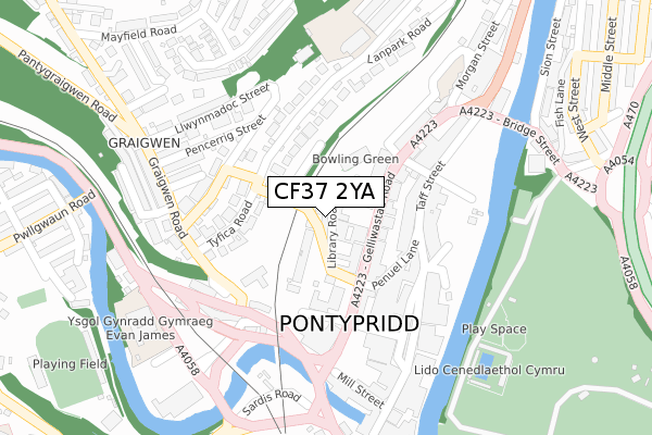
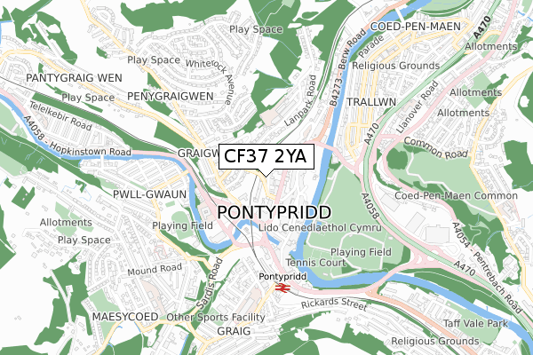
CF37 2YA lies on Library Road in Pontypridd. CF37 2YA is located in the Pontypridd Town electoral ward, within the unitary authority of Rhondda Cynon Taf and the Welsh Parliamentary constituency of Pontypridd. The Local Health Board is Cwm Taf Morgannwg University and the police force is South Wales. This postcode has been in use since August 2017.


GetTheData
Source: OS Open Zoomstack (Ordnance Survey)
Licence: Open Government Licence (requires attribution)
Attribution: Contains OS data © Crown copyright and database right 2025
Source: Open Postcode Geo
Licence: Open Government Licence (requires attribution)
Attribution: Contains OS data © Crown copyright and database right 2025; Contains Royal Mail data © Royal Mail copyright and database right 2025; Source: Office for National Statistics licensed under the Open Government Licence v.3.0
| Easting | 307124 |
| Northing | 190274 |
| Latitude | 51.603620 |
| Longitude | -3.342464 |
GetTheData
Source: Open Postcode Geo
Licence: Open Government Licence
| Street | Library Road |
| Town/City | Pontypridd |
| Country | Wales |
| Postcode District | CF37 |
➜ See where CF37 is on a map ➜ Where is Pontypridd? | |
GetTheData
Source: Land Registry Price Paid Data
Licence: Open Government Licence
| Ward | Pontypridd Town |
| Constituency | Pontypridd |
GetTheData
Source: ONS Postcode Database
Licence: Open Government Licence
| St Catherine's Church (Gelliwastad Grove) | Pontypridd | 98m |
| Iceland (Taff Street) | Pontypridd | 156m |
| Graigwen Place | Graigwen | 174m |
| Caddy`s (Rhondda Road) | Pontypridd | 180m |
| Catherine Street | Pontypridd | 189m |
| Pontypridd Station | 0.5km |
| Trefforest Station | 1.8km |
| Trehafod Station | 2.8km |
GetTheData
Source: NaPTAN
Licence: Open Government Licence
| Percentage of properties with Next Generation Access | 100.0% |
| Percentage of properties with Superfast Broadband | 100.0% |
| Percentage of properties with Ultrafast Broadband | 0.0% |
| Percentage of properties with Full Fibre Broadband | 0.0% |
Superfast Broadband is between 30Mbps and 300Mbps
Ultrafast Broadband is > 300Mbps
| Percentage of properties unable to receive 2Mbps | 0.0% |
| Percentage of properties unable to receive 5Mbps | 0.0% |
| Percentage of properties unable to receive 10Mbps | 0.0% |
| Percentage of properties unable to receive 30Mbps | 0.0% |
GetTheData
Source: Ofcom
Licence: Ofcom Terms of Use (requires attribution)
GetTheData
Source: ONS Postcode Database
Licence: Open Government Licence


➜ Get more ratings from the Food Standards Agency
GetTheData
Source: Food Standards Agency
Licence: FSA terms & conditions
| Last Collection | |||
|---|---|---|---|
| Location | Mon-Fri | Sat | Distance |
| Gelliwstad Road | 17:30 | 11:15 | 95m |
| High Street | 17:45 | 12:00 | 574m |
| Merthyr Road | 17:45 | 11:45 | 667m |
GetTheData
Source: Dracos
Licence: Creative Commons Attribution-ShareAlike
The below table lists the International Territorial Level (ITL) codes (formerly Nomenclature of Territorial Units for Statistics (NUTS) codes) and Local Administrative Units (LAU) codes for CF37 2YA:
| ITL 1 Code | Name |
|---|---|
| TLL | Wales |
| ITL 2 Code | Name |
| TLL1 | West Wales and The Valleys |
| ITL 3 Code | Name |
| TLL15 | Central Valleys |
| LAU 1 Code | Name |
| W06000016 | Rhondda Cynon Taf |
GetTheData
Source: ONS Postcode Directory
Licence: Open Government Licence
The below table lists the Census Output Area (OA), Lower Layer Super Output Area (LSOA), and Middle Layer Super Output Area (MSOA) for CF37 2YA:
| Code | Name | |
|---|---|---|
| OA | W00006448 | |
| LSOA | W01001228 | Rhondda Cynon Taf 021D |
| MSOA | W02000272 | Rhondda Cynon Taf 021 |
GetTheData
Source: ONS Postcode Directory
Licence: Open Government Licence
| CF37 2BT | Library Road | 39m |
| CF37 2BS | Gelliwastad Grove | 53m |
| CF37 2BP | Gelliwastad Road | 67m |
| CF37 2BL | Gelliwastad Road | 90m |
| CF37 2BU | Tyfica Crescent | 117m |
| CF37 2UF | Upper Church Street | 135m |
| CF37 4UA | Taff Street | 137m |
| CF37 4UF | Penuel Lane | 138m |
| CF37 2TW | Graigwen Road | 144m |
| CF37 2BW | Gelliwastad Road | 146m |
GetTheData
Source: Open Postcode Geo; Land Registry Price Paid Data
Licence: Open Government Licence