CF3 6AL maps, stats, and open data
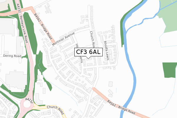
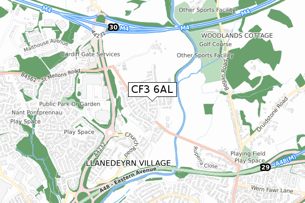
CF3 6AL is located in the Pontprennau and Old St Mellons electoral ward, within the unitary authority of Cardiff and the Welsh Parliamentary constituency of Cardiff North. The Local Health Board is Cardiff and Vale University and the police force is South Wales. This postcode has been in use since January 2019.
CF3 6AL maps


Licence: Open Government Licence (requires attribution)
Attribution: Contains OS data © Crown copyright and database right 2025
Source: Open Postcode Geo
Licence: Open Government Licence (requires attribution)
Attribution: Contains OS data © Crown copyright and database right 2025; Contains Royal Mail data © Royal Mail copyright and database right 2025; Source: Office for National Statistics licensed under the Open Government Licence v.3.0
CF3 6AL geodata
| Easting | 322259 |
| Northing | 182494 |
| Latitude | 51.535976 |
| Longitude | -3.122250 |
Where is CF3 6AL?
| Country | Wales |
| Postcode District | CF3 |
Politics
| Ward | Pontprennau And Old St Mellons |
|---|---|
| Constituency | Cardiff North |
House Prices
Sales of detached houses in CF3 6AL
1, ROGERS AVENUE, OLD ST MELLONS, CARDIFF, CF3 6AL 2025 30 APR £331,000 |
9, ROGERS AVENUE, OLD ST MELLONS, CARDIFF, CF3 6AL 2024 26 APR £335,000 |
6, ROGERS AVENUE, OLD ST MELLONS, CARDIFF, CF3 6AL 2019 7 JUN £295,000 |
2, ROGERS AVENUE, OLD ST MELLONS, CARDIFF, CF3 6AL 2019 31 MAY £299,995 |
4, ROGERS AVENUE, OLD ST MELLONS, CARDIFF, CF3 6AL 2018 21 DEC £299,995 |
1, ROGERS AVENUE, OLD ST MELLONS, CARDIFF, CF3 6AL 2018 14 DEC £264,995 |
9, ROGERS AVENUE, OLD ST MELLONS, CARDIFF, CF3 6AL 2018 14 DEC £264,995 |
Licence: Contains HM Land Registry data © Crown copyright and database right 2025. This data is licensed under the Open Government Licence v3.0.
Transport
Nearest bus stops to CF3 6AL
| Asda (Heol Pontprennau) | Pontprennau | 502m |
| Asda (Heol Pontprennau) | Pontprennau | 549m |
| Heol Pontprennau | Pontprennau | 657m |
| Heol Pontprennau | Pontprennau | 724m |
| Arnold Ave (Burnham Avenue) | Llanrumney | 772m |
Nearest railway stations to CF3 6AL
| Llanishen Station | 4.2km |
| Lisvane & Thornhill Station | 4.5km |
| Heath High Level Station | 4.7km |
Broadband
Broadband access in CF3 6AL (2020 data)
| Percentage of properties with Next Generation Access | 100.0% |
| Percentage of properties with Superfast Broadband | 0.0% |
| Percentage of properties with Ultrafast Broadband | 0.0% |
| Percentage of properties with Full Fibre Broadband | 0.0% |
Superfast Broadband is between 30Mbps and 300Mbps
Ultrafast Broadband is > 300Mbps
Broadband limitations in CF3 6AL (2020 data)
| Percentage of properties unable to receive 2Mbps | 0.0% |
| Percentage of properties unable to receive 5Mbps | 0.0% |
| Percentage of properties unable to receive 10Mbps | 0.0% |
| Percentage of properties unable to receive 30Mbps | 100.0% |
Deprivation
8.8% of Welsh postcodes are less deprived than CF3 6AL:Food Standards Agency
Three nearest food hygiene ratings to CF3 6AL (metres)


➜ Get more ratings from the Food Standards Agency
Nearest post box to CF3 6AL
| Last Collection | |||
|---|---|---|---|
| Location | Mon-Fri | Sat | Distance |
| Ball Road | 17:15 | 11:00 | 1,503m |
| Coed Y Gores | 17:30 | 11:45 | 1,981m |
| Willowbrook Drive | 17:00 | 11:15 | 2,205m |
CF3 6AL ITL and CF3 6AL LAU
The below table lists the International Territorial Level (ITL) codes (formerly Nomenclature of Territorial Units for Statistics (NUTS) codes) and Local Administrative Units (LAU) codes for CF3 6AL:
| ITL 1 Code | Name |
|---|---|
| TLL | Wales |
| ITL 2 Code | Name |
| TLL2 | East Wales |
| ITL 3 Code | Name |
| TLL22 | Cardiff and Vale of Glamorgan |
| LAU 1 Code | Name |
| W06000015 | Cardiff |
CF3 6AL census areas
The below table lists the Census Output Area (OA), Lower Layer Super Output Area (LSOA), and Middle Layer Super Output Area (MSOA) for CF3 6AL:
| Code | Name | |
|---|---|---|
| OA | W00009478 | |
| LSOA | W01001843 | Cardiff 003C |
| MSOA | W02000369 | Cardiff 003 |
Nearest postcodes to CF3 6AL
| CF3 6YA | Church Road | 363m |
| CF3 6YJ | 384m | |
| CF23 8NZ | Lascelles Drive | 536m |
| CF3 6UY | Bridge Road | 588m |
| CF23 8NU | Lascelles Drive | 617m |
| CF23 8PF | Liddell Close | 621m |
| CF23 8PE | Shields Close | 643m |
| CF23 8NS | Burwell Close | 666m |
| CF23 8PN | Highbank | 683m |
| CF3 6HX | Ruperra Close | 691m |