CF10 4ER maps, stats, and open data
- Home
- Postcode
- CF
- CF10
- CF10 4
CF10 4ER is located in the Butetown electoral ward, within the unitary authority of Cardiff and the Welsh Parliamentary constituency of Cardiff South and Penarth. The Local Health Board is Cardiff and Vale University and the police force is South Wales. This postcode has been in use since March 2018.
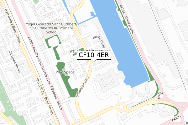
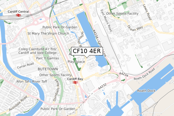
CF10 4ER maps


Source: OS Open Zoomstack (Ordnance Survey)
Licence: Open Government Licence (requires attribution)
Attribution: Contains OS data © Crown copyright and database right 2025
Source: Open Postcode GeoLicence: Open Government Licence (requires attribution)
Attribution: Contains OS data © Crown copyright and database right 2025; Contains Royal Mail data © Royal Mail copyright and database right 2025; Source: Office for National Statistics licensed under the Open Government Licence v.3.0
CF10 4ER geodata
| Easting | 319227 |
| Northing | 175260 |
| Latitude | 51.470518 |
| Longitude | -3.164296 |
Where is CF10 4ER?
| Country | Wales |
| Postcode District | CF10 |
Politics
| Ward | Butetown |
|---|
| Constituency | Cardiff South And Penarth |
|---|
Transport
Nearest bus stops to CF10 4ER
| Schooner Way | Atlantic Wharf | 83m |
| Barquentine Place (Schooner Way) | Atlantic Wharf | 97m |
| Barquentine Place (Schooner Way) | Atlantic Wharf | 110m |
| Schooner Way | Atlantic Wharf | 123m |
| County Hall (Hemmingway Road) | Atlantic Wharf | 254m |
Nearest railway stations to CF10 4ER
| Cardiff Bay Station | 0.4km |
| Cardiff Central Station | 1.2km |
| Cardiff Queen Street Station | 1.3km |
Broadband
Broadband access in CF10 4ER (2020 data)
| Percentage of properties with Next Generation Access | 100.0% |
| Percentage of properties with Superfast Broadband | 100.0% |
| Percentage of properties with Ultrafast Broadband | 100.0% |
| Percentage of properties with Full Fibre Broadband | 100.0% |
Superfast Broadband is between 30Mbps and 300Mbps
Ultrafast Broadband is > 300Mbps
Broadband limitations in CF10 4ER (2020 data)
| Percentage of properties unable to receive 2Mbps | 0.0% |
| Percentage of properties unable to receive 5Mbps | 0.0% |
| Percentage of properties unable to receive 10Mbps | 0.0% |
| Percentage of properties unable to receive 30Mbps | 0.0% |
Deprivation
33.8% of Welsh postcodes are less deprived than
CF10 4ER:
Food Standards Agency
Three nearest food hygiene ratings to CF10 4ER (metres)
Cardiff Catering
County Hall Atlantic Wharf
124m
Morrisons Daily
Good Food
25 Forio House Ffordd Garthorne
320m
➜ Get more ratings from the Food Standards Agency
Nearest post box to CF10 4ER
| | Last Collection | |
|---|
| Location | Mon-Fri | Sat | Distance |
|---|
| Bute Street South | 18:30 | 12:00 | 340m |
| Schooner Way | 17:30 | 12:45 | 382m |
| West Bute Street | 18:30 | 11:30 | 496m |
CF10 4ER ITL and CF10 4ER LAU
The below table lists the International Territorial Level (ITL) codes (formerly Nomenclature of Territorial Units for Statistics (NUTS) codes) and Local Administrative Units (LAU) codes for CF10 4ER:
| ITL 1 Code | Name |
|---|
| TLL | Wales |
| ITL 2 Code | Name |
|---|
| TLL2 | East Wales |
| ITL 3 Code | Name |
|---|
| TLL22 | Cardiff and Vale of Glamorgan |
| LAU 1 Code | Name |
|---|
| W06000015 | Cardiff |
CF10 4ER census areas
The below table lists the Census Output Area (OA), Lower Layer Super Output Area (LSOA), and Middle Layer Super Output Area (MSOA) for CF10 4ER:
| Code | Name |
|---|
| OA | W00010171 | |
|---|
| LSOA | W01001943 | Cardiff 048B |
|---|
| MSOA | W02000422 | Cardiff 048 |
|---|
Nearest postcodes to CF10 4ER


