CB9 7JA maps, stats, and open data
CB9 7JA is located in the Haverhill North electoral ward, within the local authority district of West Suffolk and the English Parliamentary constituency of West Suffolk. The Sub Integrated Care Board (ICB) Location is NHS Suffolk and North East Essex ICB - 07K and the police force is Suffolk. This postcode has been in use since March 2019.
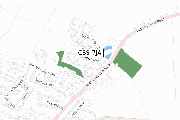
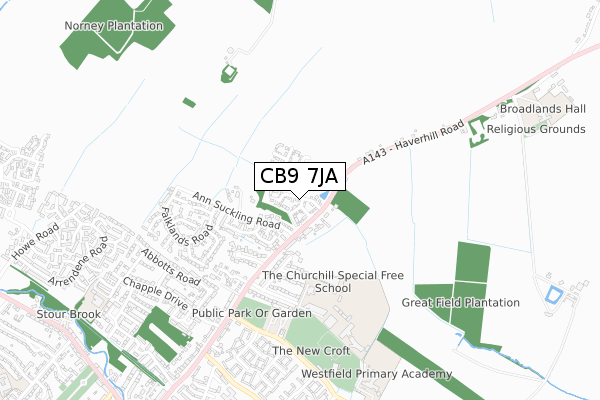
CB9 7JA maps


Licence: Open Government Licence (requires attribution)
Attribution: Contains OS data © Crown copyright and database right 2025
Source: Open Postcode Geo
Licence: Open Government Licence (requires attribution)
Attribution: Contains OS data © Crown copyright and database right 2025; Contains Royal Mail data © Royal Mail copyright and database right 2025; Source: Office for National Statistics licensed under the Open Government Licence v.3.0
CB9 7JA geodata
| Easting | 567667 |
| Northing | 246664 |
| Latitude | 52.092932 |
| Longitude | 0.446122 |
Where is CB9 7JA?
| Country | England |
| Postcode District | CB9 |
Politics
| Ward | Haverhill North |
|---|---|
| Constituency | West Suffolk |
House Prices
Sales of detached houses in CB9 7JA
2024 26 JAN £306,000 |
14, BEAVIS DRIVE, HAVERHILL, CB9 7JA 2020 25 SEP £295,000 |
27, BEAVIS DRIVE, HAVERHILL, CB9 7JA 2020 31 JUL £290,000 |
15, BEAVIS DRIVE, HAVERHILL, CB9 7JA 2020 27 MAR £285,000 |
37, BEAVIS DRIVE, HAVERHILL, CB9 7JA 2019 29 NOV £312,995 |
6, BEAVIS DRIVE, HAVERHILL, CB9 7JA 2019 22 NOV £295,995 |
31, BEAVIS DRIVE, HAVERHILL, CB9 7JA 2019 31 OCT £299,995 |
29, BEAVIS DRIVE, HAVERHILL, CB9 7JA 2019 31 OCT £294,995 |
2019 26 JUL £319,995 |
11, BEAVIS DRIVE, HAVERHILL, CB9 7JA 2019 7 JUN £310,995 |
Licence: Contains HM Land Registry data © Crown copyright and database right 2025. This data is licensed under the Open Government Licence v3.0.
Transport
Nearest bus stops to CB9 7JA
| Ann Suckling Road (Wratting Road) | Haverhill | 163m |
| Ann Suckling Road (Wratting Road) | Haverhill | 179m |
| The Fox (Haverhill Road) | Little Wratting | 251m |
| The Fox (Haverhill Road) | Little Wratting | 264m |
| Samuel Ward School (On Site) | Haverhill | 510m |
Broadband
Broadband access in CB9 7JA (2020 data)
| Percentage of properties with Next Generation Access | 100.0% |
| Percentage of properties with Superfast Broadband | 100.0% |
| Percentage of properties with Ultrafast Broadband | 0.0% |
| Percentage of properties with Full Fibre Broadband | 0.0% |
Superfast Broadband is between 30Mbps and 300Mbps
Ultrafast Broadband is > 300Mbps
Broadband limitations in CB9 7JA (2020 data)
| Percentage of properties unable to receive 2Mbps | 0.0% |
| Percentage of properties unable to receive 5Mbps | 0.0% |
| Percentage of properties unable to receive 10Mbps | 0.0% |
| Percentage of properties unable to receive 30Mbps | 0.0% |
Deprivation
47.6% of English postcodes are less deprived than CB9 7JA:Food Standards Agency
Three nearest food hygiene ratings to CB9 7JA (metres)


➜ Get more ratings from the Food Standards Agency
Nearest post box to CB9 7JA
| Last Collection | |||
|---|---|---|---|
| Location | Mon-Fri | Sat | Distance |
| Ann Suckling Lane | 17:45 | 11:45 | 154m |
| Wratting Road | 17:45 | 11:30 | 613m |
| Chaplains Close | 17:45 | 11:45 | 757m |
CB9 7JA ITL and CB9 7JA LAU
The below table lists the International Territorial Level (ITL) codes (formerly Nomenclature of Territorial Units for Statistics (NUTS) codes) and Local Administrative Units (LAU) codes for CB9 7JA:
| ITL 1 Code | Name |
|---|---|
| TLH | East |
| ITL 2 Code | Name |
| TLH1 | East Anglia |
| ITL 3 Code | Name |
| TLH14 | Suffolk CC |
| LAU 1 Code | Name |
| E07000245 | West Suffolk |
CB9 7JA census areas
The below table lists the Census Output Area (OA), Lower Layer Super Output Area (LSOA), and Middle Layer Super Output Area (MSOA) for CB9 7JA:
| Code | Name | |
|---|---|---|
| OA | E00153503 | |
| LSOA | E01030112 | St Edmundsbury 012D |
| MSOA | E02006284 | St Edmundsbury 012 |
Nearest postcodes to CB9 7JA
| CB9 7TA | Boyton Woods | 149m |
| CB9 0DZ | Boyton Close | 215m |
| CB9 0AB | Bladon Way | 283m |
| CB9 0DF | Hill Crescent | 285m |
| CB9 7UD | Haverhill Road | 329m |
| CB9 0AD | Blenheim Close | 339m |
| CB9 0EB | Cross Close | 382m |
| CB9 0EE | Rowell Close | 404m |
| CB9 0BD | Covert Close | 426m |
| CB9 0AA | Churchill Avenue | 428m |