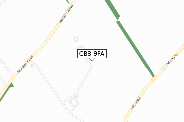
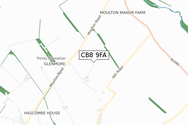
CB8 9FA is located in the Kentford & Moulton electoral ward, within the local authority district of West Suffolk and the English Parliamentary constituency of West Suffolk. The Sub Integrated Care Board (ICB) Location is NHS Suffolk and North East Essex ICB - 07K and the police force is Suffolk. This postcode has been in use since February 2020.


GetTheData
Source: OS Open Zoomstack (Ordnance Survey)
Licence: Open Government Licence (requires attribution)
Attribution: Contains OS data © Crown copyright and database right 2025
Source: Open Postcode Geo
Licence: Open Government Licence (requires attribution)
Attribution: Contains OS data © Crown copyright and database right 2025; Contains Royal Mail data © Royal Mail copyright and database right 2025; Source: Office for National Statistics licensed under the Open Government Licence v.3.0
| Easting | 569557 |
| Northing | 262865 |
| Latitude | 52.237877 |
| Longitude | 0.481768 |
GetTheData
Source: Open Postcode Geo
Licence: Open Government Licence
| Country | England |
| Postcode District | CB8 |
➜ See where CB8 is on a map | |
GetTheData
Source: Land Registry Price Paid Data
Licence: Open Government Licence
| Ward | Kentford & Moulton |
| Constituency | West Suffolk |
GetTheData
Source: ONS Postcode Database
Licence: Open Government Licence
| St Peters Avenue (Dalham Road) | Moulton | 1,132m |
| St Peters Avenue (Dalham Road) | Moulton | 1,144m |
| Chapel Row (Mill Road) | Ashley | 1,237m |
| Chapel Row (Mill Road) | Ashley | 1,265m |
| Lark Hill (Newmarket Road) | Moulton | 1,449m |
| Kennett Station | 4.4km |
GetTheData
Source: NaPTAN
Licence: Open Government Licence
GetTheData
Source: ONS Postcode Database
Licence: Open Government Licence


➜ Get more ratings from the Food Standards Agency
GetTheData
Source: Food Standards Agency
Licence: FSA terms & conditions
| Last Collection | |||
|---|---|---|---|
| Location | Mon-Fri | Sat | Distance |
| Ashley Post Office | 16:45 | 09:30 | 1,435m |
| Moulton Post Office | 16:45 | 09:00 | 1,522m |
| Broomstick Corner | 16:45 | 09:45 | 1,704m |
GetTheData
Source: Dracos
Licence: Creative Commons Attribution-ShareAlike
The below table lists the International Territorial Level (ITL) codes (formerly Nomenclature of Territorial Units for Statistics (NUTS) codes) and Local Administrative Units (LAU) codes for CB8 9FA:
| ITL 1 Code | Name |
|---|---|
| TLH | East |
| ITL 2 Code | Name |
| TLH1 | East Anglia |
| ITL 3 Code | Name |
| TLH14 | Suffolk CC |
| LAU 1 Code | Name |
| E07000245 | West Suffolk |
GetTheData
Source: ONS Postcode Directory
Licence: Open Government Licence
The below table lists the Census Output Area (OA), Lower Layer Super Output Area (LSOA), and Middle Layer Super Output Area (MSOA) for CB8 9FA:
| Code | Name | |
|---|---|---|
| OA | E00152681 | |
| LSOA | E01029957 | Forest Heath 005C |
| MSOA | E02006242 | Forest Heath 005 |
GetTheData
Source: ONS Postcode Directory
Licence: Open Government Licence
| CB8 9EE | Mill Road | 953m |
| CB8 9DW | Moulton Road | 996m |
| CB8 8WF | Cheveley Road | 1037m |
| CB8 8SB | Dalham Road | 1070m |
| CB8 8SE | St Peters Avenue | 1130m |
| CB8 8SD | St Peters Close | 1211m |
| CB8 9DS | The Millers | 1240m |
| CB8 8SF | Church Road | 1244m |
| CB8 9DU | Church Street | 1271m |
| CB8 9DR | Newmarket Road | 1277m |
GetTheData
Source: Open Postcode Geo; Land Registry Price Paid Data
Licence: Open Government Licence