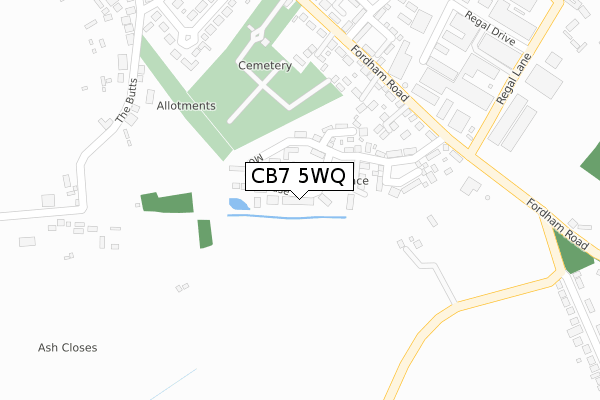
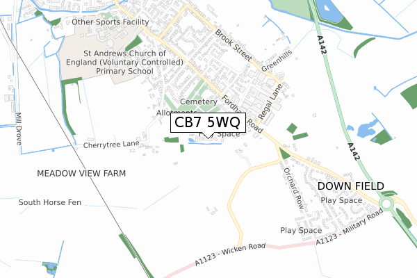
CB7 5WQ maps, stats, and open data
CB7 5WQ is located in the Soham South electoral ward, within the local authority district of East Cambridgeshire and the English Parliamentary constituency of South East Cambridgeshire. The Sub Integrated Care Board (ICB) Location is NHS Cambridgeshire and Peterborough ICB - 06H and the police force is Cambridgeshire. This postcode has been in use since March 2018.
CB7 5WQ maps


Licence: Open Government Licence (requires attribution)
Attribution: Contains OS data © Crown copyright and database right 2025
Source: Open Postcode Geo
Licence: Open Government Licence (requires attribution)
Attribution: Contains OS data © Crown copyright and database right 2025; Contains Royal Mail data © Royal Mail copyright and database right 2025; Source: Office for National Statistics licensed under the Open Government Licence v.3.0
CB7 5WQ geodata
| Easting | 560014 |
| Northing | 272089 |
| Latitude | 52.323588 |
| Longitude | 0.346512 |
Where is CB7 5WQ?
| Country | England |
| Postcode District | CB7 |
Politics
| Ward | Soham South |
|---|---|
| Constituency | South East Cambridgeshire |
House Prices
Sales of detached houses in CB7 5WQ
56, MORELLO CHASE, SOHAM, ELY, CB7 5WQ 2025 26 MAR £410,000 |
70, MORELLO CHASE, SOHAM, ELY, CB7 5WQ 2019 13 DEC £317,995 |
56, MORELLO CHASE, SOHAM, ELY, CB7 5WQ 2019 1 NOV £349,995 |
2019 24 OCT £317,995 |
68, MORELLO CHASE, SOHAM, ELY, CB7 5WQ 2019 18 OCT £317,995 |
72, MORELLO CHASE, SOHAM, ELY, CB7 5WQ 2019 13 SEP £349,995 |
86, MORELLO CHASE, SOHAM, ELY, CB7 5WQ 2019 26 APR £204,995 |
22, MORELLO CHASE, SOHAM, ELY, CB7 5WQ 2019 15 MAR £309,995 |
16, MORELLO CHASE, SOHAM, ELY, CB7 5WQ 2018 24 AUG £349,995 |
14, MORELLO CHASE, SOHAM, ELY, CB7 5WQ 2018 20 JUL £329,995 |
Licence: Contains HM Land Registry data © Crown copyright and database right 2025. This data is licensed under the Open Government Licence v3.0.
Transport
Nearest bus stops to CB7 5WQ
| Regal Lane (Fordham Road) | Down Field | 314m |
| Regal Lane (Fordham Road) | Down Field | 323m |
| Staples Lane (Fordham Road) | Soham | 438m |
| Staples Lane (Fordham Road) | Soham | 531m |
| Centre Road (Fordham Road) | Down Field | 585m |
Broadband
Broadband access in CB7 5WQ (2020 data)
| Percentage of properties with Next Generation Access | 100.0% |
| Percentage of properties with Superfast Broadband | 100.0% |
| Percentage of properties with Ultrafast Broadband | 87.0% |
| Percentage of properties with Full Fibre Broadband | 87.0% |
Superfast Broadband is between 30Mbps and 300Mbps
Ultrafast Broadband is > 300Mbps
Broadband limitations in CB7 5WQ (2020 data)
| Percentage of properties unable to receive 2Mbps | 0.0% |
| Percentage of properties unable to receive 5Mbps | 0.0% |
| Percentage of properties unable to receive 10Mbps | 0.0% |
| Percentage of properties unable to receive 30Mbps | 0.0% |
Deprivation
46.1% of English postcodes are less deprived than CB7 5WQ:Food Standards Agency
Three nearest food hygiene ratings to CB7 5WQ (metres)


➜ Get more ratings from the Food Standards Agency
Nearest post box to CB7 5WQ
| Last Collection | |||
|---|---|---|---|
| Location | Mon-Fri | Sat | Distance |
| Fordham Road | 16:45 | 10:00 | 535m |
| Fordham Road | 16:45 | 10:00 | 613m |
| Centre Road | 16:45 | 10:00 | 1,031m |
CB7 5WQ ITL and CB7 5WQ LAU
The below table lists the International Territorial Level (ITL) codes (formerly Nomenclature of Territorial Units for Statistics (NUTS) codes) and Local Administrative Units (LAU) codes for CB7 5WQ:
| ITL 1 Code | Name |
|---|---|
| TLH | East |
| ITL 2 Code | Name |
| TLH1 | East Anglia |
| ITL 3 Code | Name |
| TLH12 | Cambridgeshire CC |
| LAU 1 Code | Name |
| E07000009 | East Cambridgeshire |
CB7 5WQ census areas
The below table lists the Census Output Area (OA), Lower Layer Super Output Area (LSOA), and Middle Layer Super Output Area (MSOA) for CB7 5WQ:
| Code | Name | |
|---|---|---|
| OA | E00091049 | |
| LSOA | E01018051 | East Cambridgeshire 006E |
| MSOA | E02003737 | East Cambridgeshire 006 |
Nearest postcodes to CB7 5WQ
| CB7 5WX | Hardfields Court | 245m |
| CB7 5AH | Fordham Road | 267m |
| CB7 5FP | Fordham Road | 297m |
| CB7 5AR | Kings Parade | 320m |
| CB7 5AW | The Butts | 338m |
| CB7 5BE | Regal Drive | 377m |
| CB7 5DP | Celandine View | 381m |
| CB7 5AP | Millcroft | 434m |
| CB7 5BA | Regal Lane | 472m |
| CB7 5FB | Meadow Close | 474m |