CB6 3GW maps, stats, and open data
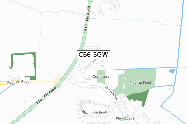
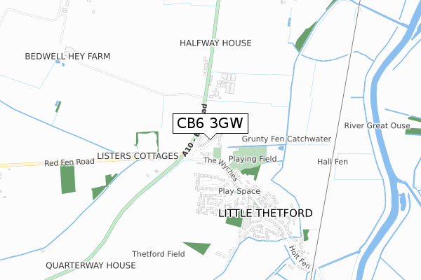
CB6 3GW is located in the Stretham electoral ward, within the local authority district of East Cambridgeshire and the English Parliamentary constituency of South East Cambridgeshire. The Sub Integrated Care Board (ICB) Location is NHS Cambridgeshire and Peterborough ICB - 06H and the police force is Cambridgeshire. This postcode has been in use since September 2019.
CB6 3GW maps


Licence: Open Government Licence (requires attribution)
Attribution: Contains OS data © Crown copyright and database right 2025
Source: Open Postcode Geo
Licence: Open Government Licence (requires attribution)
Attribution: Contains OS data © Crown copyright and database right 2025; Contains Royal Mail data © Royal Mail copyright and database right 2025; Source: Office for National Statistics licensed under the Open Government Licence v.3.0
CB6 3GW geodata
| Easting | 552884 |
| Northing | 276706 |
| Latitude | 52.367095 |
| Longitude | 0.244080 |
Where is CB6 3GW?
| Country | England |
| Postcode District | CB6 |
Politics
| Ward | Stretham |
|---|---|
| Constituency | South East Cambridgeshire |
House Prices
Sales of detached houses in CB6 3GW
8, DEWSBERRY GARDENS, LITTLE THETFORD, ELY, CB6 3GW 2020 18 DEC £509,995 |
3, DEWSBERRY GARDENS, LITTLE THETFORD, ELY, CB6 3GW 2020 15 OCT £492,500 |
7, DEWSBERRY GARDENS, LITTLE THETFORD, ELY, CB6 3GW 2020 6 OCT £575,000 |
10, DEWSBERRY GARDENS, LITTLE THETFORD, ELY, CB6 3GW 2020 28 AUG £579,995 |
4, DEWSBERRY GARDENS, LITTLE THETFORD, ELY, CB6 3GW 2020 30 JUL £499,995 |
9, DEWSBERRY GARDENS, LITTLE THETFORD, ELY, CB6 3GW 2020 31 MAR £514,995 |
1, DEWSBERRY GARDENS, LITTLE THETFORD, ELY, CB6 3GW 2020 27 MAR £558,995 |
6, DEWSBERRY GARDENS, LITTLE THETFORD, ELY, CB6 3GW 2020 3 FEB £459,995 |
2020 7 JAN £489,995 |
5, DEWSBERRY GARDENS, LITTLE THETFORD, ELY, CB6 3GW 2019 28 NOV £459,995 |
➜ Little Thetford house prices
Licence: Contains HM Land Registry data © Crown copyright and database right 2025. This data is licensed under the Open Government Licence v3.0.
Transport
Nearest bus stops to CB6 3GW
| The Wyches (Ely Road) | Little Thetford | 190m |
| Ely Road | Little Thetford | 321m |
| Ely Road | Little Thetford | 347m |
| St George's Church (Main Street) | Little Thetford | 476m |
Nearest railway stations to CB6 3GW
| Ely Station | 3.1km |
Deprivation
23.1% of English postcodes are less deprived than CB6 3GW:Food Standards Agency
Three nearest food hygiene ratings to CB6 3GW (metres)


➜ Get more ratings from the Food Standards Agency
Nearest post box to CB6 3GW
| Last Collection | |||
|---|---|---|---|
| Location | Mon-Fri | Sat | Distance |
| New Close Road | 16:15 | 10:15 | 258m |
| New Close Road | 17:00 | 10:15 | 364m |
| Greenhills | 16:15 | 10:15 | 563m |
CB6 3GW ITL and CB6 3GW LAU
The below table lists the International Territorial Level (ITL) codes (formerly Nomenclature of Territorial Units for Statistics (NUTS) codes) and Local Administrative Units (LAU) codes for CB6 3GW:
| ITL 1 Code | Name |
|---|---|
| TLH | East |
| ITL 2 Code | Name |
| TLH1 | East Anglia |
| ITL 3 Code | Name |
| TLH12 | Cambridgeshire CC |
| LAU 1 Code | Name |
| E07000009 | East Cambridgeshire |
CB6 3GW census areas
The below table lists the Census Output Area (OA), Lower Layer Super Output Area (LSOA), and Middle Layer Super Output Area (MSOA) for CB6 3GW:
| Code | Name | |
|---|---|---|
| OA | E00091073 | |
| LSOA | E01018054 | East Cambridgeshire 005F |
| MSOA | E02003736 | East Cambridgeshire 005 |
Nearest postcodes to CB6 3GW
| CB6 3HG | The Wyches | 206m |
| CB6 3HQ | New Close Road | 236m |
| CB6 3HH | Ely Road | 248m |
| CB6 3JE | Orchid Close | 363m |
| CB6 3JD | Cowslip Drive | 397m |
| CB6 3JB | Cranwells Way | 443m |
| CB6 3HW | Listers Cottages | 458m |
| CB6 3HJ | Ely Road | 464m |
| CB6 3HE | Watsons Lane | 552m |
| CB6 3HD | Green Hill | 562m |