CB25 0FS maps, stats, and open data
CB25 0FS is located in the Burwell electoral ward, within the local authority district of East Cambridgeshire and the English Parliamentary constituency of South East Cambridgeshire. The Sub Integrated Care Board (ICB) Location is NHS Cambridgeshire and Peterborough ICB - 06H and the police force is Cambridgeshire. This postcode has been in use since November 2019.
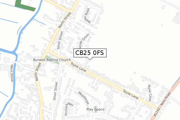
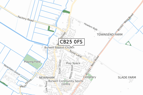
CB25 0FS maps


Licence: Open Government Licence (requires attribution)
Attribution: Contains OS data © Crown copyright and database right 2025
Source: Open Postcode Geo
Licence: Open Government Licence (requires attribution)
Attribution: Contains OS data © Crown copyright and database right 2025; Contains Royal Mail data © Royal Mail copyright and database right 2025; Source: Office for National Statistics licensed under the Open Government Licence v.3.0
CB25 0FS geodata
| Easting | 558687 |
| Northing | 268231 |
| Latitude | 52.289317 |
| Longitude | 0.325243 |
Where is CB25 0FS?
| Country | England |
| Postcode District | CB25 |
Politics
| Ward | Burwell |
|---|---|
| Constituency | South East Cambridgeshire |
Transport
Nearest bus stops to CB25 0FS
| Anchor Lane (North Street) | Burwell | 479m |
| Anchor Lane (North Street) | Burwell | 489m |
| Silver Street (Toyse Lane) | Burwell | 553m |
| Silver Street (Toyse Lane) | Burwell | 556m |
| New Road (North Street) | Burwell | 632m |
Deprivation
6.8% of English postcodes are less deprived than CB25 0FS:Food Standards Agency
Three nearest food hygiene ratings to CB25 0FS (metres)


➜ Get more ratings from the Food Standards Agency
Nearest post box to CB25 0FS
| Last Collection | |||
|---|---|---|---|
| Location | Mon-Fri | Sat | Distance |
| Grantchester Rise | 16:00 | 10:00 | 273m |
| North End | 16:00 | 10:00 | 639m |
| Toyse Lane | 16:30 | 10:00 | 957m |
CB25 0FS ITL and CB25 0FS LAU
The below table lists the International Territorial Level (ITL) codes (formerly Nomenclature of Territorial Units for Statistics (NUTS) codes) and Local Administrative Units (LAU) codes for CB25 0FS:
| ITL 1 Code | Name |
|---|---|
| TLH | East |
| ITL 2 Code | Name |
| TLH1 | East Anglia |
| ITL 3 Code | Name |
| TLH12 | Cambridgeshire CC |
| LAU 1 Code | Name |
| E07000009 | East Cambridgeshire |
CB25 0FS census areas
The below table lists the Census Output Area (OA), Lower Layer Super Output Area (LSOA), and Middle Layer Super Output Area (MSOA) for CB25 0FS:
| Code | Name | |
|---|---|---|
| OA | E00090873 | |
| LSOA | E01018015 | East Cambridgeshire 008C |
| MSOA | E02003739 | East Cambridgeshire 008 |
Nearest postcodes to CB25 0FS
| CB25 0BL | Dysons Drove | 174m |
| CB25 0FF | Old Lode Court | 247m |
| CB25 0BB | North Street | 259m |
| CB25 0BG | Mason Road | 364m |
| CB25 0BE | Grantchester Rise | 371m |
| CB25 0BX | Chestnut Rise | 383m |
| CB25 0BF | Appletree Grove | 456m |
| CB25 0BD | Anchor Lane | 505m |
| CB25 0BT | Broads Road Business Park | 532m |
| CB25 0DF | Toyse Lane | 683m |