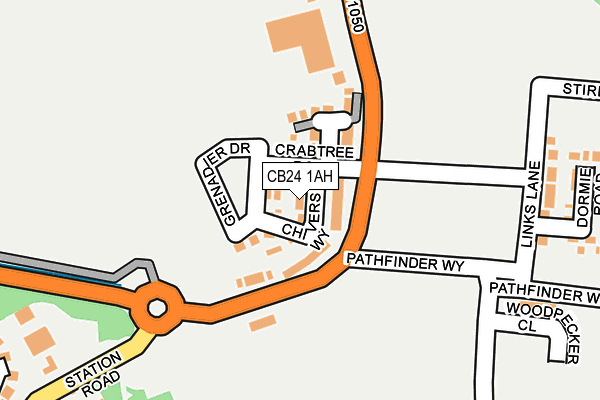
CB24 1AH is located in the Longstanton electoral ward, within the local authority district of South Cambridgeshire and the English Parliamentary constituency of South Cambridgeshire. The Sub Integrated Care Board (ICB) Location is NHS Cambridgeshire and Peterborough ICB - 06H and the police force is Cambridgeshire. This postcode has been in use since May 2017.


GetTheData
Source: OS OpenMap – Local (Ordnance Survey)
Source: OS VectorMap District (Ordnance Survey)
Licence: Open Government Licence (requires attribution)
| Easting | 539805 |
| Northing | 267547 |
| Latitude | 52.288295 |
| Longitude | 0.048321 |
GetTheData
Source: Open Postcode Geo
Licence: Open Government Licence
| Country | England |
| Postcode District | CB24 |
➜ See where CB24 is on a map ➜ Where is Northstowe? | |
GetTheData
Source: Land Registry Price Paid Data
Licence: Open Government Licence
| Ward | Longstanton |
| Constituency | South Cambridgeshire |
GetTheData
Source: ONS Postcode Database
Licence: Open Government Licence
2023 30 JAN £450,000 |
2023 16 JAN £411,000 |
10, CHIVERS WAY, NORTHSTOWE, CAMBRIDGE, CB24 1AH 2018 23 FEB £359,995 |
12, CHIVERS WAY, NORTHSTOWE, CAMBRIDGE, CB24 1AH 2017 22 DEC £392,995 |
16, CHIVERS WAY, NORTHSTOWE, CAMBRIDGE, CB24 1AH 2017 22 DEC £395,000 |
2017 22 DEC £394,995 |
14, CHIVERS WAY, NORTHSTOWE, CAMBRIDGE, CB24 1AH 2017 22 DEC £389,995 |
1, CHIVERS WAY, NORTHSTOWE, CAMBRIDGE, CB24 1AH 2017 8 DEC £359,995 |
3, CHIVERS WAY, NORTHSTOWE, CAMBRIDGE, CB24 1AH 2017 16 AUG £494,995 |
2017 30 JUN £346,995 |
GetTheData
Source: HM Land Registry Price Paid Data
Licence: Contains HM Land Registry data © Crown copyright and database right 2025. This data is licensed under the Open Government Licence v3.0.
| Ladywalk (High Street) | Longstanton | 476m |
| Longstanton Park-and-ride (Station Road) | Longstanton | 553m |
| The Busway Longstanton Park & Ride (Cambridgeshire Guided Busway) | Longstanton | 595m |
| The Busway Longstanton Park & Ride (Cambridgeshire Guided Busway) | Longstanton | 598m |
| Station Road | Longstanton | 608m |
GetTheData
Source: NaPTAN
Licence: Open Government Licence
| Percentage of properties with Next Generation Access | 100.0% |
| Percentage of properties with Superfast Broadband | 100.0% |
| Percentage of properties with Ultrafast Broadband | 100.0% |
| Percentage of properties with Full Fibre Broadband | 100.0% |
Superfast Broadband is between 30Mbps and 300Mbps
Ultrafast Broadband is > 300Mbps
| Median download speed | 100.0Mbps |
| Average download speed | 170.0Mbps |
| Maximum download speed | 350.00Mbps |
Ofcom does not currently provide upload speed data for CB24 1AH. This is because there are less than four broadband connections in this postcode.
| Percentage of properties unable to receive 2Mbps | 0.0% |
| Percentage of properties unable to receive 5Mbps | 0.0% |
| Percentage of properties unable to receive 10Mbps | 0.0% |
| Percentage of properties unable to receive 30Mbps | 0.0% |
GetTheData
Source: Ofcom
Licence: Ofcom Terms of Use (requires attribution)
GetTheData
Source: ONS Postcode Database
Licence: Open Government Licence


➜ Get more ratings from the Food Standards Agency
GetTheData
Source: Food Standards Agency
Licence: FSA terms & conditions
| Last Collection | |||
|---|---|---|---|
| Location | Mon-Fri | Sat | Distance |
| Longstanton Crossing | 16:00 | 10:45 | 637m |
| All Saints | 16:15 | 10:45 | 720m |
| Longstanton P.o. | 16:45 | 10:45 | 1,081m |
GetTheData
Source: Dracos
Licence: Creative Commons Attribution-ShareAlike
The below table lists the International Territorial Level (ITL) codes (formerly Nomenclature of Territorial Units for Statistics (NUTS) codes) and Local Administrative Units (LAU) codes for CB24 1AH:
| ITL 1 Code | Name |
|---|---|
| TLH | East |
| ITL 2 Code | Name |
| TLH1 | East Anglia |
| ITL 3 Code | Name |
| TLH12 | Cambridgeshire CC |
| LAU 1 Code | Name |
| E07000012 | South Cambridgeshire |
GetTheData
Source: ONS Postcode Directory
Licence: Open Government Licence
The below table lists the Census Output Area (OA), Lower Layer Super Output Area (LSOA), and Middle Layer Super Output Area (MSOA) for CB24 1AH:
| Code | Name | |
|---|---|---|
| OA | E00170796 | |
| LSOA | E01018266 | South Cambridgeshire 003B |
| MSOA | E02003777 | South Cambridgeshire 003 |
GetTheData
Source: ONS Postcode Directory
Licence: Open Government Licence
| CB24 3DR | Station Road | 252m |
| CB24 3BY | Brewers Close | 294m |
| CB24 3ET | Eaton Way | 356m |
| CB24 3ED | Ladywalk | 430m |
| CB24 3ES | Kides Crescent | 470m |
| CB24 3DP | Fews Lane | 488m |
| CB24 3BT | High Street | 500m |
| CB24 3DZ | Brookfield Drive | 544m |
| CB24 3ER | Mitchcroft Road | 564m |
| CB24 3EX | Hart Close | 564m |
GetTheData
Source: Open Postcode Geo; Land Registry Price Paid Data
Licence: Open Government Licence