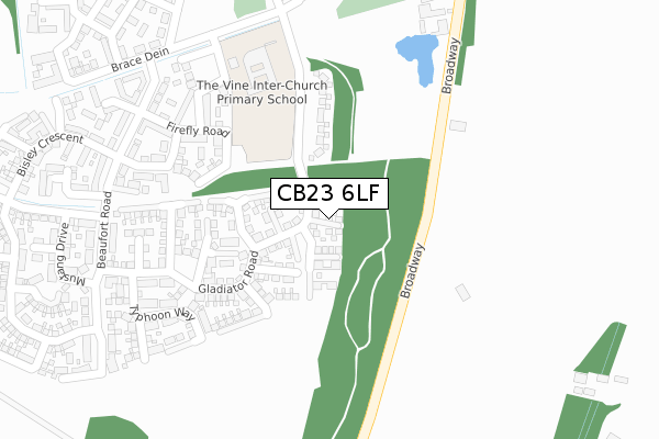
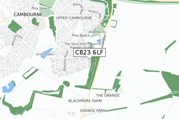
CB23 6LF is located in the Cambourne electoral ward, within the local authority district of South Cambridgeshire and the English Parliamentary constituency of South Cambridgeshire. The Sub Integrated Care Board (ICB) Location is NHS Cambridgeshire and Peterborough ICB - 06H and the police force is Cambridgeshire. This postcode has been in use since June 2019.


GetTheData
Source: OS Open Zoomstack (Ordnance Survey)
Licence: Open Government Licence (requires attribution)
Attribution: Contains OS data © Crown copyright and database right 2025
Source: Open Postcode Geo
Licence: Open Government Licence (requires attribution)
Attribution: Contains OS data © Crown copyright and database right 2025; Contains Royal Mail data © Royal Mail copyright and database right 2025; Source: Office for National Statistics licensed under the Open Government Licence v.3.0
| Easting | 533230 |
| Northing | 258993 |
| Latitude | 52.213067 |
| Longitude | -0.051388 |
GetTheData
Source: Open Postcode Geo
Licence: Open Government Licence
| Country | England |
| Postcode District | CB23 |
➜ See where CB23 is on a map ➜ Where is Cambourne? | |
GetTheData
Source: Land Registry Price Paid Data
Licence: Open Government Licence
| Ward | Cambourne |
| Constituency | South Cambridgeshire |
GetTheData
Source: ONS Postcode Database
Licence: Open Government Licence
4, BATTLE CLOSE, UPPER CAMBOURNE, CAMBRIDGE, CB23 6LF 2019 28 JUN £480,000 |
3, BATTLE CLOSE, UPPER CAMBOURNE, CAMBRIDGE, CB23 6LF 2019 28 JUN £477,000 |
5, BATTLE CLOSE, UPPER CAMBOURNE, CAMBRIDGE, CB23 6LF 2019 17 JUN £479,995 |
6, BATTLE CLOSE, UPPER CAMBOURNE, CAMBRIDGE, CB23 6LF 2019 11 JUN £504,995 |
GetTheData
Source: HM Land Registry Price Paid Data
Licence: Contains HM Land Registry data © Crown copyright and database right 2025. This data is licensed under the Open Government Licence v3.0.
| Lysander Close (Sterling Way) | Upper Cambourne | 580m |
| Whitley Road (Lancaster Gate) | Upper Cambourne | 678m |
| Hampden Close (Sterling Way) | Upper Cambourne | 790m |
| Hurricane Way (Sterling Way) | Upper Cambourne | 806m |
| Cressbrook Drive (Jeavons Lane) | Great Cambourne | 951m |
GetTheData
Source: NaPTAN
Licence: Open Government Licence
| Percentage of properties with Next Generation Access | 100.0% |
| Percentage of properties with Superfast Broadband | 100.0% |
| Percentage of properties with Ultrafast Broadband | 100.0% |
| Percentage of properties with Full Fibre Broadband | 100.0% |
Superfast Broadband is between 30Mbps and 300Mbps
Ultrafast Broadband is > 300Mbps
| Percentage of properties unable to receive 2Mbps | 0.0% |
| Percentage of properties unable to receive 5Mbps | 0.0% |
| Percentage of properties unable to receive 10Mbps | 0.0% |
| Percentage of properties unable to receive 30Mbps | 0.0% |
GetTheData
Source: Ofcom
Licence: Ofcom Terms of Use (requires attribution)
GetTheData
Source: ONS Postcode Database
Licence: Open Government Licence


➜ Get more ratings from the Food Standards Agency
GetTheData
Source: Food Standards Agency
Licence: FSA terms & conditions
| Last Collection | |||
|---|---|---|---|
| Location | Mon-Fri | Sat | Distance |
| Monkfield Lane | 17:00 | 10:30 | 1,220m |
| Broadway | 16:00 | 09:45 | 1,275m |
| Monks Drive | 17:30 | 11:00 | 1,475m |
GetTheData
Source: Dracos
Licence: Creative Commons Attribution-ShareAlike
The below table lists the International Territorial Level (ITL) codes (formerly Nomenclature of Territorial Units for Statistics (NUTS) codes) and Local Administrative Units (LAU) codes for CB23 6LF:
| ITL 1 Code | Name |
|---|---|
| TLH | East |
| ITL 2 Code | Name |
| TLH1 | East Anglia |
| ITL 3 Code | Name |
| TLH12 | Cambridgeshire CC |
| LAU 1 Code | Name |
| E07000012 | South Cambridgeshire |
GetTheData
Source: ONS Postcode Directory
Licence: Open Government Licence
The below table lists the Census Output Area (OA), Lower Layer Super Output Area (LSOA), and Middle Layer Super Output Area (MSOA) for CB23 6LF:
| Code | Name | |
|---|---|---|
| OA | E00170809 | |
| LSOA | E01033116 | South Cambridgeshire 021D |
| MSOA | E02006874 | South Cambridgeshire 021 |
GetTheData
Source: ONS Postcode Directory
Licence: Open Government Licence
| CB23 6FW | Firefly Road | 254m |
| CB23 6FS | Welkin Way | 266m |
| CB23 6HW | Tempest Road | 269m |
| CB23 6JR | Typhoon Way | 292m |
| CB23 6FP | Beaufort Road | 328m |
| CB23 6JS | Whirlwind Close | 352m |
| CB23 6FU | Westland Close | 366m |
| CB23 6HY | Mustang Drive | 405m |
| CB23 2TE | Broadway | 418m |
| CB23 6FJ | Mosquito Road | 423m |
GetTheData
Source: Open Postcode Geo; Land Registry Price Paid Data
Licence: Open Government Licence