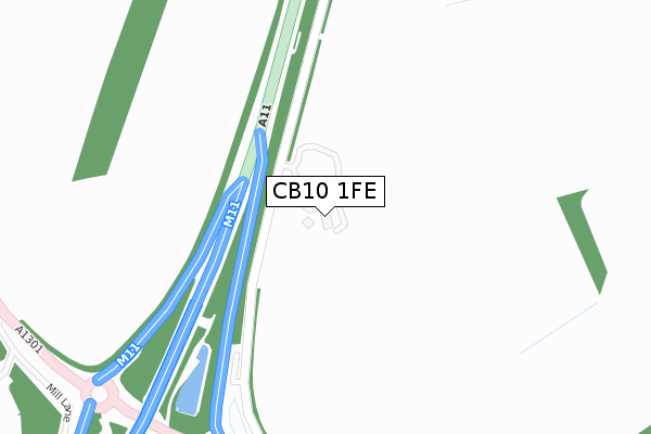
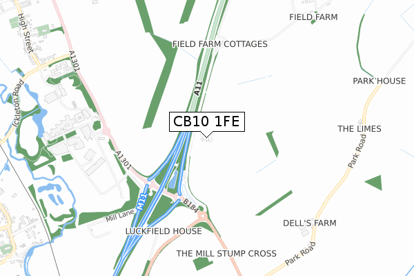
CB10 1FE is located in the Littlebury, Chesterford & Wenden Lofts electoral ward, within the local authority district of Uttlesford and the English Parliamentary constituency of Saffron Walden. The Sub Integrated Care Board (ICB) Location is NHS Hertfordshire and West Essex ICB - 07H and the police force is Essex. This postcode has been in use since February 2018.


GetTheData
Source: OS Open Zoomstack (Ordnance Survey)
Licence: Open Government Licence (requires attribution)
Attribution: Contains OS data © Crown copyright and database right 2025
Source: Open Postcode Geo
Licence: Open Government Licence (requires attribution)
Attribution: Contains OS data © Crown copyright and database right 2025; Contains Royal Mail data © Royal Mail copyright and database right 2025; Source: Office for National Statistics licensed under the Open Government Licence v.3.0
| Easting | 550687 |
| Northing | 244527 |
| Latitude | 52.078612 |
| Longitude | 0.197521 |
GetTheData
Source: Open Postcode Geo
Licence: Open Government Licence
| Country | England |
| Postcode District | CB10 |
➜ See where CB10 is on a map | |
GetTheData
Source: Land Registry Price Paid Data
Licence: Open Government Licence
| Ward | Littlebury, Chesterford & Wenden Lofts |
| Constituency | Saffron Walden |
GetTheData
Source: ONS Postcode Database
Licence: Open Government Licence
| New Road (High Street) | Hinxton | 1,133m |
| New Road (High Street) | Hinxton | 1,138m |
| Church Green (High Street) | Hinxton | 1,243m |
| Church Green (High Street) | Hinxton | 1,248m |
| Butchers Hill (Brookhampton Street) | Ickleton | 1,304m |
| Great Chesterford Station | 2.1km |
| Whittlesford Parkway Station | 3.5km |
GetTheData
Source: NaPTAN
Licence: Open Government Licence
GetTheData
Source: ONS Postcode Database
Licence: Open Government Licence


➜ Get more ratings from the Food Standards Agency
GetTheData
Source: Food Standards Agency
Licence: FSA terms & conditions
| Last Collection | |||
|---|---|---|---|
| Location | Mon-Fri | Sat | Distance |
| Church Green | 17:00 | 10:00 | 1,265m |
| Jacksons Lane | 16:45 | 10:30 | 1,310m |
| Butchers Hill | 16:15 | 08:00 | 1,335m |
GetTheData
Source: Dracos
Licence: Creative Commons Attribution-ShareAlike
The below table lists the International Territorial Level (ITL) codes (formerly Nomenclature of Territorial Units for Statistics (NUTS) codes) and Local Administrative Units (LAU) codes for CB10 1FE:
| ITL 1 Code | Name |
|---|---|
| TLH | East |
| ITL 2 Code | Name |
| TLH3 | Essex |
| ITL 3 Code | Name |
| TLH35 | West Essex |
| LAU 1 Code | Name |
| E07000077 | Uttlesford |
GetTheData
Source: ONS Postcode Directory
Licence: Open Government Licence
The below table lists the Census Output Area (OA), Lower Layer Super Output Area (LSOA), and Middle Layer Super Output Area (MSOA) for CB10 1FE:
| Code | Name | |
|---|---|---|
| OA | E00112262 | |
| LSOA | E01022094 | Uttlesford 001D |
| MSOA | E02004591 | Uttlesford 001 |
GetTheData
Source: ONS Postcode Directory
Licence: Open Government Licence
| CB10 1RL | Park Road | 924m |
| CB10 1RP | Field Farm Drive | 1004m |
| CB10 1QZ | New Road | 1055m |
| CB10 1SW | Mill Lane | 1206m |
| CB10 1RA | Church Green | 1213m |
| CB10 1PS | Walden Road | 1229m |
| CB10 1QF | Hyll Close | 1268m |
| CB10 1QY | High Street | 1291m |
| CB10 1PT | Jacksons Lane | 1306m |
| CB10 1SP | Brookhampton Street | 1313m |
GetTheData
Source: Open Postcode Geo; Land Registry Price Paid Data
Licence: Open Government Licence