CA3 0FL maps, stats, and open data
CA3 0FL is located in the Stanwix Urban electoral ward, within the unitary authority of Cumberland and the English Parliamentary constituency of Carlisle. The Sub Integrated Care Board (ICB) Location is NHS North East and North Cumbria ICB - 01H and the police force is Cumbria. This postcode has been in use since April 2019.
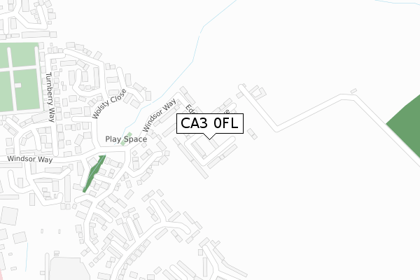
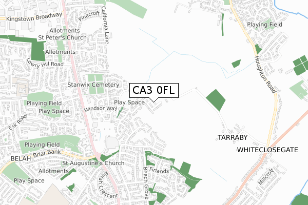
CA3 0FL maps


Licence: Open Government Licence (requires attribution)
Attribution: Contains OS data © Crown copyright and database right 2025
Source: Open Postcode Geo
Licence: Open Government Licence (requires attribution)
Attribution: Contains OS data © Crown copyright and database right 2025; Contains Royal Mail data © Royal Mail copyright and database right 2025; Source: Office for National Statistics licensed under the Open Government Licence v.3.0
CA3 0FL geodata
| Easting | 340270 |
| Northing | 558392 |
| Latitude | 54.916645 |
| Longitude | -2.933329 |
Where is CA3 0FL?
| Country | England |
| Postcode District | CA3 |
Politics
| Ward | Stanwix Urban |
|---|---|
| Constituency | Carlisle |
House Prices
Sales of detached houses in CA3 0FL
2024 22 MAR £270,000 |
9, RAISBECK CLOSE, CARLISLE, CA3 0FL 2019 30 AUG £202,995 |
13, RAISBECK CLOSE, CARLISLE, CA3 0FL 2019 25 JUL £193,995 |
21, RAISBECK CLOSE, CARLISLE, CA3 0FL 2019 28 JUN £226,995 |
23, RAISBECK CLOSE, CARLISLE, CA3 0FL 2019 27 JUN £206,995 |
15, RAISBECK CLOSE, CARLISLE, CA3 0FL 2019 27 JUN £210,995 |
11, RAISBECK CLOSE, CARLISLE, CA3 0FL 2019 21 JUN £189,995 |
1, RAISBECK CLOSE, CARLISLE, CA3 0FL 2019 26 APR £204,995 |
2019 26 APR £224,995 |
Licence: Contains HM Land Registry data © Crown copyright and database right 2025. This data is licensed under the Open Government Licence v3.0.
Transport
Nearest bus stops to CA3 0FL
| Morrisons (A7) | Stanwix | 513m |
| Moorville Terrace (Kingstown Road) | Kingstown | 559m |
| Moorville Terrace (Kingstown Road) | Kingstown | 575m |
| The Gosling Bridge (Kingstown Road) | Kingstown | 592m |
| The Gosling Bridge (Kingstown Road) | Kingstown | 616m |
Nearest railway stations to CA3 0FL
| Carlisle Station | 2.9km |
Broadband
Broadband access in CA3 0FL (2020 data)
| Percentage of properties with Next Generation Access | 100.0% |
| Percentage of properties with Superfast Broadband | 100.0% |
| Percentage of properties with Ultrafast Broadband | 100.0% |
| Percentage of properties with Full Fibre Broadband | 100.0% |
Superfast Broadband is between 30Mbps and 300Mbps
Ultrafast Broadband is > 300Mbps
Broadband limitations in CA3 0FL (2020 data)
| Percentage of properties unable to receive 2Mbps | 0.0% |
| Percentage of properties unable to receive 5Mbps | 0.0% |
| Percentage of properties unable to receive 10Mbps | 0.0% |
| Percentage of properties unable to receive 30Mbps | 0.0% |
Deprivation
2.4% of English postcodes are less deprived than CA3 0FL:Food Standards Agency
Three nearest food hygiene ratings to CA3 0FL (metres)


➜ Get more ratings from the Food Standards Agency
Nearest post box to CA3 0FL
| Last Collection | |||
|---|---|---|---|
| Location | Mon-Fri | Sat | Distance |
| Windsor Way | 17:15 | 13:15 | 259m |
| Woodlands Close | 16:30 | 13:15 | 485m |
| Moorville | 18:00 | 12:30 | 595m |
CA3 0FL ITL and CA3 0FL LAU
The below table lists the International Territorial Level (ITL) codes (formerly Nomenclature of Territorial Units for Statistics (NUTS) codes) and Local Administrative Units (LAU) codes for CA3 0FL:
| ITL 1 Code | Name |
|---|---|
| TLD | North West (England) |
| ITL 2 Code | Name |
| TLD1 | Cumbria |
| ITL 3 Code | Name |
| TLD12 | East Cumbria |
| LAU 1 Code | Name |
| E07000028 | Carlisle |
CA3 0FL census areas
The below table lists the Census Output Area (OA), Lower Layer Super Output Area (LSOA), and Middle Layer Super Output Area (MSOA) for CA3 0FL:
| Code | Name | |
|---|---|---|
| OA | E00097275 | |
| LSOA | E01019241 | Carlisle 004D |
| MSOA | E02003990 | Carlisle 004 |
Nearest postcodes to CA3 0FL
| CA3 0QE | Windsor Way | 133m |
| CA3 0PF | Pennington Drive | 272m |
| CA3 9HN | Lansdowne Close | 273m |
| CA3 0PB | Wolsty Close | 282m |
| CA3 9HW | Lansdowne Court | 301m |
| CA3 0PE | Askerton Close | 322m |
| CA3 0PD | Drumburgh Avenue | 337m |
| CA3 0QL | Turnberry Way | 375m |
| CA3 9ER | Lansdowne Crescent | 390m |
| CA3 0QG | Gosling Drive | 395m |