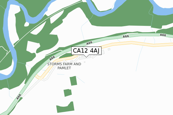
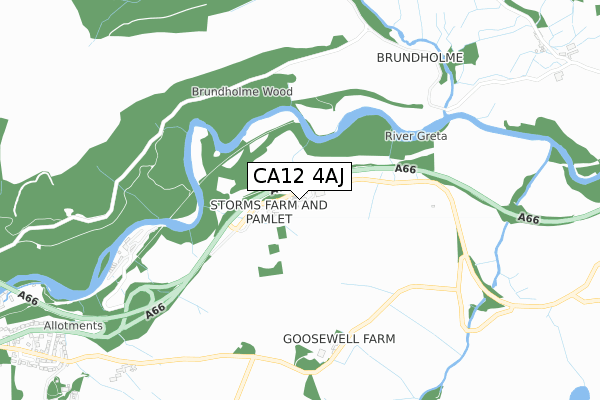
CA12 4AJ is located in the Keswick electoral ward, within the unitary authority of Cumberland and the English Parliamentary constituency of Copeland. The Sub Integrated Care Board (ICB) Location is NHS North East and North Cumbria ICB - 01H and the police force is Cumbria. This postcode has been in use since February 2019.


GetTheData
Source: OS Open Zoomstack (Ordnance Survey)
Licence: Open Government Licence (requires attribution)
Attribution: Contains OS data © Crown copyright and database right 2025
Source: Open Postcode Geo
Licence: Open Government Licence (requires attribution)
Attribution: Contains OS data © Crown copyright and database right 2025; Contains Royal Mail data © Royal Mail copyright and database right 2025; Source: Office for National Statistics licensed under the Open Government Licence v.3.0
| Easting | 329297 |
| Northing | 524389 |
| Latitude | 54.609699 |
| Longitude | -3.096185 |
GetTheData
Source: Open Postcode Geo
Licence: Open Government Licence
| Country | England |
| Postcode District | CA12 |
➜ See where CA12 is on a map | |
GetTheData
Source: Land Registry Price Paid Data
Licence: Open Government Licence
| Ward | Keswick |
| Constituency | Copeland |
GetTheData
Source: ONS Postcode Database
Licence: Open Government Licence
| Stone Circle (Unnamed Road) | Castlerigg | 672m |
| Fieldside (The Hawthorns) | Brigham | 1,120m |
| Brentfield (The Hawthorns) | Brigham | 1,160m |
| Eleven Trees (The Hawthorns) | Brigham | 1,370m |
| Hawthorns By Eleven Trees (The Hawthorns) | Brigham | 1,385m |
GetTheData
Source: NaPTAN
Licence: Open Government Licence
GetTheData
Source: ONS Postcode Database
Licence: Open Government Licence


➜ Get more ratings from the Food Standards Agency
GetTheData
Source: Food Standards Agency
Licence: FSA terms & conditions
| Last Collection | |||
|---|---|---|---|
| Location | Mon-Fri | Sat | Distance |
| Wesco | 11:00 | 11:00 | 1,218m |
| Chestnut Hill | 16:45 | 11:00 | 1,406m |
| Burns | 16:00 | 11:00 | 1,470m |
GetTheData
Source: Dracos
Licence: Creative Commons Attribution-ShareAlike
The below table lists the International Territorial Level (ITL) codes (formerly Nomenclature of Territorial Units for Statistics (NUTS) codes) and Local Administrative Units (LAU) codes for CA12 4AJ:
| ITL 1 Code | Name |
|---|---|
| TLD | North West (England) |
| ITL 2 Code | Name |
| TLD1 | Cumbria |
| ITL 3 Code | Name |
| TLD11 | West Cumbria |
| LAU 1 Code | Name |
| E07000026 | Allerdale |
GetTheData
Source: ONS Postcode Directory
Licence: Open Government Licence
The below table lists the Census Output Area (OA), Lower Layer Super Output Area (LSOA), and Middle Layer Super Output Area (MSOA) for CA12 4AJ:
| Code | Name | |
|---|---|---|
| OA | E00096564 | |
| LSOA | E01019106 | Allerdale 012E |
| MSOA | E02003976 | Allerdale 012 |
GetTheData
Source: ONS Postcode Directory
Licence: Open Government Licence
| CA12 4RN | 992m | |
| CA12 4LL | The Hawthorns | 1216m |
| CA12 4LW | Eleventrees | 1248m |
| CA12 4LP | Lonscale View | 1259m |
| CA12 4LN | Fieldside Close | 1336m |
| CA12 4NX | The Forge | 1355m |
| CA12 4RR | 1480m | |
| CA12 4LJ | Penrith Road | 1484m |
| CA12 4NY | Forge Lane | 1492m |
| CA12 4LR | Chestnut Hill | 1525m |
GetTheData
Source: Open Postcode Geo; Land Registry Price Paid Data
Licence: Open Government Licence