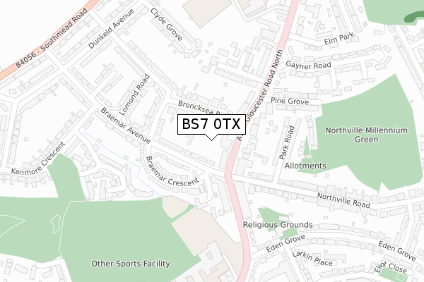
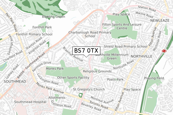
BS7 0TX is located in the Filton electoral ward, within the unitary authority of South Gloucestershire and the English Parliamentary constituency of Filton and Bradley Stoke. The Sub Integrated Care Board (ICB) Location is NHS Bristol, North Somerset and South Gloucestershire ICB - 15C and the police force is Avon and Somerset. This postcode has been in use since February 2020.


GetTheData
Source: OS Open Zoomstack (Ordnance Survey)
Licence: Open Government Licence (requires attribution)
Attribution: Contains OS data © Crown copyright and database right 2025
Source: Open Postcode Geo
Licence: Open Government Licence (requires attribution)
Attribution: Contains OS data © Crown copyright and database right 2025; Contains Royal Mail data © Royal Mail copyright and database right 2025; Source: Office for National Statistics licensed under the Open Government Licence v.3.0
| Easting | 359842 |
| Northing | 178319 |
| Latitude | 51.502369 |
| Longitude | -2.579948 |
GetTheData
Source: Open Postcode Geo
Licence: Open Government Licence
| Country | England |
| Postcode District | BS7 |
➜ See where BS7 is on a map ➜ Where is Filton? | |
GetTheData
Source: Land Registry Price Paid Data
Licence: Open Government Licence
| Ward | Filton |
| Constituency | Filton And Bradley Stoke |
GetTheData
Source: ONS Postcode Database
Licence: Open Government Licence
| Northville Road (Gloucester Road North) | Filton | 54m |
| Northville Road (Filton Road) | Filton | 149m |
| Braemar Avenue | Filton | 176m |
| Filton Police Station (Gloucester Road North) | Filton | 389m |
| Filton Police Station (Gloucester Road North) | Filton | 411m |
| Filton Abbey Wood Station | 1.2km |
| Patchway Station | 2.9km |
| Bristol Parkway Station | 2.9km |
GetTheData
Source: NaPTAN
Licence: Open Government Licence
GetTheData
Source: ONS Postcode Database
Licence: Open Government Licence


➜ Get more ratings from the Food Standards Agency
GetTheData
Source: Food Standards Agency
Licence: FSA terms & conditions
| Last Collection | |||
|---|---|---|---|
| Location | Mon-Fri | Sat | Distance |
| Northville Post Office | 17:15 | 12:30 | 136m |
| Gayner Road | 16:00 | 11:00 | 276m |
| Kenmore Crescent | 16:00 | 11:00 | 469m |
GetTheData
Source: Dracos
Licence: Creative Commons Attribution-ShareAlike
The below table lists the International Territorial Level (ITL) codes (formerly Nomenclature of Territorial Units for Statistics (NUTS) codes) and Local Administrative Units (LAU) codes for BS7 0TX:
| ITL 1 Code | Name |
|---|---|
| TLK | South West (England) |
| ITL 2 Code | Name |
| TLK1 | Gloucestershire, Wiltshire and Bath/Bristol area |
| ITL 3 Code | Name |
| TLK12 | Bath and North East Somerset, North Somerset and South Gloucestershire |
| LAU 1 Code | Name |
| E06000025 | South Gloucestershire |
GetTheData
Source: ONS Postcode Directory
Licence: Open Government Licence
The below table lists the Census Output Area (OA), Lower Layer Super Output Area (LSOA), and Middle Layer Super Output Area (MSOA) for BS7 0TX:
| Code | Name | |
|---|---|---|
| OA | E00075334 | |
| LSOA | E01014908 | South Gloucestershire 018E |
| MSOA | E02003107 | South Gloucestershire 018 |
GetTheData
Source: ONS Postcode Directory
Licence: Open Government Licence
| BS7 0SH | Gloucester Road North | 46m |
| BS7 0SE | Broncksea Road | 67m |
| BS7 0TA | Braemar Avenue | 68m |
| BS7 0SJ | Gloucester Road North | 93m |
| BS7 0TB | Braemar Avenue | 101m |
| BS7 0TD | Braemar Crescent | 137m |
| BS7 0SG | Gloucester Road North | 148m |
| BS7 0SF | Gloucester Road North | 150m |
| BS7 0SN | Gloucester Road North | 161m |
| BS7 0RH | Park Road | 165m |
GetTheData
Source: Open Postcode Geo; Land Registry Price Paid Data
Licence: Open Government Licence