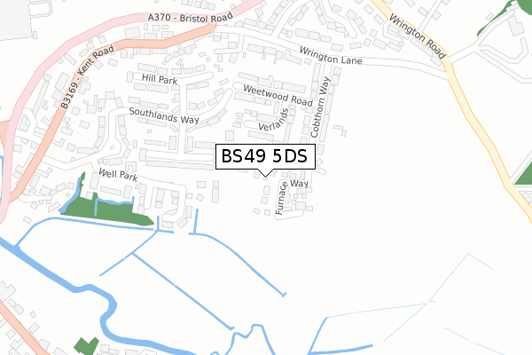
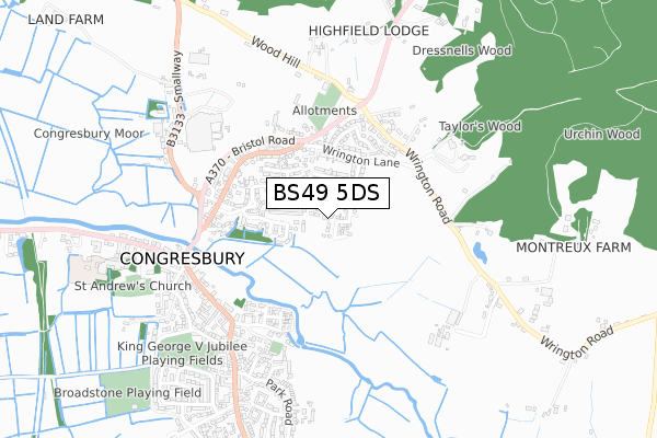
BS49 5DS is located in the Congresbury & Puxton electoral ward, within the unitary authority of North Somerset and the English Parliamentary constituency of Weston-Super-Mare. The Sub Integrated Care Board (ICB) Location is NHS Bristol, North Somerset and South Gloucestershire ICB - 15C and the police force is Avon and Somerset. This postcode has been in use since December 2019.


GetTheData
Source: OS Open Zoomstack (Ordnance Survey)
Licence: Open Government Licence (requires attribution)
Attribution: Contains OS data © Crown copyright and database right 2025
Source: Open Postcode Geo
Licence: Open Government Licence (requires attribution)
Attribution: Contains OS data © Crown copyright and database right 2025; Contains Royal Mail data © Royal Mail copyright and database right 2025; Source: Office for National Statistics licensed under the Open Government Licence v.3.0
| Easting | 344279 |
| Northing | 164001 |
| Latitude | 51.372316 |
| Longitude | -2.801889 |
GetTheData
Source: Open Postcode Geo
Licence: Open Government Licence
| Country | England |
| Postcode District | BS49 |
➜ See where BS49 is on a map ➜ Where is Congresbury? | |
GetTheData
Source: Land Registry Price Paid Data
Licence: Open Government Licence
| Ward | Congresbury & Puxton |
| Constituency | Weston-super-mare |
GetTheData
Source: ONS Postcode Database
Licence: Open Government Licence
5, FURNACE WAY, CONGRESBURY, BRISTOL, BS49 5DS 2024 20 DEC £570,000 |
2024 26 NOV £403,000 |
2024 18 APR £645,000 |
12, FURNACE WAY, CONGRESBURY, BRISTOL, BS49 5DS 2021 18 MAR £455,000 |
21, FURNACE WAY, CONGRESBURY, BRISTOL, BS49 5DS 2021 12 FEB £525,000 |
2021 5 FEB £384,000 |
24, FURNACE WAY, CONGRESBURY, BRISTOL, BS49 5DS 2020 7 DEC £540,000 |
5, FURNACE WAY, CONGRESBURY, BRISTOL, BS49 5DS 2020 3 DEC £465,000 |
22, FURNACE WAY, CONGRESBURY, BRISTOL, BS49 5DS 2020 27 NOV £515,000 |
10, FURNACE WAY, CONGRESBURY, BRISTOL, BS49 5DS 2020 25 NOV £540,000 |
GetTheData
Source: HM Land Registry Price Paid Data
Licence: Contains HM Land Registry data © Crown copyright and database right 2025. This data is licensed under the Open Government Licence v3.0.
| Tesco (Bristol Road) | Congresbury | 396m |
| Wrington Road (Bristol Road) | Congresbury | 422m |
| Wrington Road (Bristol Road) | Congresbury | 433m |
| Tesco | Congresbury | 447m |
| Kent Road Layby | Congresbury | 458m |
| Yatton Station | 2.8km |
GetTheData
Source: NaPTAN
Licence: Open Government Licence
GetTheData
Source: ONS Postcode Database
Licence: Open Government Licence


➜ Get more ratings from the Food Standards Agency
GetTheData
Source: Food Standards Agency
Licence: FSA terms & conditions
| Last Collection | |||
|---|---|---|---|
| Location | Mon-Fri | Sat | Distance |
| Rhodyate | 15:45 | 09:00 | 478m |
| Broad Street | 17:30 | 09:00 | 584m |
| Congresbury Post Office | 17:15 | 11:15 | 775m |
GetTheData
Source: Dracos
Licence: Creative Commons Attribution-ShareAlike
The below table lists the International Territorial Level (ITL) codes (formerly Nomenclature of Territorial Units for Statistics (NUTS) codes) and Local Administrative Units (LAU) codes for BS49 5DS:
| ITL 1 Code | Name |
|---|---|
| TLK | South West (England) |
| ITL 2 Code | Name |
| TLK1 | Gloucestershire, Wiltshire and Bath/Bristol area |
| ITL 3 Code | Name |
| TLK12 | Bath and North East Somerset, North Somerset and South Gloucestershire |
| LAU 1 Code | Name |
| E06000024 | North Somerset |
GetTheData
Source: ONS Postcode Directory
Licence: Open Government Licence
The below table lists the Census Output Area (OA), Lower Layer Super Output Area (LSOA), and Middle Layer Super Output Area (MSOA) for BS49 5DS:
| Code | Name | |
|---|---|---|
| OA | E00074582 | |
| LSOA | E01014764 | North Somerset 014A |
| MSOA | E02003078 | North Somerset 014 |
GetTheData
Source: ONS Postcode Directory
Licence: Open Government Licence
| BS49 5BL | Verlands | 110m |
| BS49 5BS | Southside | 155m |
| BS49 5BJ | Cobthorn Way | 169m |
| BS49 5BN | Weetwood Road | 179m |
| BS49 5BU | Well Park | 202m |
| BS49 5BQ | Wrington Lane | 236m |
| BS49 5BP | Southlands Way | 239m |
| BS49 5BT | Hill Park | 243m |
| BS49 5BW | Southlands Way | 270m |
| BS49 5AZ | Kent Road | 289m |
GetTheData
Source: Open Postcode Geo; Land Registry Price Paid Data
Licence: Open Government Licence