BS31 2GN maps, stats, and open data
- Home
- Postcode
- BS
- BS31
- BS31 2
BS31 2GN is located in the Keynsham North electoral ward, within the unitary authority of Bath and North East Somerset and the English Parliamentary constituency of North East Somerset. The Sub Integrated Care Board (ICB) Location is NHS Bath and North East Somerset, Swindon and Wiltshire ICB - 92 and the police force is Avon and Somerset. This postcode has been in use since February 2018.
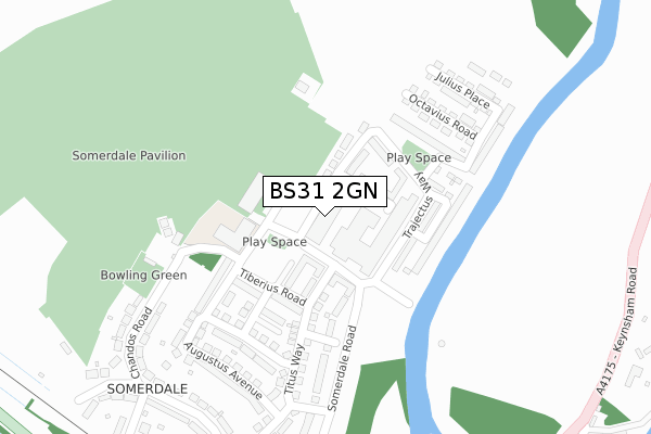
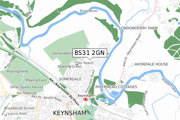
BS31 2GN maps


Source: OS Open Zoomstack (Ordnance Survey)
Licence: Open Government Licence (requires attribution)
Attribution: Contains OS data © Crown copyright and database right 2025
Source: Open Postcode GeoLicence: Open Government Licence (requires attribution)
Attribution: Contains OS data © Crown copyright and database right 2025; Contains Royal Mail data © Royal Mail copyright and database right 2025; Source: Office for National Statistics licensed under the Open Government Licence v.3.0
BS31 2GN geodata
| Easting | 365697 |
| Northing | 169435 |
| Latitude | 51.422877 |
| Longitude | -2.494733 |
Where is BS31 2GN?
| Country | England |
| Postcode District | BS31 |
Politics
| Ward | Keynsham North |
|---|
| Constituency | North East Somerset |
|---|
Transport
Nearest bus stops to BS31 2GN
| Cross Street | Somerdale | 80m |
| Somerdale Road | Somerdale | 448m |
| The Marina (Keynsham Road) | Willsbridge | 500m |
| Keynsham Station (Keynsham Road) | Somerdale | 506m |
| The Marina (Keysham Road) | Willsbridge | 507m |
Nearest underground/metro/tram to BS31 2GN
| Bitton (Avon Valley Railway) | Bitton | 1,532m |
Nearest railway stations to BS31 2GN
| Keynsham Station | 0.5km |
| Lawrence Hill Station | 6.2km |
| Stapleton Road Station | 7km |
Deprivation
41.8% of English postcodes are less deprived than
BS31 2GN:
Food Standards Agency
Three nearest food hygiene ratings to BS31 2GN (metres)
One Stop Stores Ltd
Somer Dining And B Block
Charterhouse Care Home
50m
The Lock Keeper
➜ Get more ratings from the Food Standards Agency
Nearest post box to BS31 2GN
| | Last Collection | |
|---|
| Location | Mon-Fri | Sat | Distance |
|---|
| Station Road | 17:30 | 12:30 | 538m |
| Keynsham Post Office | 18:00 | 12:00 | 847m |
| Westview Road | 17:30 | 12:15 | 1,170m |
BS31 2GN ITL and BS31 2GN LAU
The below table lists the International Territorial Level (ITL) codes (formerly Nomenclature of Territorial Units for Statistics (NUTS) codes) and Local Administrative Units (LAU) codes for BS31 2GN:
| ITL 1 Code | Name |
|---|
| TLK | South West (England) |
| ITL 2 Code | Name |
|---|
| TLK1 | Gloucestershire, Wiltshire and Bath/Bristol area |
| ITL 3 Code | Name |
|---|
| TLK12 | Bath and North East Somerset, North Somerset and South Gloucestershire |
| LAU 1 Code | Name |
|---|
| E06000022 | Bath and North East Somerset |
BS31 2GN census areas
The below table lists the Census Output Area (OA), Lower Layer Super Output Area (LSOA), and Middle Layer Super Output Area (MSOA) for BS31 2GN:
| Code | Name |
|---|
| OA | E00072724 | |
|---|
| LSOA | E01014399 | Bath and North East Somerset 001A |
|---|
| MSOA | E02002985 | Bath and North East Somerset 001 |
|---|
Nearest postcodes to BS31 2GN


