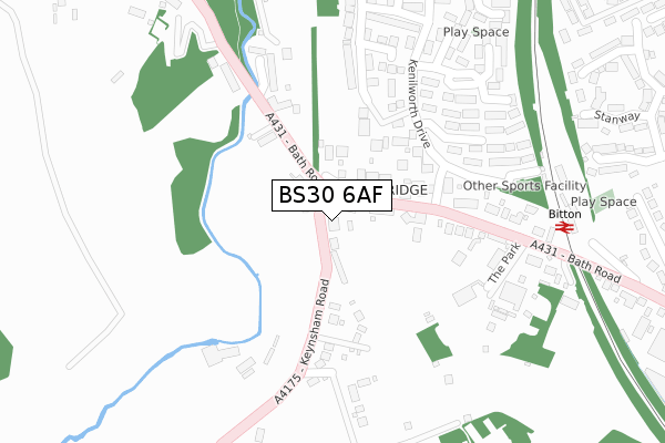
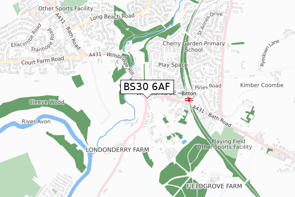
BS30 6AF is located in the Bitton & Oldland Common electoral ward, within the unitary authority of South Gloucestershire and the English Parliamentary constituency of Kingswood. The Sub Integrated Care Board (ICB) Location is NHS Bristol, North Somerset and South Gloucestershire ICB - 15C and the police force is Avon and Somerset. This postcode has been in use since July 2019.


GetTheData
Source: OS Open Zoomstack (Ordnance Survey)
Licence: Open Government Licence (requires attribution)
Attribution: Contains OS data © Crown copyright and database right 2025
Source: Open Postcode Geo
Licence: Open Government Licence (requires attribution)
Attribution: Contains OS data © Crown copyright and database right 2025; Contains Royal Mail data © Royal Mail copyright and database right 2025; Source: Office for National Statistics licensed under the Open Government Licence v.3.0
| Easting | 366676 |
| Northing | 170293 |
| Latitude | 51.430650 |
| Longitude | -2.480735 |
GetTheData
Source: Open Postcode Geo
Licence: Open Government Licence
| Country | England |
| Postcode District | BS30 |
➜ See where BS30 is on a map ➜ Where is Kingswood? | |
GetTheData
Source: Land Registry Price Paid Data
Licence: Open Government Licence
| Ward | Bitton & Oldland Common |
| Constituency | Kingswood |
GetTheData
Source: ONS Postcode Database
Licence: Open Government Licence
5, LITTLE ORCHARD CLOSE, WILLSBRIDGE, BRISTOL, BS30 6AF 2023 3 NOV £680,000 |
3, LITTLE ORCHARD CLOSE, WILLSBRIDGE, BRISTOL, BS30 6AF 2022 11 JAN £850,000 |
1, LITTLE ORCHARD CLOSE, WILLSBRIDGE, BRISTOL, BS30 6AF 2021 18 NOV £850,000 |
4, LITTLE ORCHARD CLOSE, WILLSBRIDGE, BRISTOL, BS30 6AF 2021 29 JUN £610,000 |
5, LITTLE ORCHARD CLOSE, WILLSBRIDGE, BRISTOL, BS30 6AF 2021 10 JUN £600,000 |
2, LITTLE ORCHARD CLOSE, WILLSBRIDGE, BRISTOL, BS30 6AF 2018 14 SEP £815,000 |
GetTheData
Source: HM Land Registry Price Paid Data
Licence: Contains HM Land Registry data © Crown copyright and database right 2025. This data is licensed under the Open Government Licence v3.0.
| Keynsham Road | Willsbridge | 63m |
| Kenilworth Drive (Bath Road) | Willsbridge | 64m |
| Keynsham Road | Willsbridge | 80m |
| Corfe Place (Kenilworth Drive) | Willsbridge | 136m |
| Kenilworth Drive (Bath Road) | Willsbridge | 150m |
| Bitton (Avon Valley Railway) | Bitton | 316m |
| Oldland (Avon Valley Railway) | Oldland | 1,720m |
| Keynsham Station | 1.7km |
GetTheData
Source: NaPTAN
Licence: Open Government Licence
GetTheData
Source: ONS Postcode Database
Licence: Open Government Licence


➜ Get more ratings from the Food Standards Agency
GetTheData
Source: Food Standards Agency
Licence: FSA terms & conditions
| Last Collection | |||
|---|---|---|---|
| Location | Mon-Fri | Sat | Distance |
| Cherry Gardens | 16:15 | 12:00 | 494m |
| St Annes Drive | 17:15 | 12:00 | 913m |
| Station Road | 17:30 | 12:30 | 1,787m |
GetTheData
Source: Dracos
Licence: Creative Commons Attribution-ShareAlike
The below table lists the International Territorial Level (ITL) codes (formerly Nomenclature of Territorial Units for Statistics (NUTS) codes) and Local Administrative Units (LAU) codes for BS30 6AF:
| ITL 1 Code | Name |
|---|---|
| TLK | South West (England) |
| ITL 2 Code | Name |
| TLK1 | Gloucestershire, Wiltshire and Bath/Bristol area |
| ITL 3 Code | Name |
| TLK12 | Bath and North East Somerset, North Somerset and South Gloucestershire |
| LAU 1 Code | Name |
| E06000025 | South Gloucestershire |
GetTheData
Source: ONS Postcode Directory
Licence: Open Government Licence
The below table lists the Census Output Area (OA), Lower Layer Super Output Area (LSOA), and Middle Layer Super Output Area (MSOA) for BS30 6AF:
| Code | Name | |
|---|---|---|
| OA | E00075117 | |
| LSOA | E01014865 | South Gloucestershire 024A |
| MSOA | E02003113 | South Gloucestershire 024 |
GetTheData
Source: ONS Postcode Directory
Licence: Open Government Licence
| BS30 6EF | Bath Road | 124m |
| BS30 6EQ | Keynsham Road | 136m |
| BS30 6ED | Bath Road | 144m |
| BS30 6XQ | Kenilworth Drive | 146m |
| BS30 6HB | Ludlow Court | 162m |
| BS30 6EE | The Park | 180m |
| BS30 6UY | Carmarthen Grove | 214m |
| BS30 6UZ | Caldicot Close | 241m |
| BS30 6UN | Corfe Place | 242m |
| BS30 6ES | Bath Road | 246m |
GetTheData
Source: Open Postcode Geo; Land Registry Price Paid Data
Licence: Open Government Licence