BS16 1YN maps, stats, and open data
- Home
- Postcode
- BS
- BS16
- BS16 1
BS16 1YN is located in the Stoke Park & Cheswick electoral ward, within the unitary authority of South Gloucestershire and the English Parliamentary constituency of Filton and Bradley Stoke. The Sub Integrated Care Board (ICB) Location is NHS Bristol, North Somerset and South Gloucestershire ICB - 15C and the police force is Avon and Somerset. This postcode has been in use since November 2019.
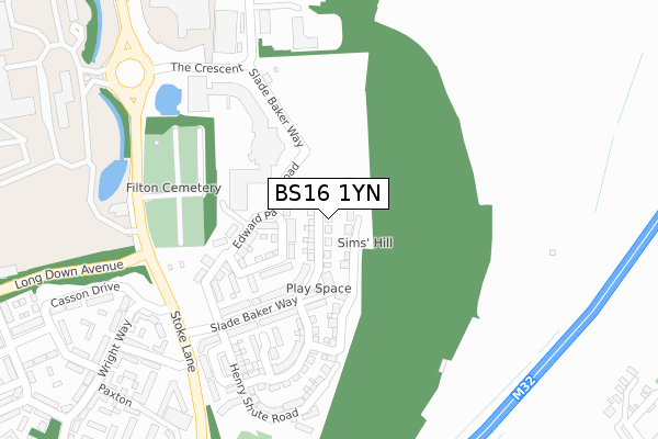
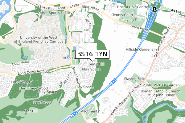
BS16 1YN maps


Source: OS Open Zoomstack (Ordnance Survey)
Licence: Open Government Licence (requires attribution)
Attribution: Contains OS data © Crown copyright and database right 2025
Source: Open Postcode GeoLicence: Open Government Licence (requires attribution)
Attribution: Contains OS data © Crown copyright and database right 2025; Contains Royal Mail data © Royal Mail copyright and database right 2025; Source: Office for National Statistics licensed under the Open Government Licence v.3.0
BS16 1YN geodata
| Easting | 362597 |
| Northing | 177905 |
| Latitude | 51.498836 |
| Longitude | -2.540214 |
Where is BS16 1YN?
| Country | England |
| Postcode District | BS16 |
Politics
| Ward | Stoke Park & Cheswick |
|---|
| Constituency | Filton And Bradley Stoke |
|---|
Transport
Nearest bus stops to BS16 1YN
| Stoke Park | Frenchay | 303m |
| Stoke Park (Coldharbour Lane) | Frenchay | 312m |
| Frenchay Campus | Frenchay | 398m |
| Frenchay Campus | Frenchay | 407m |
| The Gardens | Harry Stoke | 411m |
Nearest railway stations to BS16 1YN
| Bristol Parkway Station | 1.7km |
| Filton Abbey Wood Station | 1.7km |
| Patchway Station | 3.4km |
Broadband
Broadband access in BS16 1YN (2020 data)
| Percentage of properties with Next Generation Access | 100.0% |
| Percentage of properties with Superfast Broadband | 100.0% |
| Percentage of properties with Ultrafast Broadband | 100.0% |
| Percentage of properties with Full Fibre Broadband | 100.0% |
Superfast Broadband is between 30Mbps and 300Mbps
Ultrafast Broadband is > 300Mbps
Broadband limitations in BS16 1YN (2020 data)
| Percentage of properties unable to receive 2Mbps | 0.0% |
| Percentage of properties unable to receive 5Mbps | 0.0% |
| Percentage of properties unable to receive 10Mbps | 0.0% |
| Percentage of properties unable to receive 30Mbps | 0.0% |
Deprivation
18.8% of English postcodes are less deprived than
BS16 1YN:
Food Standards Agency
Three nearest food hygiene ratings to BS16 1YN (metres)
Your Village Shop
Stoke Gifford Retirement Village
152m
Babcock Bristol Park
Bristol Business Park
325m
Ecct - Stoke Gifford Village
➜ Get more ratings from the Food Standards Agency
Nearest post box to BS16 1YN
| | Last Collection | |
|---|
| Location | Mon-Fri | Sat | Distance |
|---|
| Cold Harbour Lane | 17:45 | 07:00 | 346m |
| Jellicoe Avenue | 16:00 | 07:15 | 530m |
| Filton Road | 17:30 | 09:30 | 646m |
BS16 1YN ITL and BS16 1YN LAU
The below table lists the International Territorial Level (ITL) codes (formerly Nomenclature of Territorial Units for Statistics (NUTS) codes) and Local Administrative Units (LAU) codes for BS16 1YN:
| ITL 1 Code | Name |
|---|
| TLK | South West (England) |
| ITL 2 Code | Name |
|---|
| TLK1 | Gloucestershire, Wiltshire and Bath/Bristol area |
| ITL 3 Code | Name |
|---|
| TLK12 | Bath and North East Somerset, North Somerset and South Gloucestershire |
| LAU 1 Code | Name |
|---|
| E06000025 | South Gloucestershire |
BS16 1YN census areas
The below table lists the Census Output Area (OA), Lower Layer Super Output Area (LSOA), and Middle Layer Super Output Area (MSOA) for BS16 1YN:
| Code | Name |
|---|
| OA | E00173036 | |
|---|
| LSOA | E01033333 | South Gloucestershire 017F |
|---|
| MSOA | E02003106 | South Gloucestershire 017 |
|---|
Nearest postcodes to BS16 1YN


