BS16 1WY maps, stats, and open data
BS16 1WY is located in the Stoke Park & Cheswick electoral ward, within the unitary authority of South Gloucestershire and the English Parliamentary constituency of Filton and Bradley Stoke. The Sub Integrated Care Board (ICB) Location is NHS Bristol, North Somerset and South Gloucestershire ICB - 15C and the police force is Avon and Somerset. This postcode has been in use since January 2018.
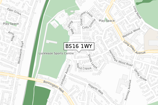
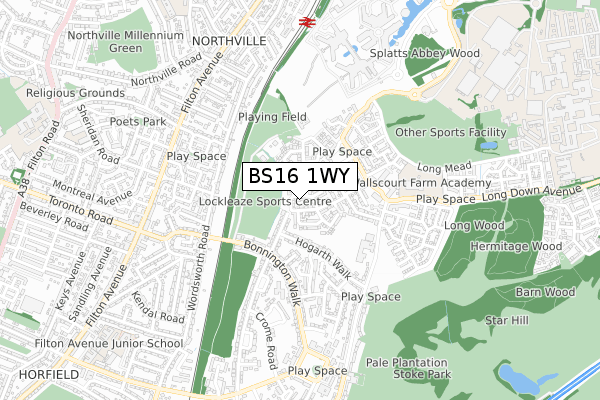
BS16 1WY maps


Licence: Open Government Licence (requires attribution)
Attribution: Contains OS data © Crown copyright and database right 2025
Source: Open Postcode Geo
Licence: Open Government Licence (requires attribution)
Attribution: Contains OS data © Crown copyright and database right 2025; Contains Royal Mail data © Royal Mail copyright and database right 2025; Source: Office for National Statistics licensed under the Open Government Licence v.3.0
BS16 1WY geodata
| Easting | 360932 |
| Northing | 177671 |
| Latitude | 51.496619 |
| Longitude | -2.564173 |
Where is BS16 1WY?
| Country | England |
| Postcode District | BS16 |
Politics
| Ward | Stoke Park & Cheswick |
|---|---|
| Constituency | Filton And Bradley Stoke |
House Prices
Sales of detached houses in BS16 1WY
43, HONEY PENS CRESCENT, STOKE GIFFORD, BRISTOL, BS16 1WY 2019 14 NOV £399,995 |
45, HONEY PENS CRESCENT, STOKE GIFFORD, BRISTOL, BS16 1WY 2019 25 SEP £449,995 |
36, HONEY PENS CRESCENT, STOKE GIFFORD, BRISTOL, BS16 1WY 2019 20 SEP £492,995 |
34, HONEY PENS CRESCENT, STOKE GIFFORD, BRISTOL, BS16 1WY 2019 23 AUG £489,995 |
31, HONEY PENS CRESCENT, STOKE GIFFORD, BRISTOL, BS16 1WY 2019 26 JUL £449,995 |
29, HONEY PENS CRESCENT, STOKE GIFFORD, BRISTOL, BS16 1WY 2019 26 JUL £421,995 |
28, HONEY PENS CRESCENT, STOKE GIFFORD, BRISTOL, BS16 1WY 2019 17 JUN £419,995 |
23, HONEY PENS CRESCENT, STOKE GIFFORD, BRISTOL, BS16 1WY 2018 25 MAY £494,995 |
11, HONEY PENS CRESCENT, STOKE GIFFORD, BRISTOL, BS16 1WY 2018 25 MAY £383,995 |
4, HONEY PENS CRESCENT, STOKE GIFFORD, BRISTOL, BS16 1WY 2018 23 FEB £459,995 |
Licence: Contains HM Land Registry data © Crown copyright and database right 2025. This data is licensed under the Open Government Licence v3.0.
Transport
Nearest bus stops to BS16 1WY
| Eastlake Close (Bonnington Walk) | Lockleaze | 272m |
| Stothard Road (Bonnington Walk) | Lockleaze | 362m |
| Hogarth Walk (Romney Avenue) | Lockleaze | 381m |
| Stothard Road (Bonnington Walk) | Lockleaze | 397m |
| Hogarth Walk (Romney Avenue) | Lockleaze | 428m |
Nearest railway stations to BS16 1WY
| Filton Abbey Wood Station | 0.9km |
| Bristol Parkway Station | 2.4km |
| Stapleton Road Station | 3.2km |
Broadband
Broadband access in BS16 1WY (2020 data)
| Percentage of properties with Next Generation Access | 100.0% |
| Percentage of properties with Superfast Broadband | 100.0% |
| Percentage of properties with Ultrafast Broadband | 100.0% |
| Percentage of properties with Full Fibre Broadband | 100.0% |
Superfast Broadband is between 30Mbps and 300Mbps
Ultrafast Broadband is > 300Mbps
Broadband limitations in BS16 1WY (2020 data)
| Percentage of properties unable to receive 2Mbps | 0.0% |
| Percentage of properties unable to receive 5Mbps | 0.0% |
| Percentage of properties unable to receive 10Mbps | 0.0% |
| Percentage of properties unable to receive 30Mbps | 0.0% |
Deprivation
17.3% of English postcodes are less deprived than BS16 1WY:Food Standards Agency
Three nearest food hygiene ratings to BS16 1WY (metres)


➜ Get more ratings from the Food Standards Agency
Nearest post box to BS16 1WY
| Last Collection | |||
|---|---|---|---|
| Location | Mon-Fri | Sat | Distance |
| Bonnington Walk | 17:00 | 12:15 | 272m |
| Lockleaze Post Office | 17:00 | 12:15 | 655m |
| Filton Ave Post Office | 17:00 | 12:45 | 706m |
BS16 1WY ITL and BS16 1WY LAU
The below table lists the International Territorial Level (ITL) codes (formerly Nomenclature of Territorial Units for Statistics (NUTS) codes) and Local Administrative Units (LAU) codes for BS16 1WY:
| ITL 1 Code | Name |
|---|---|
| TLK | South West (England) |
| ITL 2 Code | Name |
| TLK1 | Gloucestershire, Wiltshire and Bath/Bristol area |
| ITL 3 Code | Name |
| TLK12 | Bath and North East Somerset, North Somerset and South Gloucestershire |
| LAU 1 Code | Name |
| E06000025 | South Gloucestershire |
BS16 1WY census areas
The below table lists the Census Output Area (OA), Lower Layer Super Output Area (LSOA), and Middle Layer Super Output Area (MSOA) for BS16 1WY:
| Code | Name | |
|---|---|---|
| OA | E00173041 | |
| LSOA | E01033331 | South Gloucestershire 017E |
| MSOA | E02003106 | South Gloucestershire 017 |
Nearest postcodes to BS16 1WY
| BS16 1FG | Cow Barton | 137m |
| BS7 9YT | Landseer Avenue | 157m |
| BS16 1FD | Long Wood Road | 168m |
| BS7 9YS | Landseer Avenue | 186m |
| BS7 9XS | Hogarth Walk | 241m |
| BS16 1FH | Horse Leaze Road | 243m |
| BS7 9XQ | Eastlake Close | 251m |
| BS7 9XF | Bonnington Walk | 268m |
| BS7 9XR | Hogarth Walk | 271m |
| BS16 1BF | Hermitage Wood Road | 281m |