BR2 9UY maps, stats, and open data
- Home
- Postcode
- BR
- BR2
- BR2 9
BR2 9UY is located in the Bromley Town electoral ward, within the London borough of Bromley and the English Parliamentary constituency of Bromley and Chislehurst. The Sub Integrated Care Board (ICB) Location is NHS South East London ICB - 72Q and the police force is Metropolitan Police. This postcode has been in use since November 2018.
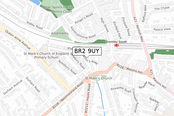
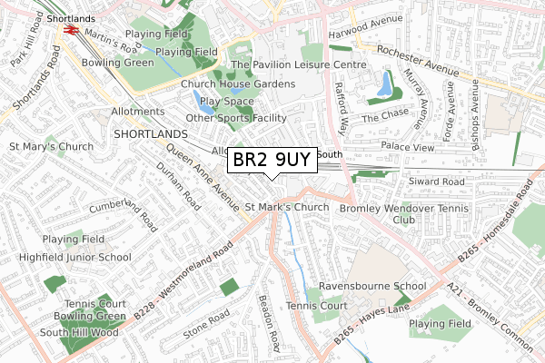
BR2 9UY maps


Source: OS Open Zoomstack (Ordnance Survey)
Licence: Open Government Licence (requires attribution)
Attribution: Contains OS data © Crown copyright and database right 2025
Source: Open Postcode GeoLicence: Open Government Licence (requires attribution)
Attribution: Contains OS data © Crown copyright and database right 2025; Contains Royal Mail data © Royal Mail copyright and database right 2025; Source: Office for National Statistics licensed under the Open Government Licence v.3.0
BR2 9UY geodata
| Easting | 540264 |
| Northing | 168639 |
| Latitude | 51.399449 |
| Longitude | 0.014960 |
Where is BR2 9UY?
| Country | England |
| Postcode District | BR2 |
Politics
| Ward | Bromley Town |
|---|
| Constituency | Bromley And Chislehurst |
|---|
Transport
Nearest bus stops to BR2 9UY
| St Mark's Church (Westmoreland Road) | Bromley | 120m |
| St Mark's Church | Bromley | 131m |
| St Mark's Church | Bromley | 138m |
| Bromley South Station (Bromley High Street) | Bromley | 163m |
| Queen Anne Avenue (Westmoreland Road) | Bromley | 171m |
Nearest railway stations to BR2 9UY
| Bromley South Station | 0.2km |
| Bromley North Station | 1km |
| Shortlands Station | 1.2km |
Broadband
Broadband access in BR2 9UY (2020 data)
| Percentage of properties with Next Generation Access | 100.0% |
| Percentage of properties with Superfast Broadband | 100.0% |
| Percentage of properties with Ultrafast Broadband | 0.0% |
| Percentage of properties with Full Fibre Broadband | 0.0% |
Superfast Broadband is between 30Mbps and 300Mbps
Ultrafast Broadband is > 300Mbps
Broadband limitations in BR2 9UY (2020 data)
| Percentage of properties unable to receive 2Mbps | 0.0% |
| Percentage of properties unable to receive 5Mbps | 0.0% |
| Percentage of properties unable to receive 10Mbps | 0.0% |
| Percentage of properties unable to receive 30Mbps | 0.0% |
Deprivation
24.6% of English postcodes are less deprived than
BR2 9UY:
Food Standards Agency
Three nearest food hygiene ratings to BR2 9UY (metres)
Vue Cinema
Premier Inn / Thyme Restaurant
Nando's
➜ Get more ratings from the Food Standards Agency
Nearest post box to BR2 9UY
| | Last Collection | |
|---|
| Location | Mon-Fri | Sat | Distance |
|---|
| Westmorland Place | 18:30 | 12:00 | 141m |
| Westmorland Road (Lower 32) | 18:15 | 12:00 | 186m |
| Bromley South Station | 18:30 | 12:00 | 189m |
BR2 9UY ITL and BR2 9UY LAU
The below table lists the International Territorial Level (ITL) codes (formerly Nomenclature of Territorial Units for Statistics (NUTS) codes) and Local Administrative Units (LAU) codes for BR2 9UY:
| ITL 1 Code | Name |
|---|
| TLI | London |
| ITL 2 Code | Name |
|---|
| TLI6 | Outer London - South |
| ITL 3 Code | Name |
|---|
| TLI61 | Bromley |
| LAU 1 Code | Name |
|---|
| E09000006 | Bromley |
BR2 9UY census areas
The below table lists the Census Output Area (OA), Lower Layer Super Output Area (LSOA), and Middle Layer Super Output Area (MSOA) for BR2 9UY:
| Code | Name |
|---|
| OA | E00003264 | |
|---|
| LSOA | E01000675 | Bromley 018B |
|---|
| MSOA | E02000144 | Bromley 018 |
|---|
Nearest postcodes to BR2 9UY


