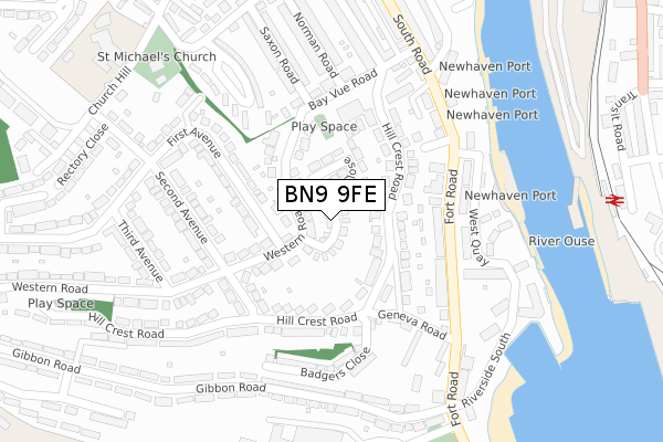
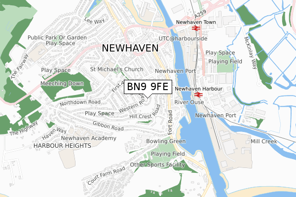
BN9 9FE is located in the Newhaven South electoral ward, within the local authority district of Lewes and the English Parliamentary constituency of Lewes. The Sub Integrated Care Board (ICB) Location is NHS Sussex ICB - 97R and the police force is Sussex. This postcode has been in use since April 2020.


GetTheData
Source: OS Open Zoomstack (Ordnance Survey)
Licence: Open Government Licence (requires attribution)
Attribution: Contains OS data © Crown copyright and database right 2025
Source: Open Postcode Geo
Licence: Open Government Licence (requires attribution)
Attribution: Contains OS data © Crown copyright and database right 2025; Contains Royal Mail data © Royal Mail copyright and database right 2025; Source: Office for National Statistics licensed under the Open Government Licence v.3.0
| Easting | 544522 |
| Northing | 100874 |
| Latitude | 50.789422 |
| Longitude | 0.049032 |
GetTheData
Source: Open Postcode Geo
Licence: Open Government Licence
| Country | England |
| Postcode District | BN9 |
➜ See where BN9 is on a map ➜ Where is Newhaven? | |
GetTheData
Source: Land Registry Price Paid Data
Licence: Open Government Licence
| Ward | Newhaven South |
| Constituency | Lewes |
GetTheData
Source: ONS Postcode Database
Licence: Open Government Licence
22, GRAYS CRESCENT, NEWHAVEN, BN9 9FE 2022 6 JUL £375,000 |
6, GRAYS CRESCENT, NEWHAVEN, BN9 9FE 2021 25 NOV £385,000 |
11, GRAYS CRESCENT, NEWHAVEN, BN9 9FE 2021 12 NOV £349,950 |
10, GRAYS CRESCENT, NEWHAVEN, BN9 9FE 2021 6 SEP £375,000 |
9, GRAYS CRESCENT, NEWHAVEN, BN9 9FE 2021 3 JUN £399,950 |
8, GRAYS CRESCENT, NEWHAVEN, BN9 9FE 2021 7 APR £380,000 |
7, GRAYS CRESCENT, NEWHAVEN, BN9 9FE 2021 19 MAR £375,000 |
20, GRAYS CRESCENT, NEWHAVEN, BN9 9FE 2020 12 OCT £362,500 |
3, GRAYS CRESCENT, NEWHAVEN, BN9 9FE 2020 24 SEP £384,950 |
1, GRAYS CRESCENT, NEWHAVEN, BN9 9FE 2020 31 MAR £405,000 |
GetTheData
Source: HM Land Registry Price Paid Data
Licence: Contains HM Land Registry data © Crown copyright and database right 2025. This data is licensed under the Open Government Licence v3.0.
| Fort Road | Newhaven | 176m |
| Second Avenue | Newhaven | 177m |
| Hillcrest Centre (Bay Vue Road) | Newhaven | 275m |
| Second Avenue North End (Second Avenue) | Newhaven | 278m |
| Gibbon Road Bottom (Gibbon Road) | Newhaven | 299m |
| Newhaven Harbour Station | 0.4km |
| Newhaven Town Station | 0.7km |
| Bishopstone Station | 2.6km |
GetTheData
Source: NaPTAN
Licence: Open Government Licence
GetTheData
Source: ONS Postcode Database
Licence: Open Government Licence


➜ Get more ratings from the Food Standards Agency
GetTheData
Source: Food Standards Agency
Licence: FSA terms & conditions
| Last Collection | |||
|---|---|---|---|
| Location | Mon-Fri | Sat | Distance |
| Western Road | 17:30 | 12:00 | 88m |
| Hillcrest Road | 17:30 | 12:00 | 109m |
| Fort Road | 17:15 | 12:00 | 356m |
GetTheData
Source: Dracos
Licence: Creative Commons Attribution-ShareAlike
The below table lists the International Territorial Level (ITL) codes (formerly Nomenclature of Territorial Units for Statistics (NUTS) codes) and Local Administrative Units (LAU) codes for BN9 9FE:
| ITL 1 Code | Name |
|---|---|
| TLJ | South East (England) |
| ITL 2 Code | Name |
| TLJ2 | Surrey, East and West Sussex |
| ITL 3 Code | Name |
| TLJ22 | East Sussex CC |
| LAU 1 Code | Name |
| E07000063 | Lewes |
GetTheData
Source: ONS Postcode Directory
Licence: Open Government Licence
The below table lists the Census Output Area (OA), Lower Layer Super Output Area (LSOA), and Middle Layer Super Output Area (MSOA) for BN9 9FE:
| Code | Name | |
|---|---|---|
| OA | E00106893 | |
| LSOA | E01021045 | Lewes 008A |
| MSOA | E02004386 | Lewes 008 |
GetTheData
Source: ONS Postcode Directory
Licence: Open Government Licence
| BN9 9JR | Western Road | 68m |
| BN9 9HS | Western Road | 90m |
| BN9 9EB | Brooks Close | 96m |
| BN9 9EE | Hillcrest Road | 112m |
| BN9 9EG | Hillcrest Road | 117m |
| BN9 9JS | Western Road | 129m |
| BN9 9DP | Geneva Road | 159m |
| BN9 9HR | Second Avenue | 173m |
| BN9 9EJ | Fort Road | 175m |
| BN9 9HT | First Avenue | 180m |
GetTheData
Source: Open Postcode Geo; Land Registry Price Paid Data
Licence: Open Government Licence