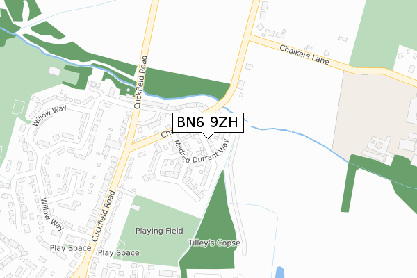
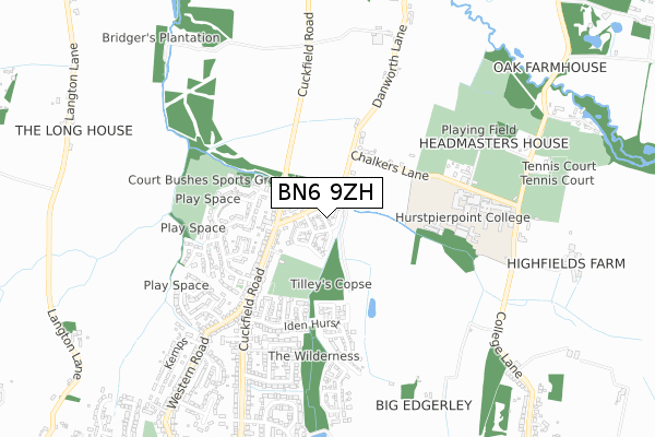
BN6 9ZH is located in the Hassocks electoral ward, within the local authority district of Mid Sussex and the English Parliamentary constituency of Arundel and South Downs. The Sub Integrated Care Board (ICB) Location is NHS Sussex ICB - 70F and the police force is Sussex. This postcode has been in use since March 2019.


GetTheData
Source: OS Open Zoomstack (Ordnance Survey)
Licence: Open Government Licence (requires attribution)
Attribution: Contains OS data © Crown copyright and database right 2025
Source: Open Postcode Geo
Licence: Open Government Licence (requires attribution)
Attribution: Contains OS data © Crown copyright and database right 2025; Contains Royal Mail data © Royal Mail copyright and database right 2025; Source: Office for National Statistics licensed under the Open Government Licence v.3.0
| Easting | 529965 |
| Northing | 115857 |
| Latitude | 50.927530 |
| Longitude | -0.152056 |
GetTheData
Source: Open Postcode Geo
Licence: Open Government Licence
| Country | England |
| Postcode District | BN6 |
➜ See where BN6 is on a map ➜ Where is Hassocks? | |
GetTheData
Source: Land Registry Price Paid Data
Licence: Open Government Licence
| Ward | Hassocks |
| Constituency | Arundel And South Downs |
GetTheData
Source: ONS Postcode Database
Licence: Open Government Licence
45, HASSOCKS GATE, HASSOCKS, BN6 9ZH 2019 29 NOV £524,995 |
3, HASSOCKS GATE, HASSOCKS, BN6 9ZH 2019 10 MAY £499,995 |
1, HASSOCKS GATE, HASSOCKS, BN6 9ZH 2019 29 MAR £499,995 |
GetTheData
Source: HM Land Registry Price Paid Data
Licence: Contains HM Land Registry data © Crown copyright and database right 2025. This data is licensed under the Open Government Licence v3.0.
| Little Copse Road (London Road) | Hassocks | 257m |
| Stone Pound (London Road) | Hassocks | 269m |
| Stone Pound (Hurst Road) | Hassocks | 364m |
| Stone Pound (Keymer Road) | Hassocks | 365m |
| Little Copse Road | Hassocks | 366m |
| Hassocks Station | 0.5km |
| Burgess Hill Station | 3.4km |
| Wivelsfield Station | 4.6km |
GetTheData
Source: NaPTAN
Licence: Open Government Licence
| Percentage of properties with Next Generation Access | 100.0% |
| Percentage of properties with Superfast Broadband | 100.0% |
| Percentage of properties with Ultrafast Broadband | 47.9% |
| Percentage of properties with Full Fibre Broadband | 47.9% |
Superfast Broadband is between 30Mbps and 300Mbps
Ultrafast Broadband is > 300Mbps
| Percentage of properties unable to receive 2Mbps | 0.0% |
| Percentage of properties unable to receive 5Mbps | 0.0% |
| Percentage of properties unable to receive 10Mbps | 0.0% |
| Percentage of properties unable to receive 30Mbps | 0.0% |
GetTheData
Source: Ofcom
Licence: Ofcom Terms of Use (requires attribution)
GetTheData
Source: ONS Postcode Database
Licence: Open Government Licence


➜ Get more ratings from the Food Standards Agency
GetTheData
Source: Food Standards Agency
Licence: FSA terms & conditions
| Last Collection | |||
|---|---|---|---|
| Location | Mon-Fri | Sat | Distance |
| Little Copse Road | 17:30 | 12:30 | 351m |
| Stonepound | 18:00 | 12:30 | 371m |
| Railway Station | 17:45 | 12:30 | 537m |
GetTheData
Source: Dracos
Licence: Creative Commons Attribution-ShareAlike
The below table lists the International Territorial Level (ITL) codes (formerly Nomenclature of Territorial Units for Statistics (NUTS) codes) and Local Administrative Units (LAU) codes for BN6 9ZH:
| ITL 1 Code | Name |
|---|---|
| TLJ | South East (England) |
| ITL 2 Code | Name |
| TLJ2 | Surrey, East and West Sussex |
| ITL 3 Code | Name |
| TLJ28 | West Sussex (North East) |
| LAU 1 Code | Name |
| E07000228 | Mid Sussex |
GetTheData
Source: ONS Postcode Directory
Licence: Open Government Licence
The below table lists the Census Output Area (OA), Lower Layer Super Output Area (LSOA), and Middle Layer Super Output Area (MSOA) for BN6 9ZH:
| Code | Name | |
|---|---|---|
| OA | E00161872 | |
| LSOA | E01031744 | Mid Sussex 017A |
| MSOA | E02006620 | Mid Sussex 017 |
GetTheData
Source: ONS Postcode Directory
Licence: Open Government Licence
| BN6 9NT | London Road | 123m |
| BN6 9NY | London Road | 168m |
| BN6 8PR | Stonepound Road | 174m |
| BN6 8JN | Stanford Close | 186m |
| BN6 8PP | Stonepound Road | 213m |
| BN6 8NW | Pine Trees | 232m |
| BN6 8PJ | Farm Close | 257m |
| BN6 8JS | North Court | 261m |
| BN6 8JT | Pine Trees | 280m |
| BN6 8PN | Stonepound Road | 291m |
GetTheData
Source: Open Postcode Geo; Land Registry Price Paid Data
Licence: Open Government Licence