Property/Postcode Data Search:
BN5 0FB maps, stats, and open data
BN5 0FB is located in the Henfield electoral ward, within the local authority district of Horsham and the English Parliamentary constituency of Arundel and South Downs. The Sub Integrated Care Board (ICB) Location is NHS Sussex ICB - 70F and the police force is Sussex. This postcode has been in use since December 2018.
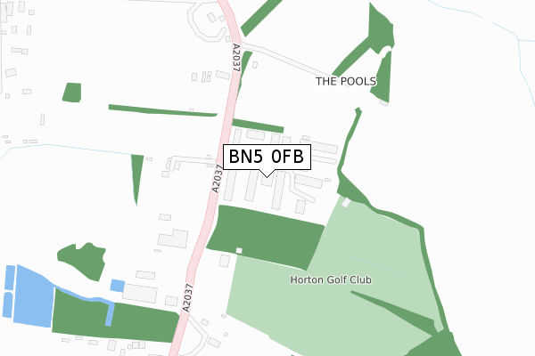
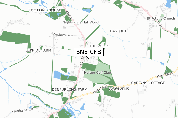
BN5 0FB maps


Source: OS Open Zoomstack (Ordnance Survey)
Licence: Open Government Licence (requires attribution)
Attribution: Contains OS data © Crown copyright and database right 2025
Source: Open Postcode Geo
Licence: Open Government Licence (requires attribution)
Attribution: Contains OS data © Crown copyright and database right 2025; Contains Royal Mail data © Royal Mail copyright and database right 2025; Source: Office for National Statistics licensed under the Open Government Licence v.3.0
Licence: Open Government Licence (requires attribution)
Attribution: Contains OS data © Crown copyright and database right 2025
Source: Open Postcode Geo
Licence: Open Government Licence (requires attribution)
Attribution: Contains OS data © Crown copyright and database right 2025; Contains Royal Mail data © Royal Mail copyright and database right 2025; Source: Office for National Statistics licensed under the Open Government Licence v.3.0
BN5 0FB geodata
| Easting | 522090 |
| Northing | 114406 |
| Latitude | 50.916207 |
| Longitude | -0.264540 |
Where is BN5 0FB?
| Country | England |
| Postcode District | BN5 |
Politics
| Ward | Henfield |
|---|---|
| Constituency | Arundel And South Downs |
Transport
Nearest bus stops to BN5 0FB
| Business Park (A2037) | Henfield | 90m |
| Business Park (B2037) | Henfield | 108m |
| Woods Mill (Shoreham Road) | Henfield | 684m |
| Woods Mill (Shoreham Road) | Henfield | 724m |
| Broadmare Farm (A2037) | Henfield | 860m |
Deprivation
4.4% of English postcodes are less deprived than BN5 0FB:Food Standards Agency
Three nearest food hygiene ratings to BN5 0FB (metres)
Goldstone Rum

Unit 43 Henfield Business Park
60m
Bakehouse76

Bakehouse76
60m
Roasted Coffee Limited
Roasted Coffee Limited
60m
➜ Get more ratings from the Food Standards Agency
Nearest post box to BN5 0FB
| Last Collection | |||
|---|---|---|---|
| Location | Mon-Fri | Sat | Distance |
| Edburton Farm | 16:00 | 07:15 | 3,286m |
| Horsebridge Common | 16:30 | 09:00 | 4,098m |
| Fountain (Ashurst) | 16:45 | 09:00 | 4,477m |
BN5 0FB ITL and BN5 0FB LAU
The below table lists the International Territorial Level (ITL) codes (formerly Nomenclature of Territorial Units for Statistics (NUTS) codes) and Local Administrative Units (LAU) codes for BN5 0FB:
| ITL 1 Code | Name |
|---|---|
| TLJ | South East (England) |
| ITL 2 Code | Name |
| TLJ2 | Surrey, East and West Sussex |
| ITL 3 Code | Name |
| TLJ28 | West Sussex (North East) |
| LAU 1 Code | Name |
| E07000227 | Horsham |
BN5 0FB census areas
The below table lists the Census Output Area (OA), Lower Layer Super Output Area (LSOA), and Middle Layer Super Output Area (MSOA) for BN5 0FB:
| Code | Name | |
|---|---|---|
| OA | E00161359 | |
| LSOA | E01031641 | Horsham 014B |
| MSOA | E02006601 | Horsham 014 |
Nearest postcodes to BN5 0FB
| BN5 9SL | The Henfield Business Park | 46m |
| BN5 9SE | Shoreham Road | 205m |
| BN5 9SD | Shoreham Road | 507m |
| BN5 9SJ | New Barn Lane | 589m |
| BN5 9SA | Horn Lane | 591m |
| BN5 9SB | Oreham Common | 837m |
| BN5 9SQ | Broadmere Common | 859m |
| BN5 9SU | Brighton Road | 945m |
| BN5 9RT | Brighton Road | 952m |
| BN5 9RR | Brighton Road | 1002m |