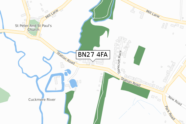
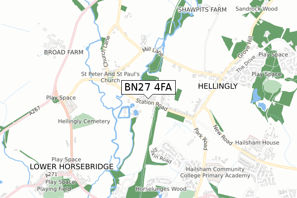
BN27 4FA is located in the Hellingly electoral ward, within the local authority district of Wealden and the English Parliamentary constituency of Wealden. The Sub Integrated Care Board (ICB) Location is NHS Sussex ICB - 97R and the police force is Sussex. This postcode has been in use since August 2017.


GetTheData
Source: OS Open Zoomstack (Ordnance Survey)
Licence: Open Government Licence (requires attribution)
Attribution: Contains OS data © Crown copyright and database right 2025
Source: Open Postcode Geo
Licence: Open Government Licence (requires attribution)
Attribution: Contains OS data © Crown copyright and database right 2025; Contains Royal Mail data © Royal Mail copyright and database right 2025; Source: Office for National Statistics licensed under the Open Government Licence v.3.0
| Easting | 558412 |
| Northing | 112110 |
| Latitude | 50.886759 |
| Longitude | 0.250791 |
GetTheData
Source: Open Postcode Geo
Licence: Open Government Licence
| Country | England |
| Postcode District | BN27 |
➜ See where BN27 is on a map ➜ Where is Hellingly? | |
GetTheData
Source: Land Registry Price Paid Data
Licence: Open Government Licence
| Ward | Hellingly |
| Constituency | Wealden |
GetTheData
Source: ONS Postcode Database
Licence: Open Government Licence
7, THE MARTLETS, HELLINGLY, HAILSHAM, BN27 4FA 2019 18 JUL £665,000 |
9, THE MARTLETS, HELLINGLY, HAILSHAM, BN27 4FA 2018 17 DEC £685,000 |
24, THE MARTLETS, HELLINGLY, HAILSHAM, BN27 4FA 2018 23 AUG £695,000 |
16, THE MARTLETS, HELLINGLY, HAILSHAM, BN27 4FA 2017 18 AUG £319,500 |
GetTheData
Source: HM Land Registry Price Paid Data
Licence: Contains HM Land Registry data © Crown copyright and database right 2025. This data is licensed under the Open Government Licence v3.0.
| Roebuck Park (Park Road) | Hellingly | 602m |
| Roebuck Park (Park Road) | Hellingly | 605m |
| Chichester Road (The Drive) | Hellingly | 668m |
| Chichester Road (The Drive) | Hellingly | 704m |
| Village Hall (North Street) | Hellingly | 717m |
GetTheData
Source: NaPTAN
Licence: Open Government Licence
| Percentage of properties with Next Generation Access | 100.0% |
| Percentage of properties with Superfast Broadband | 100.0% |
| Percentage of properties with Ultrafast Broadband | 0.0% |
| Percentage of properties with Full Fibre Broadband | 0.0% |
Superfast Broadband is between 30Mbps and 300Mbps
Ultrafast Broadband is > 300Mbps
| Median download speed | 40.0Mbps |
| Average download speed | 44.3Mbps |
| Maximum download speed | 78.12Mbps |
| Median upload speed | 10.0Mbps |
| Average upload speed | 10.6Mbps |
| Maximum upload speed | 19.53Mbps |
| Percentage of properties unable to receive 2Mbps | 0.0% |
| Percentage of properties unable to receive 5Mbps | 0.0% |
| Percentage of properties unable to receive 10Mbps | 0.0% |
| Percentage of properties unable to receive 30Mbps | 0.0% |
GetTheData
Source: Ofcom
Licence: Ofcom Terms of Use (requires attribution)
GetTheData
Source: ONS Postcode Database
Licence: Open Government Licence


➜ Get more ratings from the Food Standards Agency
GetTheData
Source: Food Standards Agency
Licence: FSA terms & conditions
| Last Collection | |||
|---|---|---|---|
| Location | Mon-Fri | Sat | Distance |
| Green Lanes | 16:00 | 08:00 | 411m |
| Hellingly Post Office | 16:00 | 08:45 | 440m |
| Horsebridge Post Office | 16:30 | 11:15 | 897m |
GetTheData
Source: Dracos
Licence: Creative Commons Attribution-ShareAlike
The below table lists the International Territorial Level (ITL) codes (formerly Nomenclature of Territorial Units for Statistics (NUTS) codes) and Local Administrative Units (LAU) codes for BN27 4FA:
| ITL 1 Code | Name |
|---|---|
| TLJ | South East (England) |
| ITL 2 Code | Name |
| TLJ2 | Surrey, East and West Sussex |
| ITL 3 Code | Name |
| TLJ22 | East Sussex CC |
| LAU 1 Code | Name |
| E07000065 | Wealden |
GetTheData
Source: ONS Postcode Directory
Licence: Open Government Licence
The below table lists the Census Output Area (OA), Lower Layer Super Output Area (LSOA), and Middle Layer Super Output Area (MSOA) for BN27 4FA:
| Code | Name | |
|---|---|---|
| OA | E00170896 | |
| LSOA | E01021195 | Wealden 018D |
| MSOA | E02004420 | Wealden 018 |
GetTheData
Source: ONS Postcode Directory
Licence: Open Government Licence
| BN27 4EU | Station Road | 241m |
| BN27 4EY | Mill Lane | 329m |
| BN27 4EZ | Church Path | 397m |
| BN27 4ET | Swingate Cross | 436m |
| BN27 4HA | Church Lane | 473m |
| BN27 4HD | Mill Lane | 474m |
| BN27 4HB | Vicarage Lane | 573m |
| BN27 1PB | Park Road | 591m |
| BN27 4EJ | Kiln Close | 688m |
| BN27 1PA | Longfield Cottages | 775m |
GetTheData
Source: Open Postcode Geo; Land Registry Price Paid Data
Licence: Open Government Licence