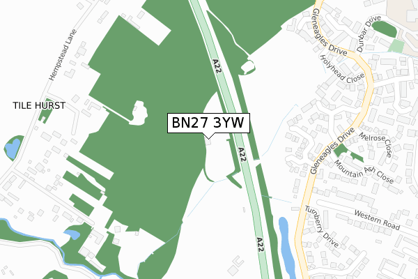
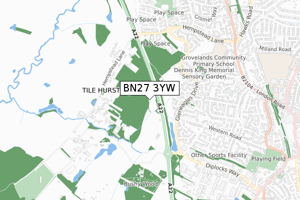
BN27 3YW is located in the Arlington electoral ward, within the local authority district of Wealden and the English Parliamentary constituency of Wealden. The Sub Integrated Care Board (ICB) Location is NHS Sussex ICB - 97R and the police force is Sussex. This postcode has been in use since October 2017.


GetTheData
Source: OS Open Zoomstack (Ordnance Survey)
Licence: Open Government Licence (requires attribution)
Attribution: Contains OS data © Crown copyright and database right 2025
Source: Open Postcode Geo
Licence: Open Government Licence (requires attribution)
Attribution: Contains OS data © Crown copyright and database right 2025; Contains Royal Mail data © Royal Mail copyright and database right 2025; Source: Office for National Statistics licensed under the Open Government Licence v.3.0
| Easting | 557749 |
| Northing | 109822 |
| Latitude | 50.866381 |
| Longitude | 0.240386 |
GetTheData
Source: Open Postcode Geo
Licence: Open Government Licence
| Country | England |
| Postcode District | BN27 |
➜ See where BN27 is on a map | |
GetTheData
Source: Land Registry Price Paid Data
Licence: Open Government Licence
| Ward | Arlington |
| Constituency | Wealden |
GetTheData
Source: ONS Postcode Database
Licence: Open Government Licence
| Woodpecker Drive | Hailsham | 579m |
| The Diplocks | Hailsham | 599m |
| Tilehurst Drive (Forest Way) | Hailsham | 624m |
| Western Road | Hailsham | 674m |
| Forest View (Summerfields Avenue) | Hailsham | 723m |
GetTheData
Source: NaPTAN
Licence: Open Government Licence
GetTheData
Source: ONS Postcode Database
Licence: Open Government Licence


➜ Get more ratings from the Food Standards Agency
GetTheData
Source: Food Standards Agency
Licence: FSA terms & conditions
| Last Collection | |||
|---|---|---|---|
| Location | Mon-Fri | Sat | Distance |
| Hempstead Lane | 16:00 | 07:30 | 544m |
| Gleneagles Drive | 16:30 | 12:00 | 574m |
| Tilehurst Drive | 17:00 | 12:15 | 646m |
GetTheData
Source: Dracos
Licence: Creative Commons Attribution-ShareAlike
The below table lists the International Territorial Level (ITL) codes (formerly Nomenclature of Territorial Units for Statistics (NUTS) codes) and Local Administrative Units (LAU) codes for BN27 3YW:
| ITL 1 Code | Name |
|---|---|
| TLJ | South East (England) |
| ITL 2 Code | Name |
| TLJ2 | Surrey, East and West Sussex |
| ITL 3 Code | Name |
| TLJ22 | East Sussex CC |
| LAU 1 Code | Name |
| E07000065 | Wealden |
GetTheData
Source: ONS Postcode Directory
Licence: Open Government Licence
The below table lists the Census Output Area (OA), Lower Layer Super Output Area (LSOA), and Middle Layer Super Output Area (MSOA) for BN27 3YW:
| Code | Name | |
|---|---|---|
| OA | E00107605 | |
| LSOA | E01021181 | Wealden 016B |
| MSOA | E02004418 | Wealden 016 |
GetTheData
Source: ONS Postcode Directory
Licence: Open Government Licence
| BN27 3UY | St Mellion Close | 219m |
| BN27 3UA | Troon Cottages | 271m |
| BN27 3WB | St Boswells Close | 304m |
| BN27 3WE | Lavender Close | 340m |
| BN27 3UQ | Turnberry Drive | 356m |
| BN27 3PR | Hempstead Lane | 364m |
| BN27 3WD | Holyhead Close | 367m |
| BN27 3XN | Mountain Ash Close | 368m |
| BN27 3EW | Western Road | 384m |
| BN27 3XP | Melrose Close | 407m |
GetTheData
Source: Open Postcode Geo; Land Registry Price Paid Data
Licence: Open Government Licence