BN13 3GL maps, stats, and open data
BN13 3GL is located in the Northbrook electoral ward, within the local authority district of Worthing and the English Parliamentary constituency of Worthing West. The Sub Integrated Care Board (ICB) Location is NHS Sussex ICB - 70F and the police force is Sussex. This postcode has been in use since January 2018.
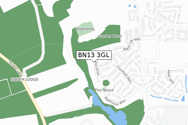
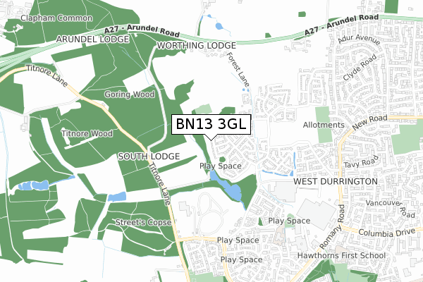
BN13 3GL maps


Licence: Open Government Licence (requires attribution)
Attribution: Contains OS data © Crown copyright and database right 2025
Source: Open Postcode Geo
Licence: Open Government Licence (requires attribution)
Attribution: Contains OS data © Crown copyright and database right 2025; Contains Royal Mail data © Royal Mail copyright and database right 2025; Source: Office for National Statistics licensed under the Open Government Licence v.3.0
BN13 3GL geodata
| Easting | 510502 |
| Northing | 105086 |
| Latitude | 50.834760 |
| Longitude | -0.432132 |
Where is BN13 3GL?
| Country | England |
| Postcode District | BN13 |
Politics
| Ward | Northbrook |
|---|---|
| Constituency | Worthing West |
House Prices
Sales of detached houses in BN13 3GL
2023 17 JUL £587,500 |
2023 9 JAN £430,000 |
2020 25 SEP £410,000 |
2020 1 MAY £420,000 |
46, LOBELIA DRIVE, WORTHING, BN13 3GL 2018 27 APR £374,950 |
38, LOBELIA DRIVE, WORTHING, BN13 3GL 2018 28 MAR £374,950 |
2018 22 MAR £324,950 |
40, LOBELIA DRIVE, WORTHING, BN13 3GL 2018 20 MAR £329,950 |
2018 2 MAR £399,950 |
42, LOBELIA DRIVE, WORTHING, BN13 3GL 2018 28 FEB £334,950 |
Licence: Contains HM Land Registry data © Crown copyright and database right 2025. This data is licensed under the Open Government Licence v3.0.
Transport
Nearest bus stops to BN13 3GL
| Castle Goring Mews (Arundel Road) | Clapham | 592m |
| Castle Goring Mews (Arundel Road) | Clapham | 606m |
| Orkney Court (Carisbrooke Drive) | Durrington | 692m |
| Coach And Horses (Arundel Road) | Clapham | 739m |
| Torridge Close (New Road) | Durrington | 757m |
Nearest railway stations to BN13 3GL
| Goring-by-Sea Station | 1.9km |
| Durrington-on-Sea Station | 2.4km |
| West Worthing Station | 3.3km |
Broadband
Broadband access in BN13 3GL (2020 data)
| Percentage of properties with Next Generation Access | 100.0% |
| Percentage of properties with Superfast Broadband | 100.0% |
| Percentage of properties with Ultrafast Broadband | 100.0% |
| Percentage of properties with Full Fibre Broadband | 100.0% |
Superfast Broadband is between 30Mbps and 300Mbps
Ultrafast Broadband is > 300Mbps
Broadband speed in BN13 3GL (2019 data)
Download
| Median download speed | 360.0Mbps |
| Average download speed | 360.0Mbps |
| Maximum download speed | 360.00Mbps |
Upload
| Median upload speed | 360.0Mbps |
| Average upload speed | 360.0Mbps |
| Maximum upload speed | 360.00Mbps |
Broadband limitations in BN13 3GL (2020 data)
| Percentage of properties unable to receive 2Mbps | 0.0% |
| Percentage of properties unable to receive 5Mbps | 0.0% |
| Percentage of properties unable to receive 10Mbps | 0.0% |
| Percentage of properties unable to receive 30Mbps | 0.0% |
Deprivation
87.7% of English postcodes are less deprived than BN13 3GL:Food Standards Agency
Three nearest food hygiene ratings to BN13 3GL (metres)


➜ Get more ratings from the Food Standards Agency
Nearest post box to BN13 3GL
| Last Collection | |||
|---|---|---|---|
| Location | Mon-Fri | Sat | Distance |
| Tesco | 18:00 | 11:30 | 579m |
| Adur Avenue | 16:30 | 11:30 | 1,075m |
| Buckingham Road | 18:00 | 12:15 | 1,095m |
BN13 3GL ITL and BN13 3GL LAU
The below table lists the International Territorial Level (ITL) codes (formerly Nomenclature of Territorial Units for Statistics (NUTS) codes) and Local Administrative Units (LAU) codes for BN13 3GL:
| ITL 1 Code | Name |
|---|---|
| TLJ | South East (England) |
| ITL 2 Code | Name |
| TLJ2 | Surrey, East and West Sussex |
| ITL 3 Code | Name |
| TLJ27 | West Sussex (South West) |
| LAU 1 Code | Name |
| E07000229 | Worthing |
BN13 3GL census areas
The below table lists the Census Output Area (OA), Lower Layer Super Output Area (LSOA), and Middle Layer Super Output Area (MSOA) for BN13 3GL:
| Code | Name | |
|---|---|---|
| OA | E00162255 | |
| LSOA | E01031819 | Worthing 006E |
| MSOA | E02006626 | Worthing 006 |
Nearest postcodes to BN13 3GL
| BN13 3FD | Forest Barn Mews | 329m |
| BN13 3ST | Rees Close | 479m |
| BN13 3SP | Callon Close | 493m |
| BN13 3SN | Varey Road | 510m |
| BN13 3UD | Castle Goring Mews | 536m |
| BN13 3UN | Castle Goring Way | 538m |
| BN13 3SL | Squadron Drive | 542m |
| BN13 3HL | Hobart Close | 562m |
| BN13 3SW | Essenhigh Drive | 587m |
| BN13 3RT | Titnore Way | 595m |