BN11 3FA maps, stats, and open data
- Home
- Postcode
- BN
- BN11
- BN11 3
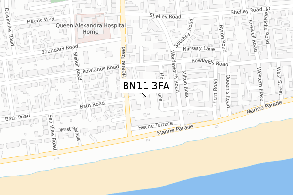
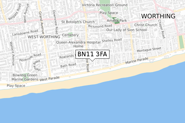
BN11 3FA is located in the Heene electoral ward, within the local authority district of Worthing and the English Parliamentary constituency of Worthing West. The Sub Integrated Care Board (ICB) Location is NHS Sussex ICB - 70F and the police force is Sussex. This postcode has been in use since August 2018.
BN11 3FA maps


Source: OS Open Zoomstack (Ordnance Survey)
Licence: Open Government Licence (requires attribution)
Attribution: Contains OS data © Crown copyright and database right 2025
Source: Open Postcode GeoLicence: Open Government Licence (requires attribution)
Attribution: Contains OS data © Crown copyright and database right 2025; Contains Royal Mail data © Royal Mail copyright and database right 2025; Source: Office for National Statistics licensed under the Open Government Licence v.3.0
BN11 3FA geodata
| Easting | 513953 |
| Northing | 102281 |
| Latitude | 50.808877 |
| Longitude | -0.384017 |
Where is BN11 3FA?
| Country | England |
| Postcode District | BN11 |
Politics
| Ward | Heene |
|---|
| Constituency | Worthing West |
|---|
Transport
Nearest bus stops to BN11 3FA
| Rowlands Road (Heene Road) | West Worthing | 99m |
| Rowlands Road (Heene Road) | West Worthing | 111m |
| Wordsworth Road (Rowlands Road) | Worthing | 125m |
| Wordsworth Road (Rowlands Road) | Worthing | 137m |
| Heene Terrace (Marine Parade) | Worthing | 139m |
Nearest railway stations to BN11 3FA
| Worthing Station | 1.2km |
| West Worthing Station | 1.2km |
| Durrington-on-Sea Station | 2.2km |
Broadband
Broadband access in BN11 3FA (2020 data)
| Percentage of properties with Next Generation Access | 100.0% |
| Percentage of properties with Superfast Broadband | 100.0% |
| Percentage of properties with Ultrafast Broadband | 100.0% |
| Percentage of properties with Full Fibre Broadband | 100.0% |
Superfast Broadband is between 30Mbps and 300Mbps
Ultrafast Broadband is > 300Mbps
Broadband limitations in BN11 3FA (2020 data)
| Percentage of properties unable to receive 2Mbps | 0.0% |
| Percentage of properties unable to receive 5Mbps | 0.0% |
| Percentage of properties unable to receive 10Mbps | 0.0% |
| Percentage of properties unable to receive 30Mbps | 0.0% |
Deprivation
57.9% of English postcodes are less deprived than
BN11 3FA:
Food Standards Agency
Three nearest food hygiene ratings to BN11 3FA (metres)
Caterplus @ McCarthy & Stone Neptune House
1 Neptune House 6 Heene Road
0m
Radish
1 Neptune House 6 Heene Road
0m
Heene Road Service Station
Heene Road Service Station 48 Heene Road
48m
➜ Get more ratings from the Food Standards Agency
Nearest post box to BN11 3FA
| | Last Collection | |
|---|
| Location | Mon-Fri | Sat | Distance |
|---|
| Heene Road Post Office | 17:00 | 12:00 | 89m |
| Heene Terrace | 17:00 | 12:00 | 142m |
| Winchester Road | 16:30 | 11:30 | 406m |
BN11 3FA ITL and BN11 3FA LAU
The below table lists the International Territorial Level (ITL) codes (formerly Nomenclature of Territorial Units for Statistics (NUTS) codes) and Local Administrative Units (LAU) codes for BN11 3FA:
| ITL 1 Code | Name |
|---|
| TLJ | South East (England) |
| ITL 2 Code | Name |
|---|
| TLJ2 | Surrey, East and West Sussex |
| ITL 3 Code | Name |
|---|
| TLJ27 | West Sussex (South West) |
| LAU 1 Code | Name |
|---|
| E07000229 | Worthing |
BN11 3FA census areas
The below table lists the Census Output Area (OA), Lower Layer Super Output Area (LSOA), and Middle Layer Super Output Area (MSOA) for BN11 3FA:
| Code | Name |
|---|
| OA | E00162199 | |
|---|
| LSOA | E01031809 | Worthing 010C |
|---|
| MSOA | E02006630 | Worthing 010 |
|---|
Nearest postcodes to BN11 3FA


