Property/Postcode Data Search:
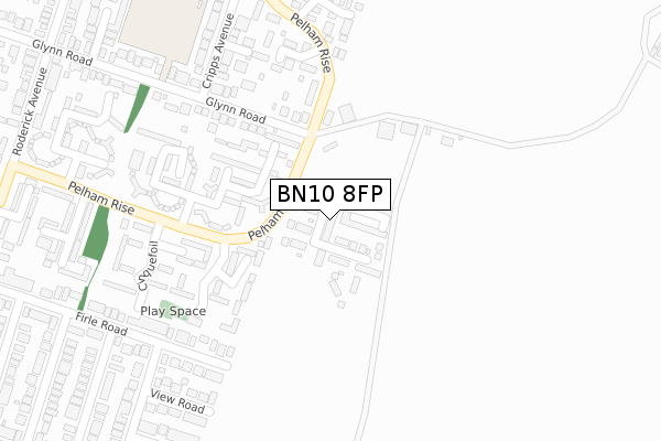
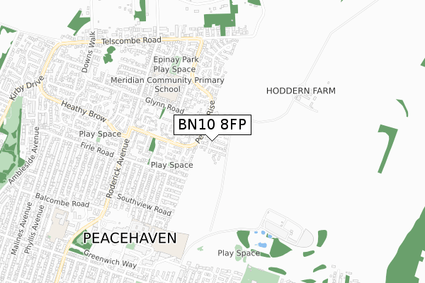
BN10 8FP maps, stats, and open data
BN10 8FP is located in the Peacehaven North electoral ward, within the local authority district of Lewes and the English Parliamentary constituency of Brighton, Kemptown. The Sub Integrated Care Board (ICB) Location is NHS Sussex ICB - 97R and the police force is Sussex. This postcode has been in use since August 2019.
BN10 8FP maps


Source: OS Open Zoomstack (Ordnance Survey)
Licence: Open Government Licence (requires attribution)
Attribution: Contains OS data © Crown copyright and database right 2025
Source: Open Postcode Geo
Licence: Open Government Licence (requires attribution)
Attribution: Contains OS data © Crown copyright and database right 2025; Contains Royal Mail data © Royal Mail copyright and database right 2025; Source: Office for National Statistics licensed under the Open Government Licence v.3.0
Licence: Open Government Licence (requires attribution)
Attribution: Contains OS data © Crown copyright and database right 2025
Source: Open Postcode Geo
Licence: Open Government Licence (requires attribution)
Attribution: Contains OS data © Crown copyright and database right 2025; Contains Royal Mail data © Royal Mail copyright and database right 2025; Source: Office for National Statistics licensed under the Open Government Licence v.3.0
BN10 8FP geodata
| Easting | 541692 |
| Northing | 101887 |
| Latitude | 50.799224 |
| Longitude | 0.009299 |
Where is BN10 8FP?
| Country | England |
| Postcode District | BN10 |
Politics
| Ward | Peacehaven North |
|---|---|
| Constituency | Brighton, Kemptown |
House Prices
Sales of detached houses in BN10 8FP
43, SKYLARK AVENUE, PEACEHAVEN, BN10 8FP 2024 12 JUL £445,000 |
43, SKYLARK AVENUE, PEACEHAVEN, BN10 8FP 2022 14 DEC £500,000 |
53, SKYLARK AVENUE, PEACEHAVEN, BN10 8FP 2022 22 NOV £474,995 |
57, SKYLARK AVENUE, PEACEHAVEN, BN10 8FP 2022 30 AUG £484,995 |
55, SKYLARK AVENUE, PEACEHAVEN, BN10 8FP 2022 29 JUL £469,995 |
51, SKYLARK AVENUE, PEACEHAVEN, BN10 8FP 2022 30 JUN £459,995 |
49, SKYLARK AVENUE, PEACEHAVEN, BN10 8FP 2022 24 JUN £459,995 |
41, SKYLARK AVENUE, PEACEHAVEN, BN10 8FP 2022 25 FEB £454,995 |
43, SKYLARK AVENUE, PEACEHAVEN, BN10 8FP 2022 25 FEB £444,995 |
39, SKYLARK AVENUE, PEACEHAVEN, BN10 8FP 2022 27 JAN £444,995 |
Source: HM Land Registry Price Paid Data
Licence: Contains HM Land Registry data © Crown copyright and database right 2025. This data is licensed under the Open Government Licence v3.0.
Licence: Contains HM Land Registry data © Crown copyright and database right 2025. This data is licensed under the Open Government Licence v3.0.
Transport
Nearest bus stops to BN10 8FP
| Collingwood Close (Pelham Rise) | Peacehaven | 249m |
| Collingwood Close (Pelham Rise) | Peacehaven | 258m |
| Glynn Road (Pelham Rise) | Peacehaven | 315m |
| Glynn Road (Pelham Rise) | Peacehaven | 346m |
| Annexe Shops (Roderick Avenue) | Peacehaven | 525m |
Nearest railway stations to BN10 8FP
| Newhaven Town Station | 3.3km |
| Newhaven Harbour Station | 3.4km |
| Southease Station | 3.9km |
Deprivation
79.8% of English postcodes are less deprived than BN10 8FP:Food Standards Agency
Three nearest food hygiene ratings to BN10 8FP (metres)
Dorothy House

127 Dorothy Avenue North
398m
Wild Monkeys Childcare Ltd

29 Glynn Road
497m
Annexe Stores

123 Roderick Avenue
522m
➜ Get more ratings from the Food Standards Agency
Nearest post box to BN10 8FP
| Last Collection | |||
|---|---|---|---|
| Location | Mon-Fri | Sat | Distance |
| The Annexe | 16:15 | 11:15 | 535m |
| Firle Road | 16:15 | 11:15 | 644m |
| Meridian Centre | 18:15 | 11:45 | 735m |
BN10 8FP ITL and BN10 8FP LAU
The below table lists the International Territorial Level (ITL) codes (formerly Nomenclature of Territorial Units for Statistics (NUTS) codes) and Local Administrative Units (LAU) codes for BN10 8FP:
| ITL 1 Code | Name |
|---|---|
| TLJ | South East (England) |
| ITL 2 Code | Name |
| TLJ2 | Surrey, East and West Sussex |
| ITL 3 Code | Name |
| TLJ22 | East Sussex CC |
| LAU 1 Code | Name |
| E07000063 | Lewes |
BN10 8FP census areas
The below table lists the Census Output Area (OA), Lower Layer Super Output Area (LSOA), and Middle Layer Super Output Area (MSOA) for BN10 8FP:
| Code | Name | |
|---|---|---|
| OA | E00106971 | |
| LSOA | E01021062 | Lewes 010D |
| MSOA | E02004388 | Lewes 010 |
Nearest postcodes to BN10 8FP
| BN10 8PQ | The Bricky | 178m |
| BN10 8BQ | Collingwood Close | 209m |
| BN10 8DD | Firle Road | 223m |
| BN10 8BH | Collingwood Close | 243m |
| BN10 8DE | View Road | 251m |
| BN10 8BG | Collingwood Close | 254m |
| BN10 8DF | Bee Road | 293m |
| BN10 8DZ | Cinque Foil | 311m |
| BN10 8AB | The Sycamores | 314m |
| BN10 8AP | Glynn Road | 320m |