BN1 7AE maps, stats, and open data
- Home
- Postcode
- BN
- BN1
- BN1 7
BN1 7AE is located in the Hollingdean & Fiveways electoral ward, within the unitary authority of Brighton and Hove and the English Parliamentary constituency of Brighton, Pavilion. The Sub Integrated Care Board (ICB) Location is NHS Sussex ICB - 09D and the police force is Sussex. This postcode has been in use since July 2018.
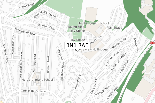
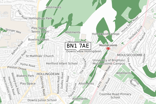
BN1 7AE maps


Source: OS Open Zoomstack (Ordnance Survey)
Licence: Open Government Licence (requires attribution)
Attribution: Contains OS data © Crown copyright and database right 2025
Source: Open Postcode GeoLicence: Open Government Licence (requires attribution)
Attribution: Contains OS data © Crown copyright and database right 2025; Contains Royal Mail data © Royal Mail copyright and database right 2025; Source: Office for National Statistics licensed under the Open Government Licence v.3.0
BN1 7AE geodata
| Easting | 532031 |
| Northing | 106857 |
| Latitude | 50.846172 |
| Longitude | -0.125924 |
Where is BN1 7AE?
| Country | England |
| Postcode District | BN1 |
Politics
| Ward | Hollingdean & Fiveways |
|---|
| Constituency | Brighton, Pavilion |
|---|
Transport
Nearest bus stops to BN1 7AE
| Mountfields (Stephens Road) | Brighton | 104m |
| Lynchet Close (Brentwood Road) | Brighton | 145m |
| Tavistock Down (The Crestway) | Brighton | 274m |
| Brentwood Crescent (Brentwood Road) | Brighton | 394m |
| St Joseph's School (Davey Drive) | Brighton | 400m |
Nearest railway stations to BN1 7AE
| Moulsecoomb Station | 0.5km |
| London Road (Brighton) Station | 1.3km |
| Preston Park Station | 2.1km |
Broadband
Broadband access in BN1 7AE (2020 data)
| Percentage of properties with Next Generation Access | 100.0% |
| Percentage of properties with Superfast Broadband | 100.0% |
| Percentage of properties with Ultrafast Broadband | 100.0% |
| Percentage of properties with Full Fibre Broadband | 0.0% |
Superfast Broadband is between 30Mbps and 300Mbps
Ultrafast Broadband is > 300Mbps
Broadband speed in BN1 7AE (2019 data)
Download
| Median download speed | 46.7Mbps |
| Average download speed | 34.6Mbps |
| Maximum download speed | 53.26Mbps |
Upload
| Median upload speed | 10.0Mbps |
| Average upload speed | 7.0Mbps |
| Maximum upload speed | 10.24Mbps |
Broadband limitations in BN1 7AE (2020 data)
| Percentage of properties unable to receive 2Mbps | 0.0% |
| Percentage of properties unable to receive 5Mbps | 0.0% |
| Percentage of properties unable to receive 10Mbps | 0.0% |
| Percentage of properties unable to receive 30Mbps | 0.0% |
Deprivation
62.9% of English postcodes are less deprived than
BN1 7AE:
Food Standards Agency
Three nearest food hygiene ratings to BN1 7AE (metres)
Hertford Junior School Breakfast Club
Hertford Junior School
136m
Breakfast Club @ Hertford Infant And Nursery School
Hertford Infant School
270m
Hertford HUB Club
Hertford Infant School
270m
➜ Get more ratings from the Food Standards Agency
Nearest post box to BN1 7AE
| | Last Collection | |
|---|
| Location | Mon-Fri | Sat | Distance |
|---|
| Bevendean Avenue | 16:30 | 11:15 | 418m |
| Hollingbury Place P.o. | 17:00 | 12:00 | 422m |
| Dover Road | 16:30 | 10:30 | 663m |
BN1 7AE ITL and BN1 7AE LAU
The below table lists the International Territorial Level (ITL) codes (formerly Nomenclature of Territorial Units for Statistics (NUTS) codes) and Local Administrative Units (LAU) codes for BN1 7AE:
| ITL 1 Code | Name |
|---|
| TLJ | South East (England) |
| ITL 2 Code | Name |
|---|
| TLJ2 | Surrey, East and West Sussex |
| ITL 3 Code | Name |
|---|
| TLJ21 | Brighton and Hove |
| LAU 1 Code | Name |
|---|
| E06000043 | Brighton and Hove |
BN1 7AE census areas
The below table lists the Census Output Area (OA), Lower Layer Super Output Area (LSOA), and Middle Layer Super Output Area (MSOA) for BN1 7AE:
| Code | Name |
|---|
| OA | E00085307 | |
|---|
| LSOA | E01016902 | Brighton and Hove 008B |
|---|
| MSOA | E02003498 | Brighton and Hove 008 |
|---|
Nearest postcodes to BN1 7AE


