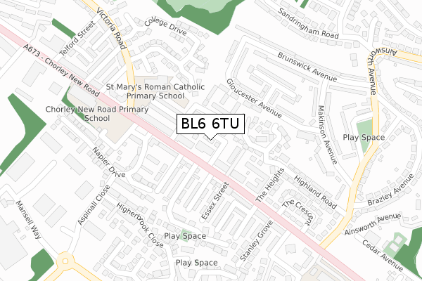
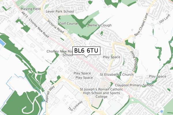
BL6 6TU is located in the Horwich North electoral ward, within the metropolitan district of Bolton and the English Parliamentary constituency of Bolton West. The Sub Integrated Care Board (ICB) Location is NHS Greater Manchester ICB - 00T and the police force is Greater Manchester. This postcode has been in use since October 2017.


GetTheData
Source: OS Open Zoomstack (Ordnance Survey)
Licence: Open Government Licence (requires attribution)
Attribution: Contains OS data © Crown copyright and database right 2025
Source: Open Postcode Geo
Licence: Open Government Licence (requires attribution)
Attribution: Contains OS data © Crown copyright and database right 2025; Contains Royal Mail data © Royal Mail copyright and database right 2025; Source: Office for National Statistics licensed under the Open Government Licence v.3.0
| Easting | 364818 |
| Northing | 410469 |
| Latitude | 53.589629 |
| Longitude | -2.532969 |
GetTheData
Source: Open Postcode Geo
Licence: Open Government Licence
| Country | England |
| Postcode District | BL6 |
➜ See where BL6 is on a map ➜ Where is Horwich? | |
GetTheData
Source: Land Registry Price Paid Data
Licence: Open Government Licence
| Ward | Horwich North |
| Constituency | Bolton West |
GetTheData
Source: ONS Postcode Database
Licence: Open Government Licence
| Chorley New Rd/Panton Street (Chorley New Rd) | Horwich | 96m |
| Chorley New Rd/Mount Street (Chorley New Rd) | Horwich | 104m |
| Gloucester Avenue/Lancaster Avenue (Gloucester Ave) | Horwich | 131m |
| Gloucester Avenue/Lancaster Avenue (Gloucester Ave) | Horwich | 140m |
| Chorley New Rd/Greenbank (Chorley New Rd) | Horwich | 156m |
| Horwich Parkway Station | 1.4km |
| Blackrod Station | 2.4km |
| Lostock Station | 3.2km |
GetTheData
Source: NaPTAN
Licence: Open Government Licence
| Percentage of properties with Next Generation Access | 100.0% |
| Percentage of properties with Superfast Broadband | 100.0% |
| Percentage of properties with Ultrafast Broadband | 0.0% |
| Percentage of properties with Full Fibre Broadband | 0.0% |
Superfast Broadband is between 30Mbps and 300Mbps
Ultrafast Broadband is > 300Mbps
| Median download speed | 43.6Mbps |
| Average download speed | 35.0Mbps |
| Maximum download speed | 60.39Mbps |
| Median upload speed | 10.0Mbps |
| Average upload speed | 9.5Mbps |
| Maximum upload speed | 19.53Mbps |
| Percentage of properties unable to receive 2Mbps | 0.0% |
| Percentage of properties unable to receive 5Mbps | 0.0% |
| Percentage of properties unable to receive 10Mbps | 0.0% |
| Percentage of properties unable to receive 30Mbps | 0.0% |
GetTheData
Source: Ofcom
Licence: Ofcom Terms of Use (requires attribution)
GetTheData
Source: ONS Postcode Database
Licence: Open Government Licence


➜ Get more ratings from the Food Standards Agency
GetTheData
Source: Food Standards Agency
Licence: FSA terms & conditions
| Last Collection | |||
|---|---|---|---|
| Location | Mon-Fri | Sat | Distance |
| Lower Brazeley P O | 17:15 | 12:10 | 33m |
| Chapel Lane Post Office | 17:00 | 11:15 | 1,387m |
| Winter Hey Lane P O | 18:45 | 12:05 | 1,418m |
GetTheData
Source: Dracos
Licence: Creative Commons Attribution-ShareAlike
The below table lists the International Territorial Level (ITL) codes (formerly Nomenclature of Territorial Units for Statistics (NUTS) codes) and Local Administrative Units (LAU) codes for BL6 6TU:
| ITL 1 Code | Name |
|---|---|
| TLD | North West (England) |
| ITL 2 Code | Name |
| TLD3 | Greater Manchester |
| ITL 3 Code | Name |
| TLD36 | Greater Manchester North West |
| LAU 1 Code | Name |
| E08000001 | Bolton |
GetTheData
Source: ONS Postcode Directory
Licence: Open Government Licence
The below table lists the Census Output Area (OA), Lower Layer Super Output Area (LSOA), and Middle Layer Super Output Area (MSOA) for BL6 6TU:
| Code | Name | |
|---|---|---|
| OA | E00024716 | |
| LSOA | E01004886 | Bolton 014C |
| MSOA | E02000997 | Bolton 014 |
GetTheData
Source: ONS Postcode Directory
Licence: Open Government Licence
| BL6 6DX | Mulberry Court | 36m |
| BL6 6JZ | Chorley New Road | 49m |
| BL6 6JY | Dale Street East | 62m |
| BL6 6JX | Craven Street East | 62m |
| BL6 6LD | Mount Pleasant Street | 63m |
| BL6 6PB | Craven Court | 75m |
| BL6 6ES | Chorley New Road | 94m |
| BL6 6PA | Gloucester Court | 120m |
| BL6 6PD | Lower Makinson Fold | 125m |
| BL6 6JU | Dale Street West | 129m |
GetTheData
Source: Open Postcode Geo; Land Registry Price Paid Data
Licence: Open Government Licence