Property/Postcode Data Search:
BL5 3FG maps, stats, and open data
BL5 3FG is located in the Westhoughton South electoral ward, within the metropolitan district of Bolton and the English Parliamentary constituency of Bolton West. The Sub Integrated Care Board (ICB) Location is NHS Greater Manchester ICB - 00T and the police force is Greater Manchester. This postcode has been in use since August 2019.
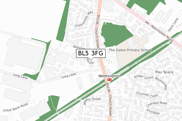
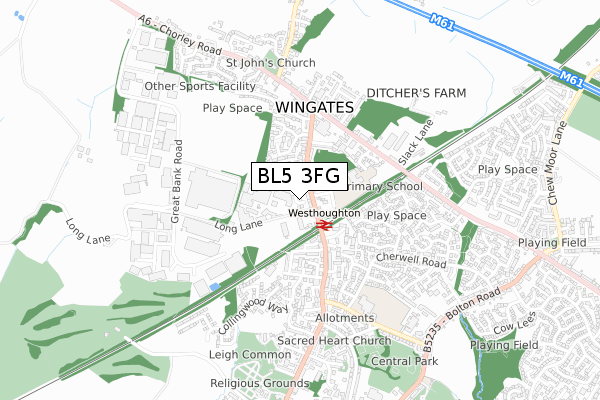
BL5 3FG maps


Source: OS Open Zoomstack (Ordnance Survey)
Licence: Open Government Licence (requires attribution)
Attribution: Contains OS data © Crown copyright and database right 2025
Source: Open Postcode Geo
Licence: Open Government Licence (requires attribution)
Attribution: Contains OS data © Crown copyright and database right 2025; Contains Royal Mail data © Royal Mail copyright and database right 2025; Source: Office for National Statistics licensed under the Open Government Licence v.3.0
Licence: Open Government Licence (requires attribution)
Attribution: Contains OS data © Crown copyright and database right 2025
Source: Open Postcode Geo
Licence: Open Government Licence (requires attribution)
Attribution: Contains OS data © Crown copyright and database right 2025; Contains Royal Mail data © Royal Mail copyright and database right 2025; Source: Office for National Statistics licensed under the Open Government Licence v.3.0
BL5 3FG geodata
| Easting | 364910 |
| Northing | 406204 |
| Latitude | 53.551302 |
| Longitude | -2.531099 |
Where is BL5 3FG?
| Country | England |
| Postcode District | BL5 |
Politics
| Ward | Westhoughton South |
|---|---|
| Constituency | Bolton West |
House Prices
Sales of detached houses in BL5 3FG
9, WESTLEIGH CLOSE, WESTHOUGHTON, BOLTON, BL5 3FG 2022 22 JUL £294,995 |
8, WESTLEIGH CLOSE, WESTHOUGHTON, BOLTON, BL5 3FG 2022 22 JUL £309,995 |
10, WESTLEIGH CLOSE, WESTHOUGHTON, BOLTON, BL5 3FG 2022 15 JUL £334,995 |
6, WESTLEIGH CLOSE, WESTHOUGHTON, BOLTON, BL5 3FG 2022 30 JUN £294,995 |
4, WESTLEIGH CLOSE, WESTHOUGHTON, BOLTON, BL5 3FG 2022 31 MAY £309,995 |
14, WESTLEIGH CLOSE, WESTHOUGHTON, BOLTON, BL5 3FG 2022 29 APR £344,995 |
12, WESTLEIGH CLOSE, WESTHOUGHTON, BOLTON, BL5 3FG 2022 29 APR £334,995 |
Source: HM Land Registry Price Paid Data
Licence: Contains HM Land Registry data © Crown copyright and database right 2025. This data is licensed under the Open Government Licence v3.0.
Licence: Contains HM Land Registry data © Crown copyright and database right 2025. This data is licensed under the Open Government Licence v3.0.
Transport
Nearest bus stops to BL5 3FG
| Church St/Westhoughton Church (Church St) | Westhoughton | 403m |
| Church St/Westhoughton Church (Church St) | Westhoughton | 414m |
| Wigan Rd/Westhoughton Police Station (Wigan Road) | Westhoughton | 459m |
| Church St/Lord St (Church St) | Westhoughton | 490m |
| Church St/Lord St (Church St) | Westhoughton | 492m |
Nearest railway stations to BL5 3FG
| Westhoughton Station | 0.7km |
| Daisy Hill Station | 1.7km |
| Horwich Parkway Station | 3km |
Deprivation
50% of English postcodes are less deprived than BL5 3FG:Food Standards Agency
Three nearest food hygiene ratings to BL5 3FG (metres)
B's Bakery

14 Etherstone Way
90m
St Bartholomew's C of E

School Street
366m
Westhoughton Golf Club

Westhoughton Golf Club
366m
➜ Get more ratings from the Food Standards Agency
Nearest post box to BL5 3FG
| Last Collection | |||
|---|---|---|---|
| Location | Mon-Fri | Sat | Distance |
| 2 Lord Street | 17:30 | 11:25 | 504m |
| Westhoughton P O | 19:00 | 12:10 | 699m |
| Rylands Court | 16:50 | 11:25 | 913m |
BL5 3FG ITL and BL5 3FG LAU
The below table lists the International Territorial Level (ITL) codes (formerly Nomenclature of Territorial Units for Statistics (NUTS) codes) and Local Administrative Units (LAU) codes for BL5 3FG:
| ITL 1 Code | Name |
|---|---|
| TLD | North West (England) |
| ITL 2 Code | Name |
| TLD3 | Greater Manchester |
| ITL 3 Code | Name |
| TLD36 | Greater Manchester North West |
| LAU 1 Code | Name |
| E08000001 | Bolton |
BL5 3FG census areas
The below table lists the Census Output Area (OA), Lower Layer Super Output Area (LSOA), and Middle Layer Super Output Area (MSOA) for BL5 3FG:
| Code | Name | |
|---|---|---|
| OA | E00024985 | |
| LSOA | E01004936 | Bolton 031C |
| MSOA | E02001014 | Bolton 031 |
Nearest postcodes to BL5 3FG
| BL5 3TT | Collingwood Way | 179m |
| BL5 3TJ | Breaktemper | 289m |
| BL5 2BD | Bowlands Hey | 294m |
| BL5 3LW | Sandyway Close | 300m |
| BL5 2BE | Church Walks | 301m |
| BL5 3TQ | Leigh Common | 301m |
| BL5 3TP | Beatty Drive | 305m |
| BL5 3TH | Gerrard Street | 316m |
| BL5 2BG | School Street | 342m |
| BL5 3TL | Cemetery Street | 350m |